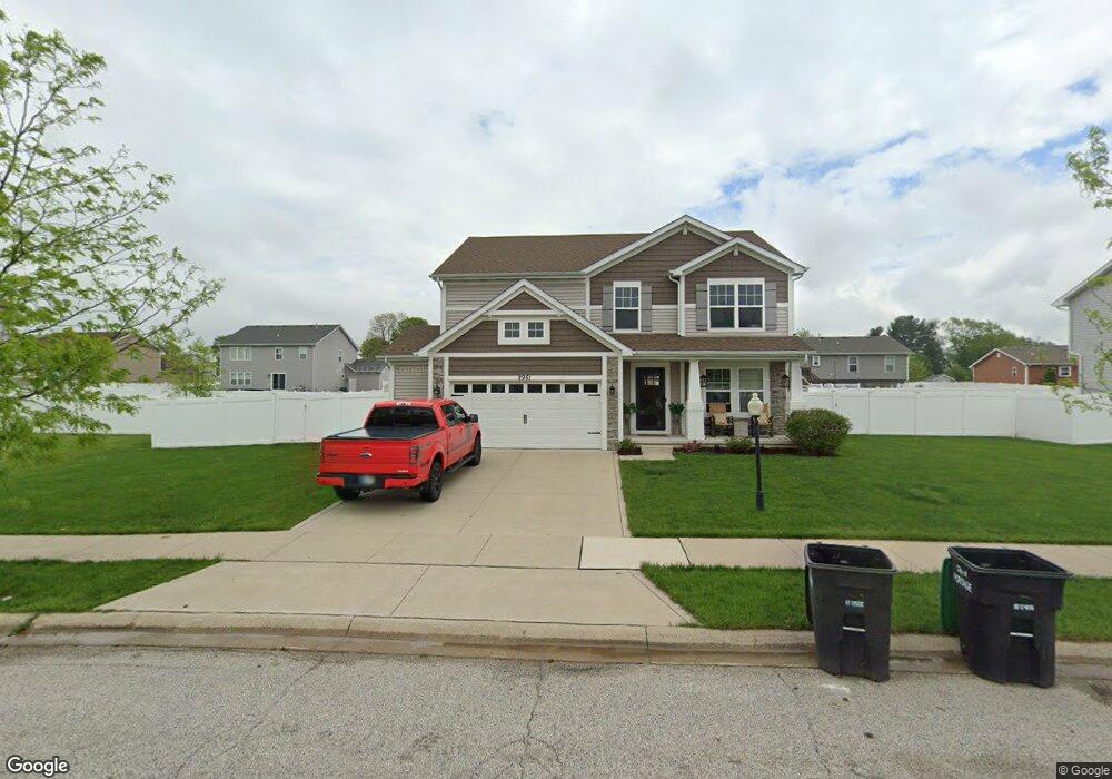
2951 Wingstem Dr Portage, IN 46368
Estimated Value: $399,730 - $431,000
4
Beds
3
Baths
2,698
Sq Ft
$153/Sq Ft
Est. Value
About This Home
This home is located at 2951 Wingstem Dr, Portage, IN 46368 and is currently estimated at $411,933, approximately $152 per square foot. 2951 Wingstem Dr is a home located in Porter County with nearby schools including Rowena Kyle Elementary School, Willowcreek Middle School, and Portage High School.
Ownership History
Date
Name
Owned For
Owner Type
Purchase Details
Closed on
Dec 6, 2016
Sold by
Olthof Homes Nwi Lots Llc
Bought by
Janik Troy E and Janik Sarah E
Current Estimated Value
Home Financials for this Owner
Home Financials are based on the most recent Mortgage that was taken out on this home.
Original Mortgage
$210,000
Outstanding Balance
$169,309
Interest Rate
3.47%
Mortgage Type
New Conventional
Estimated Equity
$242,624
Purchase Details
Closed on
Aug 16, 2016
Sold by
Indiana Land Trust Company
Bought by
Olthof Homes Nwi Lots Llc
Create a Home Valuation Report for This Property
The Home Valuation Report is an in-depth analysis detailing your home's value as well as a comparison with similar homes in the area
Home Values in the Area
Average Home Value in this Area
Purchase History
| Date | Buyer | Sale Price | Title Company |
|---|---|---|---|
| Janik Troy E | -- | Fidelity National Title Co | |
| Olthof Homes Nwi Lots Llc | -- | Fidelity Natl Title Co Llc |
Source: Public Records
Mortgage History
| Date | Status | Borrower | Loan Amount |
|---|---|---|---|
| Open | Janik Troy E | $210,000 |
Source: Public Records
Tax History Compared to Growth
Tax History
| Year | Tax Paid | Tax Assessment Tax Assessment Total Assessment is a certain percentage of the fair market value that is determined by local assessors to be the total taxable value of land and additions on the property. | Land | Improvement |
|---|---|---|---|---|
| 2024 | $3,844 | $384,300 | $47,100 | $337,200 |
| 2023 | $3,824 | $380,800 | $44,800 | $336,000 |
| 2022 | $3,413 | $348,100 | $44,800 | $303,300 |
| 2021 | $3,108 | $309,900 | $44,800 | $265,100 |
| 2020 | $2,999 | $297,900 | $39,000 | $258,900 |
| 2019 | $2,827 | $280,700 | $39,000 | $241,700 |
| 2018 | $2,713 | $269,300 | $39,000 | $230,300 |
| 2017 | $2,454 | $243,400 | $39,000 | $204,400 |
| 2016 | $10 | $700 | $700 | $0 |
| 2014 | $20 | $700 | $700 | $0 |
| 2013 | -- | $600 | $600 | $0 |
Source: Public Records
Map
Nearby Homes
- 2954 Airport Rd
- 3038 Alexis St
- 6280 Summershade Dr
- 6356 Meadowridge
- 6363 Mulberry Ave
- 3055 Ramblewood St
- 6576 Fairview Ave
- 6458 Kristina Ave
- 6550 Elizabeth Ln
- 3036 Mallory St
- 6155 Sunrise Ave
- 3175 St Julian St
- 2823 Eleanor St
- 6190 Oglethorpe Ave
- 3096 Eleanor St
- 3259 Augusta Blvd
- 3263 Augusta Blvd
- 2820 Lois St
- T-1356 Piper Plan at Rivertrace - Townhomes
- T-1415 Adler Plan at Rivertrace - Townhomes
- 2959 Wingstem Dr
- 2950 Amanda Dr
- 2958 Amanda Dr
- 2675 Wingstem Dr
- 2942 Amanda Dr
- 2967 Wingstem Dr
- 2954 Wingstem Dr
- 2940 Wingstem Dr
- 2966 Amanda Dr
- 2935 Wingstem Dr
- 2934 Amanda Dr
- 2975 Wingstem Dr
- 6427 Button Bush Ave
- 2968 Amanda Dr
- 2932 Wingstem Dr
- 2953 Amanda Dr
- 2980 Amanda Dr
- 2945 Amanda Dr
- 6416 Buttonbush Ave
- 2927 Wingstem Dr