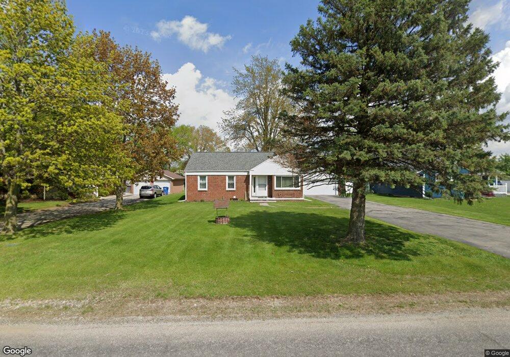
2953 Airport Rd Unit AIRPORT Adrian, MI 49221
Estimated Value: $182,465 - $223,000
3
Beds
1
Bath
1,151
Sq Ft
$180/Sq Ft
Est. Value
About This Home
This home is located at 2953 Airport Rd Unit AIRPORT, Adrian, MI 49221 and is currently estimated at $207,155, approximately $179 per square foot. 2953 Airport Rd Unit AIRPORT is a home located in Lenawee County with nearby schools including Adrian High School and St. Stephen Lutheran School.
Ownership History
Date
Name
Owned For
Owner Type
Purchase Details
Closed on
Jul 30, 2010
Sold by
Federal National Mortgage Association
Bought by
Schwartzwalder Brandon
Current Estimated Value
Home Financials for this Owner
Home Financials are based on the most recent Mortgage that was taken out on this home.
Original Mortgage
$55,432
Outstanding Balance
$38,381
Interest Rate
5.5%
Mortgage Type
FHA
Estimated Equity
$168,774
Purchase Details
Closed on
Jun 16, 2009
Sold by
United Mortgage Co
Bought by
Federal National Mortgage Association
Purchase Details
Closed on
Jun 11, 2009
Sold by
Dabideen Gregory P
Bought by
United Mortgage Co
Create a Home Valuation Report for This Property
The Home Valuation Report is an in-depth analysis detailing your home's value as well as a comparison with similar homes in the area
Home Values in the Area
Average Home Value in this Area
Purchase History
| Date | Buyer | Sale Price | Title Company |
|---|---|---|---|
| Schwartzwalder Brandon | $56,180 | Attorneys Title Agency Llc | |
| Federal National Mortgage Association | -- | None Available | |
| United Mortgage Co | $121,948 | None Available |
Source: Public Records
Mortgage History
| Date | Status | Borrower | Loan Amount |
|---|---|---|---|
| Open | Schwartzwalder Brandon | $55,432 |
Source: Public Records
Tax History Compared to Growth
Tax History
| Year | Tax Paid | Tax Assessment Tax Assessment Total Assessment is a certain percentage of the fair market value that is determined by local assessors to be the total taxable value of land and additions on the property. | Land | Improvement |
|---|---|---|---|---|
| 2025 | $1,593 | $83,400 | $0 | $0 |
| 2024 | $920 | $75,500 | $0 | $0 |
| 2022 | $834 | $55,200 | $0 | $0 |
| 2021 | $1,450 | $53,100 | $0 | $0 |
| 2020 | $1,449 | $54,800 | $0 | $0 |
| 2019 | $125,423 | $48,300 | $0 | $0 |
| 2018 | $1,405 | $48,283 | $0 | $0 |
| 2017 | $1,355 | $47,774 | $0 | $0 |
| 2016 | $1,303 | $44,888 | $0 | $0 |
| 2014 | -- | $41,038 | $0 | $0 |
Source: Public Records
Map
Nearby Homes
- 2682 Elmwood Dr
- 1902 W Cadmus Rd
- 1692 Rivers Edge Ct
- 302 Lakewood Dr
- 802 Lakewood Dr
- 1639 Rivers Edge Ct
- 2018 Green Acres Dr
- 2029 Green Acres Dr
- 2023 Green Acres Dr
- 2027 Green Acres Dr
- 2015 Green Acres Dr
- 2012 Green Acres Dr
- 2010 Green Acres Dr
- 3224 Sand Creek Hwy
- 2008 Green Acres Dr
- 3079 Hillview Dr
- 3031 Planeview Dr
- 301 Ohio River Dr Unit LOT 52
- 1227 Sherman St
- 5000 BLK S Adrian Hwy
- 2953 Airport Rd
- 2937 Airport Rd
- 2975 Airport Rd
- 2917 Airport Rd
- 2991 Airport Rd
- 2897 Airport Rd
- 2250 W Cadmus Rd
- 2952 Sharon Dr
- 2936 Sharon Dr
- 2881 Airport Rd
- 2275 W Cadmus Rd
- 2906 Sharon Dr
- 2896 Sharon Dr
- 3000 Madison Lake Ct
- 3000 Madison Lake Ct Unit MADISON LAKE
- 2240 W Cadmus Rd
- 2865 Airport Rd
- 2916 Sharon Dr
- 2236 W Cadmus Rd
- 2880 Sharon Dr