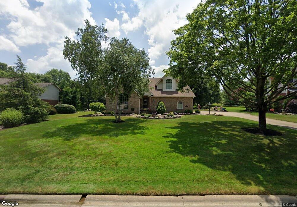
2953 Carie Hill Cir NW Massillon, OH 44646
Amherst Heights-Clearview NeighborhoodEstimated Value: $361,000 - $380,000
3
Beds
3
Baths
2,700
Sq Ft
$136/Sq Ft
Est. Value
About This Home
This home is located at 2953 Carie Hill Cir NW, Massillon, OH 44646 and is currently estimated at $368,199, approximately $136 per square foot. 2953 Carie Hill Cir NW is a home located in Stark County with nearby schools including Amherst Elementary School, Jackson Memorial Middle School, and Jackson High School.
Ownership History
Date
Name
Owned For
Owner Type
Purchase Details
Closed on
Jan 15, 2018
Sold by
Daugherty David E and Daugherty Julie K
Bought by
Daugherty Julie K and Julie K Daugherty Trust
Current Estimated Value
Purchase Details
Closed on
Nov 20, 2008
Sold by
Daugherty David E and Daugherty Julie K
Bought by
Daugherty David E and Daugherty Julie K
Purchase Details
Closed on
Mar 3, 1992
Create a Home Valuation Report for This Property
The Home Valuation Report is an in-depth analysis detailing your home's value as well as a comparison with similar homes in the area
Home Values in the Area
Average Home Value in this Area
Purchase History
| Date | Buyer | Sale Price | Title Company |
|---|---|---|---|
| Daugherty Julie K | -- | None Available | |
| Daugherty David E | -- | Attorney | |
| -- | $26,500 | -- |
Source: Public Records
Tax History Compared to Growth
Tax History
| Year | Tax Paid | Tax Assessment Tax Assessment Total Assessment is a certain percentage of the fair market value that is determined by local assessors to be the total taxable value of land and additions on the property. | Land | Improvement |
|---|---|---|---|---|
| 2025 | -- | $121,700 | $32,100 | $89,600 |
| 2024 | -- | $121,700 | $32,100 | $89,600 |
| 2023 | $4,673 | $93,910 | $24,330 | $69,580 |
| 2022 | $4,650 | $93,910 | $24,330 | $69,580 |
| 2021 | $4,669 | $93,910 | $24,330 | $69,580 |
| 2020 | $4,527 | $83,690 | $21,630 | $62,060 |
| 2019 | $4,360 | $83,690 | $21,630 | $62,060 |
| 2018 | $4,382 | $83,690 | $21,630 | $62,060 |
| 2017 | $4,473 | $81,280 | $20,270 | $61,010 |
| 2016 | $4,502 | $81,280 | $20,270 | $61,010 |
| 2015 | $4,557 | $81,280 | $20,270 | $61,010 |
| 2014 | $304 | $73,400 | $18,310 | $55,090 |
| 2013 | $2,118 | $73,400 | $18,310 | $55,090 |
Source: Public Records
Map
Nearby Homes
- 7942 Loriwood Cir NW
- 2866 Carie Hill Cir NW
- 0 Wildridge Rd NW Unit 36853475
- 3252 Stahl Ave NW
- 7770 Hills And Dales Rd NW
- 1204 Taggart St NW
- 3410 Wales Ave NW
- 7841 Tahiti St NW
- 3315 Broadhaven Ave NW
- 1056 Taggart St NW
- 7604 Greenview Ave NW
- 1717 Chittenden Cir NE
- 1026 Beverly Rd NE
- 3536 Oxford Ave NW
- 3552 Marys Way Ave NW
- 3543 Marys Way Ave NW
- 3688 Marys Way Ave NW
- 3575 Marys Way Ave NW
- 3566 Marys Way Ave NW
- 3527 Marys Way Ave NW
- 2949 Carie Hill Cir NW
- 2969 Carie Hill Cir NW
- 287 Carie Hill Cir NW
- 2956 Carie Hill Cir NW
- 2973 Carie Hill Cir NW
- 2950 Carie Hill Cir NW
- 2974 Carie Hill Cir NW
- 2979 Carie Hill Cir NW
- 2940 Carie Hill Cir NW
- 7950 Loriwood Cir NW
- 2946 Aaronwood Ave NW
- 2985 Carie Hill Cir NW
- 3010 Carie Hill Cir NW
- 2920 Carie Hill Cir NW
- 3001 Carie Hill Cir NW
- 2929 Carie Hill Cir NW
- 2910 Carie Hill Cir NW
- 3017 Carie Hill Cir NW
- 7945 Loriwood Cir NW
- 7969 Loriwood Cir NW