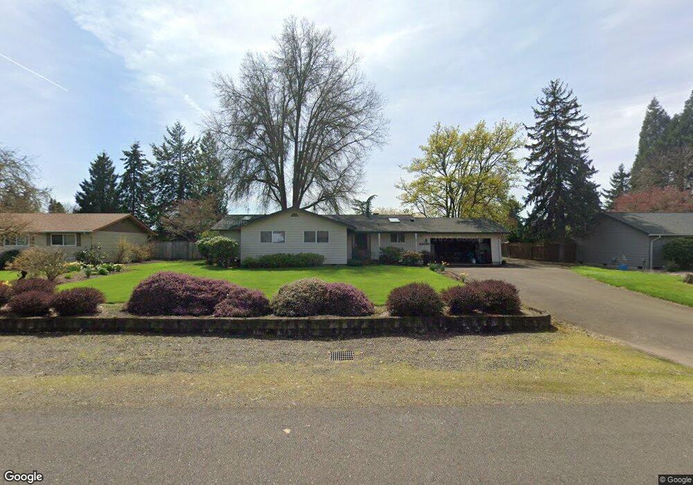
29538 NE Pheasant Ave Corvallis, OR 97333
Estimated Value: $548,422 - $657,000
3
Beds
3
Baths
1,738
Sq Ft
$347/Sq Ft
Est. Value
About This Home
This home is located at 29538 NE Pheasant Ave, Corvallis, OR 97333 and is currently estimated at $602,711, approximately $346 per square foot. 29538 NE Pheasant Ave is a home located in Linn County with nearby schools including Garfield Elementary School, Linus Pauling Middle School, and Corvallis High School.
Ownership History
Date
Name
Owned For
Owner Type
Purchase Details
Closed on
Jun 26, 2006
Sold by
Sather Michael D and Sather Kimberly E
Bought by
Hill Rosa Y and Hill Richard A
Current Estimated Value
Home Financials for this Owner
Home Financials are based on the most recent Mortgage that was taken out on this home.
Original Mortgage
$263,900
Outstanding Balance
$155,978
Interest Rate
6.57%
Mortgage Type
Fannie Mae Freddie Mac
Estimated Equity
$446,733
Create a Home Valuation Report for This Property
The Home Valuation Report is an in-depth analysis detailing your home's value as well as a comparison with similar homes in the area
Home Values in the Area
Average Home Value in this Area
Purchase History
| Date | Buyer | Sale Price | Title Company |
|---|---|---|---|
| Hill Rosa Y | $329,900 | First American Title |
Source: Public Records
Mortgage History
| Date | Status | Borrower | Loan Amount |
|---|---|---|---|
| Open | Hill Rosa Y | $263,900 |
Source: Public Records
Tax History Compared to Growth
Tax History
| Year | Tax Paid | Tax Assessment Tax Assessment Total Assessment is a certain percentage of the fair market value that is determined by local assessors to be the total taxable value of land and additions on the property. | Land | Improvement |
|---|---|---|---|---|
| 2024 | $4,953 | $321,820 | -- | -- |
| 2023 | $4,808 | $312,450 | $0 | $0 |
| 2022 | $4,667 | $303,350 | $0 | $0 |
| 2021 | $4,464 | $294,520 | $0 | $0 |
| 2020 | $4,331 | $285,950 | $0 | $0 |
| 2019 | $4,216 | $277,630 | $0 | $0 |
| 2018 | $4,013 | $269,550 | $0 | $0 |
| 2017 | $3,515 | $261,700 | $0 | $0 |
| 2016 | $3,367 | $254,080 | $0 | $0 |
| 2015 | $3,234 | $241,710 | $0 | $0 |
| 2014 | $3,365 | $246,680 | $0 | $0 |
Source: Public Records
Map
Nearby Homes
- 29509 NE Pheasant Ave
- 33844 SE White Oak Rd
- 34123 Cushman Rd Unit 1400
- 34123 Cushman Rd Unit 1300
- 34123 Cushman Rd Unit 3 Lots
- 34123 Cushman Rd Unit 1200
- (Near 34123) Rd
- (Near 34123) Cushman (Lot 1400) Rd
- (Near 34123) Cushman (Lot 1300) Rd
- (Near 34123) Cushman (Lot 1200) Rd
- 33321 SE Peoria Rd
- 33125 SE White Oak Rd Unit 5 Rd
- 33125 SE White Oak Rd Unit 21 Rd
- 33125 SE White Oak Rd Unit 17
- 33125 SE White Oak (#1) Rd Unit 1
- 33125 SE White Oak (#56) Rd Unit 56
- 2635 NE Seavy Place
- Lot 601 NE Circle Blvd
- 800 (next to) NE Circle Bl
- 651 NE Sherwood Way
- 29552 NE Pheasant Ave
- 29549 NE Pheasant Ave
- 29528 NE Pheasant Ave
- 29562 NE Pheasant Ave
- 29543 NE Pheasant Ave
- 29563 NE Pheasant Ave
- 29529 NE Pheasant Ave
- 29518 NE Pheasant Ave
- 29568 NE Pheasant Ave
- 29531 NE Weslinn Dr
- 29521 NE Pheasant Ave
- 29561 NE Weslinn Dr
- 29508 NE Pheasant Ave
- 29569 NE Pheasant Ave
- 29541 NE Weslinn Dr
- 29547 NE Weslinn Dr
- 29567 NE Weslinn Dr
- 29580 NE Pheasant Ave
- 29505 NE Weslinn Dr
- 29585 NE Pheasant Ave