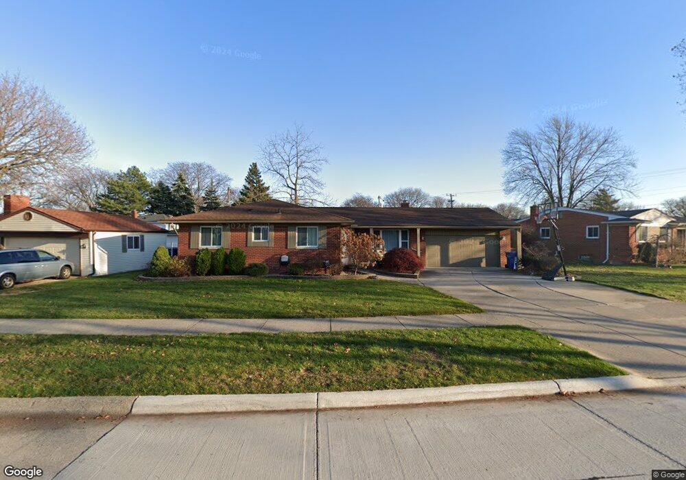
29546 Norma Dr Warren, MI 48093
Northeast Warren NeighborhoodEstimated Value: $258,896 - $289,000
3
Beds
2
Baths
1,398
Sq Ft
$195/Sq Ft
Est. Value
About This Home
This home is located at 29546 Norma Dr, Warren, MI 48093 and is currently estimated at $271,974, approximately $194 per square foot. 29546 Norma Dr is a home located in Macomb County with nearby schools including Warren Woods Tower High School, Frontier International Academy Elementary, and Warren Woods Christian School.
Ownership History
Date
Name
Owned For
Owner Type
Purchase Details
Closed on
Dec 2, 2016
Sold by
Smith Cheryl L
Bought by
Smith Cheryl L
Current Estimated Value
Home Financials for this Owner
Home Financials are based on the most recent Mortgage that was taken out on this home.
Original Mortgage
$90,000
Outstanding Balance
$72,718
Interest Rate
3.54%
Mortgage Type
New Conventional
Estimated Equity
$199,256
Purchase Details
Closed on
Dec 20, 2011
Sold by
Lystad Margaret L
Bought by
Smith Cheryl L and The Margaret L Lystad Revocable Living T
Create a Home Valuation Report for This Property
The Home Valuation Report is an in-depth analysis detailing your home's value as well as a comparison with similar homes in the area
Home Values in the Area
Average Home Value in this Area
Purchase History
| Date | Buyer | Sale Price | Title Company |
|---|---|---|---|
| Smith Cheryl L | $120,000 | Fidelity National Title | |
| Smith Cheryl L | -- | None Available | |
| Lystad Margaret L | -- | None Available |
Source: Public Records
Mortgage History
| Date | Status | Borrower | Loan Amount |
|---|---|---|---|
| Open | Smith Cheryl L | $90,000 |
Source: Public Records
Tax History
| Year | Tax Paid | Tax Assessment Tax Assessment Total Assessment is a certain percentage of the fair market value that is determined by local assessors to be the total taxable value of land and additions on the property. | Land | Improvement |
|---|---|---|---|---|
| 2025 | $4,962 | $132,940 | $0 | $0 |
| 2024 | $48 | $121,160 | $0 | $0 |
| 2023 | $4,577 | $113,040 | $0 | $0 |
| 2022 | $4,340 | $97,700 | $0 | $0 |
| 2021 | $4,292 | $89,980 | $0 | $0 |
| 2020 | $4,157 | $86,770 | $0 | $0 |
| 2019 | $4,016 | $82,090 | $0 | $0 |
| 2018 | $0 | $75,390 | $0 | $0 |
| 2017 | $3,854 | $67,960 | $15,190 | $52,770 |
| 2016 | $3,828 | $67,960 | $0 | $0 |
| 2015 | -- | $58,610 | $0 | $0 |
| 2013 | $2,733 | $53,480 | $0 | $0 |
Source: Public Records
Map
Nearby Homes
- 29368 Hoover Rd Unit A3
- 29626 Hoover Rd Unit 626
- 29460 Hoover Rd Unit D37
- 29366 Wagner Dr
- 29248 Hoover Rd Unit 171
- 29451 Hoover Rd
- 29337 Roan Dr
- 29091 Wagner Dr
- 54765 Palomino Ave
- 12531 Common Rd
- 29105 Palomino Dr
- 11357 Geoffry Dr
- 30045 Iroquois Dr
- 30616 Mcgrath Dr
- 28804 Aline Dr
- 28540 Roan Dr
- 11116 Racine Rd
- 28646 Aline Dr
- 29143 Dover Ave
- 29444 Geraldine Dr
- 29520 Norma Dr
- 29569 Bonnie Dr
- 29549 Bonnie Dr
- 29531 Bonnie Dr
- 29504 Norma Dr
- 29507 Bonnie Dr
- 29555 Norma Dr
- 29543 Norma Dr
- 29607 Norma Dr
- 29531 Norma Dr
- 29362 Norma Dr
- 29519 Norma Dr
- 29507 Norma Dr
- 29353 Bonnie Dr
- 29350 Norma Dr
- 29612 Bonnie Dr
- 11818 Irene Ave
- 29621 Norma Dr
- 29548 Bonnie Dr
- 29365 Norma Dr
Your Personal Tour Guide
Ask me questions while you tour the home.