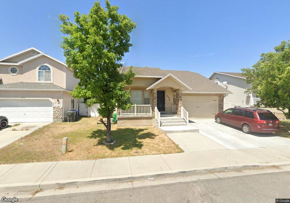
2955 Asplund Cir Salt Lake City, UT 84119
Granger NeighborhoodEstimated Value: $449,723 - $493,000
3
Beds
2
Baths
1,192
Sq Ft
$398/Sq Ft
Est. Value
About This Home
This home is located at 2955 Asplund Cir, Salt Lake City, UT 84119 and is currently estimated at $474,681, approximately $398 per square foot. 2955 Asplund Cir is a home located in Salt Lake County with nearby schools including Hillsdale Elementary School, West Lake Junior High School, and Granger High School.
Ownership History
Date
Name
Owned For
Owner Type
Purchase Details
Closed on
Sep 9, 2025
Sold by
Le True
Bought by
True Le Family Trust and Le
Current Estimated Value
Purchase Details
Closed on
Sep 5, 2006
Sold by
Udovicic Anto and Udovicic Nada
Bought by
Le Truc
Home Financials for this Owner
Home Financials are based on the most recent Mortgage that was taken out on this home.
Original Mortgage
$163,500
Interest Rate
6.67%
Mortgage Type
Purchase Money Mortgage
Purchase Details
Closed on
May 3, 2002
Sold by
Celebrity Builders Inc
Bought by
Udovicic Anto and Udovicic Nada
Home Financials for this Owner
Home Financials are based on the most recent Mortgage that was taken out on this home.
Original Mortgage
$138,050
Interest Rate
7.13%
Mortgage Type
FHA
Create a Home Valuation Report for This Property
The Home Valuation Report is an in-depth analysis detailing your home's value as well as a comparison with similar homes in the area
Home Values in the Area
Average Home Value in this Area
Purchase History
| Date | Buyer | Sale Price | Title Company |
|---|---|---|---|
| True Le Family Trust | -- | None Listed On Document | |
| Le Truc | -- | Security Title Ins Agency | |
| Udovicic Anto | -- | Guardian Title |
Source: Public Records
Mortgage History
| Date | Status | Borrower | Loan Amount |
|---|---|---|---|
| Previous Owner | Le Truc | $163,500 | |
| Previous Owner | Udovicic Anto | $138,050 |
Source: Public Records
Tax History Compared to Growth
Tax History
| Year | Tax Paid | Tax Assessment Tax Assessment Total Assessment is a certain percentage of the fair market value that is determined by local assessors to be the total taxable value of land and additions on the property. | Land | Improvement |
|---|---|---|---|---|
| 2025 | $2,904 | $455,900 | $84,600 | $371,300 |
| 2024 | $2,904 | $444,900 | $82,400 | $362,500 |
| 2023 | $2,904 | $410,500 | $79,300 | $331,200 |
| 2022 | $2,738 | $402,700 | $77,700 | $325,000 |
| 2021 | $2,462 | $325,400 | $59,800 | $265,600 |
| 2020 | $2,264 | $282,500 | $54,600 | $227,900 |
| 2019 | $2,230 | $268,300 | $51,500 | $216,800 |
| 2018 | $2,101 | $243,600 | $51,500 | $192,100 |
| 2017 | $1,878 | $221,500 | $51,500 | $170,000 |
| 2016 | $1,702 | $201,100 | $49,400 | $151,700 |
| 2015 | $1,441 | $162,100 | $52,900 | $109,200 |
| 2014 | $1,408 | $155,200 | $51,100 | $104,100 |
Source: Public Records
Map
Nearby Homes
- 2831 S Snowdon Park Dr Unit 122
- 2841 Clearbrook Dr
- 3280 W Oxford Park Dr
- 3018 Asplund Cir
- 2852 Hampton Park Dr
- 3281 W Coventry Dr S Unit 184
- 3224 W Regency Park Dr
- 3224 W Regency Park Dr Unit 12
- 2774 S Downs Way Unit 3
- 3188 S Jason Place
- 2791 S 3050 W
- 3007 W 2960 S
- 2968 W 2920 S
- 3111 S Beaver St
- 3321 Valcrest Dr Unit 3323
- 2999 S 2910 W
- 3315 Valcrest Cir Unit A
- 3315 W Valcrest Cir Unit B
- 3201 Barney St
- 2870 W 3100 S
- 2963 Asplund Cir
- 2947 Asplund Cir
- 2956 Losser Dr
- 2956 Losser Dr Unit 51
- 2941 S Asplund Cir
- 2948 Losser Dr
- 2948 S Losser Dr Unit 50
- 2948 S Losser Dr
- 2956 S Losser Dr
- 2971 Asplund Cir
- 2964 Losser Dr
- 3373 Brookway Dr
- 2971 S Asplund Cir
- 2954 S Asplund Cir
- 3395 Brookway Dr
- 2954 Asplund Cir
- 2940 Losser Dr
- 2940 Losser Dr Unit 49
- 2946 S Asplund Cir
- 2962 Asplund Cir