Estimated Value: $131,966 - $181,000
3
Beds
2
Baths
1,178
Sq Ft
$134/Sq Ft
Est. Value
About This Home
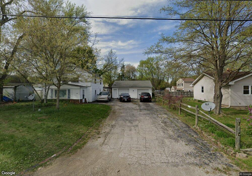
This home is located at 2955 Gale Dr, Akron, OH 44312 and is currently estimated at $157,742, approximately $133 per square foot. 2955 Gale Dr is a home located in Summit County with nearby schools including Springfield High School, Summit Academy Akron Elementary School, and Hatton Community Learning Center.
Ownership History
Date
Name
Owned For
Owner Type
Purchase Details
Closed on
Jan 4, 2012
Sold by
Marker Diana Lynn
Bought by
Marker Glenn E
Current Estimated Value
Home Financials for this Owner
Home Financials are based on the most recent Mortgage that was taken out on this home.
Original Mortgage
$77,500
Interest Rate
3.87%
Mortgage Type
FHA
Purchase Details
Closed on
Oct 28, 2003
Sold by
Marker Allen L and Marker Tanya C
Bought by
Marker Glenn E and Marker Diana L
Home Financials for this Owner
Home Financials are based on the most recent Mortgage that was taken out on this home.
Original Mortgage
$32,000
Interest Rate
5.85%
Mortgage Type
Purchase Money Mortgage
Create a Home Valuation Report for This Property
The Home Valuation Report is an in-depth analysis detailing your home's value as well as a comparison with similar homes in the area
Home Values in the Area
Average Home Value in this Area
Purchase History
| Date | Buyer | Sale Price | Title Company |
|---|---|---|---|
| Marker Glenn E | -- | Attorney | |
| Marker Glenn E | $40,000 | Meridian Title |
Source: Public Records
Mortgage History
| Date | Status | Borrower | Loan Amount |
|---|---|---|---|
| Previous Owner | Marker Glenn E | $77,500 | |
| Previous Owner | Marker Glenn E | $32,000 |
Source: Public Records
Tax History Compared to Growth
Tax History
| Year | Tax Paid | Tax Assessment Tax Assessment Total Assessment is a certain percentage of the fair market value that is determined by local assessors to be the total taxable value of land and additions on the property. | Land | Improvement |
|---|---|---|---|---|
| 2025 | $1,176 | $29,407 | $4,396 | $25,011 |
| 2024 | $1,176 | $29,407 | $4,396 | $25,011 |
| 2023 | $1,176 | $29,407 | $4,396 | $25,011 |
| 2022 | $1,146 | $25,795 | $3,857 | $21,938 |
| 2021 | $1,120 | $25,795 | $3,857 | $21,938 |
| 2020 | $1,105 | $25,800 | $3,860 | $21,940 |
| 2019 | $742 | $19,060 | $3,570 | $15,490 |
| 2018 | $715 | $19,060 | $3,570 | $15,490 |
| 2017 | $741 | $19,060 | $3,570 | $15,490 |
| 2016 | $748 | $19,060 | $3,570 | $15,490 |
| 2015 | $741 | $19,060 | $3,570 | $15,490 |
| 2014 | $733 | $19,060 | $3,570 | $15,490 |
| 2013 | $736 | $19,060 | $3,570 | $15,490 |
Source: Public Records
Map
Nearby Homes
- 379 Stull Ave
- 2948 Trenton Rd
- 0 Kreiner Ave
- 307 Pauline Ave
- 117 Kreiner Ave
- V/L Marion Ave
- 233 Marion Ave
- 366 Dennison Ave
- 544 Dennison Ave
- 47 Kreiner Ave
- 48 Marion Ave
- 6 Kreiner Ave
- 5 Kreiner Ave
- 490 Stevenson Ave
- 3472 Curtis St
- 412 Stevenson Ave
- 3394 Albrecht Ave
- 256 High Grove Blvd
- 440 Wirth Ave
- 2835 Farmdale Rd
- 2955 Gale Dr
- 2959 Gale Dr
- 287 Columbine Ave
- 275 Columbine Ave
- 2954 Gale Dr
- 2968 Gale Dr
- 2977 Gale Dr
- 265 Columbine Ave
- S/L 14 Columbine Ave
- 301 Columbine Ave
- 2987 Gale Dr
- 2978 Gale Dr
- 276 Columbine Ave
- 257 Columbine Ave
- 311 Columbine Ave
- 286 Columbine Ave
- 298 Columbine Ave
- 2984 Gale Dr
- 2993 Gale Dr
- 262 Columbine Ave