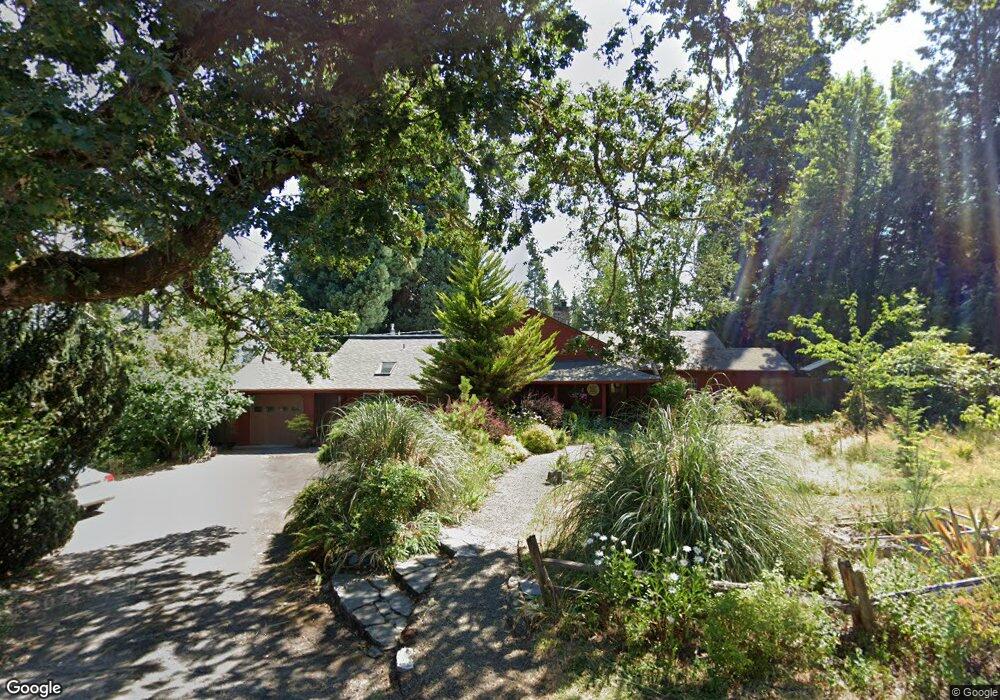
2955 McKendrick St Eugene, OR 97405
Crest Drive NeighborhoodEstimated Value: $674,000 - $890,000
3
Beds
4
Baths
3,557
Sq Ft
$224/Sq Ft
Est. Value
About This Home
This home is located at 2955 McKendrick St, Eugene, OR 97405 and is currently estimated at $797,677, approximately $224 per square foot. 2955 McKendrick St is a home located in Lane County with nearby schools including Adams Elementary School, Arts And Technology Academy At Jefferson, and Churchill High School.
Ownership History
Date
Name
Owned For
Owner Type
Purchase Details
Closed on
May 19, 2022
Sold by
Fox Christian C
Bought by
Fox Joint Trust
Current Estimated Value
Purchase Details
Closed on
Jan 5, 2007
Sold by
Barnes George E and Barnes Virginia
Bought by
Fox Susan and Fox Christian
Home Financials for this Owner
Home Financials are based on the most recent Mortgage that was taken out on this home.
Original Mortgage
$318,750
Interest Rate
6.12%
Mortgage Type
Purchase Money Mortgage
Create a Home Valuation Report for This Property
The Home Valuation Report is an in-depth analysis detailing your home's value as well as a comparison with similar homes in the area
Home Values in the Area
Average Home Value in this Area
Purchase History
| Date | Buyer | Sale Price | Title Company |
|---|---|---|---|
| Fox Joint Trust | -- | None Listed On Document | |
| Fox Susan | $375,000 | Western Title & Escrow Compa |
Source: Public Records
Mortgage History
| Date | Status | Borrower | Loan Amount |
|---|---|---|---|
| Previous Owner | Fox Susan | $318,750 |
Source: Public Records
Tax History
| Year | Tax Paid | Tax Assessment Tax Assessment Total Assessment is a certain percentage of the fair market value that is determined by local assessors to be the total taxable value of land and additions on the property. | Land | Improvement |
|---|---|---|---|---|
| 2025 | $6,843 | $351,221 | -- | -- |
| 2024 | $6,758 | $340,992 | -- | -- |
| 2023 | $6,758 | $331,061 | $0 | $0 |
| 2022 | $6,331 | $321,419 | $0 | $0 |
| 2021 | $5,946 | $312,058 | $0 | $0 |
| 2020 | $5,967 | $302,969 | $0 | $0 |
| 2019 | $5,763 | $294,145 | $0 | $0 |
| 2018 | $5,425 | $277,260 | $0 | $0 |
| 2017 | $5,182 | $277,260 | $0 | $0 |
| 2016 | $5,053 | $269,184 | $0 | $0 |
| 2015 | $4,908 | $261,344 | $0 | $0 |
| 2014 | $4,809 | $253,732 | $0 | $0 |
Source: Public Records
Map
Nearby Homes
- 1783 Graham Dr
- 0 Mclean Blvd Unit 24671448
- 0 Mclean Blvd Unit 697374759
- 2850 Garfield St
- 2673 Garfield St
- 3023 Ashley Loop
- 3093 Soloman Loop
- 2030 W 34th Ave
- 2225 W 28th Ave
- 2037 Morning View Dr
- 3087 Whitbeck Blvd
- 2315 W 28th Ave
- 2323 W 28th Ave
- 2455 W 29th Ave
- 3160 Whitten Dr
- 951 W 27th Ave
- 865 W 28th Ave
- 2572 W 28th Ave
- 1 Storey Blvd
- 2 Storey Blvd
- 1760 Graham Dr
- 2945 McKendrick St
- 2977 McKendrick St
- 3010 McKendrick St
- 1740 Graham Dr
- 1910 Graham Dr
- 1775 Mclean Blvd
- 3020 McKendrick St
- 1930 Graham Dr
- 2944 McKendrick St
- 1895 Mclean Blvd
- 1730 Graham Dr
- 3050 McKendrick St
- 1755 Graham Dr
- 1755 Mclean Blvd
- 2923 McKendrick St
- 2924 McKendrick St
- 1735 Mclean Blvd
- 1950 Graham Dr
- 3060 McKendrick St
Your Personal Tour Guide
Ask me questions while you tour the home.