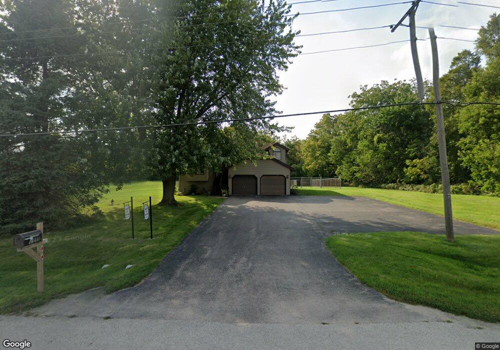
2955 S 4th St Dekalb, IL 60115
Estimated Value: $277,056 - $354,000
--
Bed
--
Bath
--
Sq Ft
1
Acres
About This Home
This home is located at 2955 S 4th St, Dekalb, IL 60115 and is currently estimated at $312,264. 2955 S 4th St is a home located in DeKalb County with nearby schools including Lincoln Elementary School, Huntley Middle School, and De Kalb High School.
Ownership History
Date
Name
Owned For
Owner Type
Purchase Details
Closed on
Jul 25, 2022
Sold by
Davenport Deborah L
Bought by
Davenport Deborah L and Carlson Dawn E
Current Estimated Value
Home Financials for this Owner
Home Financials are based on the most recent Mortgage that was taken out on this home.
Original Mortgage
$75,000
Outstanding Balance
$71,452
Interest Rate
5.25%
Mortgage Type
New Conventional
Estimated Equity
$240,812
Purchase Details
Closed on
Jul 10, 2019
Sold by
Davenport Kathleen M
Bought by
Davenport Kathleen M and Davenport Deborah L
Create a Home Valuation Report for This Property
The Home Valuation Report is an in-depth analysis detailing your home's value as well as a comparison with similar homes in the area
Home Values in the Area
Average Home Value in this Area
Purchase History
| Date | Buyer | Sale Price | Title Company |
|---|---|---|---|
| Davenport Deborah L | -- | None Listed On Document | |
| Davenport Kathleen M | -- | None Available |
Source: Public Records
Mortgage History
| Date | Status | Borrower | Loan Amount |
|---|---|---|---|
| Open | Davenport Deborah L | $75,000 |
Source: Public Records
Tax History Compared to Growth
Tax History
| Year | Tax Paid | Tax Assessment Tax Assessment Total Assessment is a certain percentage of the fair market value that is determined by local assessors to be the total taxable value of land and additions on the property. | Land | Improvement |
|---|---|---|---|---|
| 2024 | $5,249 | $84,284 | $21,127 | $63,157 |
| 2023 | $5,249 | $73,489 | $18,421 | $55,068 |
| 2022 | $5,083 | $67,095 | $21,022 | $46,073 |
| 2021 | $3,467 | $62,929 | $19,717 | $43,212 |
| 2020 | $3,595 | $61,926 | $19,403 | $42,523 |
| 2019 | $3,636 | $59,493 | $18,641 | $40,852 |
| 2018 | $3,935 | $57,476 | $18,009 | $39,467 |
| 2017 | $3,881 | $55,249 | $17,311 | $37,938 |
| 2016 | $3,929 | $53,854 | $16,874 | $36,980 |
| 2015 | -- | $51,027 | $15,988 | $35,039 |
| 2014 | -- | $50,845 | $13,844 | $37,001 |
| 2013 | -- | $53,409 | $14,542 | $38,867 |
Source: Public Records
Map
Nearby Homes
- 3011 S 4th St
- 18.6 Acre Lot Fairview Dr
- TBD Peace Rd
- TBD Fairview Dr
- 283 Par Five Dr Unit D
- 255 Bent Grass Cir
- 253 Bent Grass Cir
- Lot 66 Pebble Beach Ct
- Lot 78 Pebble Beach Ct
- Lot 77 Pebble Beach Ct
- TBD 8.67 Acres Fairview Dr
- 617 E Fairview Dr
- 235 Saint Andrews Dr
- 212 Saint Andrews Dr
- 129 Devonshire Dr
- 427 & 427.5 6th St
- 532 - 534 College Ave
- 216 Pardridge Place
- 8750 Gurler Rd
- 1208 Stafford St
- 2905 S 4th St
- 2975 S 4th St
- 3051 S 4th St
- 3101 S 4th St
- 300 Harvestore Dr
- 3155 S 4th St
- 3175 S 4th St
- 3205 S 4th St
- 3255 S 4th St
- 3275 S 4th St
- 345 Gurler Rd
- Lot 22 S 5th St
- 120&122 Cotton Ave
- 1 B Rd
- 00 St
- 00 Confidential
- 0 E Rt 38 Rd Unit 7088593
- 0 Lincoln Hwy (38) Hwy Unit 7317852
- 999 Confidential Ave
- 999 Confidential Hwy