Estimated Value: $140,803 - $197,000
4
Beds
1
Bath
2,496
Sq Ft
$63/Sq Ft
Est. Value
About This Home
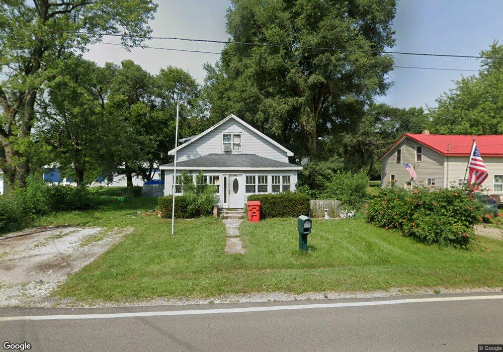
This home is located at 2955 S Range Rd, Knox, IN 46534 and is currently estimated at $156,701, approximately $62 per square foot. 2955 S Range Rd is a home located in Starke County with nearby schools including North Judson-San Pierre Elementary School and N. Judson-San Pierre Junior/Senior High School.
Ownership History
Date
Name
Owned For
Owner Type
Purchase Details
Closed on
May 11, 2005
Sold by
Bank Of New York
Bought by
Danford Matthew K and Danford Jessica J
Current Estimated Value
Home Financials for this Owner
Home Financials are based on the most recent Mortgage that was taken out on this home.
Original Mortgage
$31,500
Outstanding Balance
$15,964
Interest Rate
5.91%
Mortgage Type
New Conventional
Estimated Equity
$140,737
Create a Home Valuation Report for This Property
The Home Valuation Report is an in-depth analysis detailing your home's value as well as a comparison with similar homes in the area
Purchase History
| Date | Buyer | Sale Price | Title Company |
|---|---|---|---|
| Danford Matthew K | -- | Security Title Services Llc |
Source: Public Records
Mortgage History
| Date | Status | Borrower | Loan Amount |
|---|---|---|---|
| Open | Danford Matthew K | $31,500 |
Source: Public Records
Tax History
| Year | Tax Paid | Tax Assessment Tax Assessment Total Assessment is a certain percentage of the fair market value that is determined by local assessors to be the total taxable value of land and additions on the property. | Land | Improvement |
|---|---|---|---|---|
| 2025 | $1,356 | $101,300 | $8,400 | $92,900 |
| 2024 | $1,356 | $97,900 | $8,000 | $89,900 |
| 2023 | $1,366 | $89,800 | $7,300 | $82,500 |
| 2022 | $1,345 | $83,500 | $6,800 | $76,700 |
| 2021 | $1,337 | $71,900 | $6,800 | $65,100 |
| 2020 | $1,265 | $65,300 | $6,800 | $58,500 |
| 2019 | $1,045 | $54,100 | $6,400 | $47,700 |
| 2018 | $947 | $50,900 | $5,800 | $45,100 |
| 2017 | $890 | $50,300 | $5,800 | $44,500 |
| 2016 | $843 | $50,100 | $5,800 | $44,300 |
| 2014 | $804 | $50,200 | $5,900 | $44,300 |
| 2013 | $816 | $50,700 | $6,200 | $44,500 |
Source: Public Records
Map
Nearby Homes
- 840 W 450 S
- 3360 S State Road 39
- 1892 W 200 S
- 0 E 500 S
- 2760 S Lovelia Dr
- 2075 E 200 S
- 2455 W Impala St
- 4540 S 300 E
- 2240 S 350 E
- 1301 W Culver Rd
- 1309 S Roosevelt Rd
- 14.89 Acres W Culver Rd
- 3395 U S 35
- 2260 S Us Highway 35
- 903 S Portland St
- 4189 E County Road 200 S
- 305 W New York St
- 701 S Shield St
- 703 S Main St
- 154 W New York St
- 2937 S Range Rd
- 0 E Toto Rd
- 0 E Toto Rd Unit NRA545431
- 0 E Toto Rd Unit GNR523935
- 0 E Toto Rd Unit GNR501595
- 0 E Toto Rd Unit GNR471821
- 0 E Toto Rd Unit GNR367698
- 0 E Toto Rd Unit GNR355327
- 0 E Toto Rd Unit GNR6292331
- 0 E Toto Rd Unit GNR319530
- 0 E Toto Rd Unit GNR313048
- 0 E Toto Rd Unit GNR312253
- 0 E Toto Rd Unit GNR296484
- 0 E Toto Rd Unit GNR237889
- 0 E Toto Rd Unit GNR212787
- 0 E Toto Rd Unit 6296334
- 0 E Toto Rd Unit 6296763
- 20 E Toto Rd
- 20 W Toto Rd
- 2883 S Range Rd
Your Personal Tour Guide
Ask me questions while you tour the home.