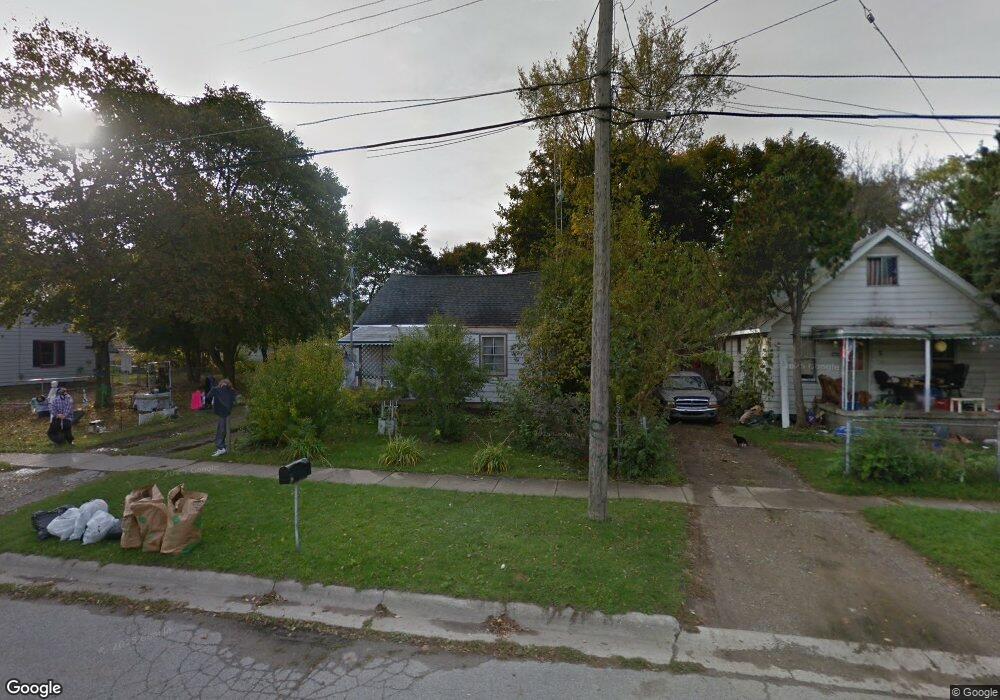
2956 Meisner Ave Flint, MI 48506
Potter Longway NeighborhoodEstimated Value: $30,000 - $41,000
3
Beds
1
Bath
864
Sq Ft
$41/Sq Ft
Est. Value
About This Home
This home is located at 2956 Meisner Ave, Flint, MI 48506 and is currently estimated at $35,500, approximately $41 per square foot. 2956 Meisner Ave is a home located in Genesee County with nearby schools including Potter School, Richfield Public School Academy, and Richfield Early Learning Center.
Ownership History
Date
Name
Owned For
Owner Type
Purchase Details
Closed on
Dec 21, 2021
Sold by
Cherry Deborah L
Bought by
Genessee County Land Bank Authority
Current Estimated Value
Purchase Details
Closed on
May 13, 1998
Sold by
Sorge Alford J
Bought by
Thick Robert E
Purchase Details
Closed on
Sep 10, 1996
Sold by
Thick R E
Bought by
Flynn Kathy M and Flynn Michael L
Purchase Details
Closed on
Jan 7, 1992
Sold by
Thick R E
Bought by
Thick Robert E and Flynn Kathy M
Create a Home Valuation Report for This Property
The Home Valuation Report is an in-depth analysis detailing your home's value as well as a comparison with similar homes in the area
Home Values in the Area
Average Home Value in this Area
Purchase History
| Date | Buyer | Sale Price | Title Company |
|---|---|---|---|
| Genessee County Land Bank Authority | -- | None Available | |
| Thick Robert E | $13,000 | Lawyers Title Insurance Corp | |
| Flynn Kathy M | -- | -- | |
| Thick Robert E | -- | -- |
Source: Public Records
Tax History Compared to Growth
Tax History
| Year | Tax Paid | Tax Assessment Tax Assessment Total Assessment is a certain percentage of the fair market value that is determined by local assessors to be the total taxable value of land and additions on the property. | Land | Improvement |
|---|---|---|---|---|
| 2025 | -- | $0 | $0 | $0 |
| 2024 | -- | $0 | $0 | $0 |
| 2023 | -- | $0 | $0 | $0 |
| 2022 | $0 | $0 | $0 | $0 |
| 2021 | $643 | $7,500 | $0 | $0 |
| 2020 | $603 | $7,400 | $0 | $0 |
| 2019 | $613 | $6,500 | $0 | $0 |
| 2018 | $1,434 | $4,900 | $0 | $0 |
| 2017 | $822 | $0 | $0 | $0 |
| 2016 | $578 | $0 | $0 | $0 |
| 2015 | -- | $0 | $0 | $0 |
| 2014 | -- | $0 | $0 | $0 |
| 2012 | -- | $9,400 | $0 | $0 |
Source: Public Records
Map
Nearby Homes
- 3912 Western Rd
- 3710 Branch Rd
- 2935 Richfield Rd
- 3702 Branch Rd
- 3226 Mcclure Ave
- 3121 Thom St
- 00 Richfield Rd
- 3200 N Averill Ave
- 3250 Carr St
- 2435 Oklahoma Ave
- 2310 Thom St
- 2719 Branch Rd
- 3009 Plainfield Ave
- 3413 Dakota Ave
- 4907 Delta Dr
- 2801 Epsilon Trail
- 3116 Beechwood Ave
- 3729 Craig Dr
- 3602 Dakota Ave
- 1805 Montana Ave
- 2952 Meisner Ave
- 2964 Meisner Ave
- 2930 Meisner Ave
- 2955 Henry St
- 2959 Henry St
- 2951 Henry St
- 2926 Meisner Ave
- 2963 Henry St
- 2935 Meisner Ave
- 2959 Meisner Ave
- 2967 Henry St
- 2927 Henry St
- 2922 Meisner Ave
- 2931 Meisner Ave
- 2971 Henry St
- 2927 Meisner Ave
- 2923 Henry St
- 3901 Coggins Ave
- 2976 Meisner Ave
- 2918 Meisner Ave