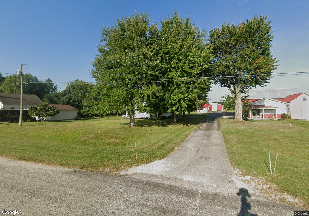
29565 State Route 1 West Harrison, IN 47060
Estimated Value: $257,000 - $373,000
3
Beds
2
Baths
2,384
Sq Ft
$127/Sq Ft
Est. Value
About This Home
This home is located at 29565 State Route 1, West Harrison, IN 47060 and is currently estimated at $303,220, approximately $127 per square foot. 29565 State Route 1 is a home located in Dearborn County with nearby schools including East Central High School.
Ownership History
Date
Name
Owned For
Owner Type
Purchase Details
Closed on
Jan 16, 2020
Sold by
Fischer Bradley J and Fischer Michelle S
Bought by
Fischer Bradley J
Current Estimated Value
Home Financials for this Owner
Home Financials are based on the most recent Mortgage that was taken out on this home.
Original Mortgage
$178,000
Outstanding Balance
$157,573
Interest Rate
3.7%
Mortgage Type
New Conventional
Estimated Equity
$145,647
Purchase Details
Closed on
Apr 8, 2015
Sold by
Fischer Bradley
Bought by
Fischer Bradley J and Fischer Michelle S
Purchase Details
Closed on
Aug 7, 2009
Sold by
Fischer Robert A and Fischer Elizabeth A
Bought by
Fischer Bradley
Home Financials for this Owner
Home Financials are based on the most recent Mortgage that was taken out on this home.
Original Mortgage
$128,250
Interest Rate
5.29%
Mortgage Type
Stand Alone First
Create a Home Valuation Report for This Property
The Home Valuation Report is an in-depth analysis detailing your home's value as well as a comparison with similar homes in the area
Home Values in the Area
Average Home Value in this Area
Purchase History
| Date | Buyer | Sale Price | Title Company |
|---|---|---|---|
| Fischer Bradley J | -- | None Available | |
| Fischer Bradley J | -- | Attorney | |
| Fischer Bradley | $135,000 | Se Indiana Title | |
| Fischer Bradley | -- | -- |
Source: Public Records
Mortgage History
| Date | Status | Borrower | Loan Amount |
|---|---|---|---|
| Open | Fischer Bradley J | $178,000 | |
| Previous Owner | Fischer Bradley | $128,250 |
Source: Public Records
Tax History Compared to Growth
Tax History
| Year | Tax Paid | Tax Assessment Tax Assessment Total Assessment is a certain percentage of the fair market value that is determined by local assessors to be the total taxable value of land and additions on the property. | Land | Improvement |
|---|---|---|---|---|
| 2024 | $1,590 | $187,400 | $32,400 | $155,000 |
| 2023 | $1,633 | $186,400 | $32,400 | $154,000 |
| 2022 | $1,737 | $190,000 | $32,400 | $157,600 |
| 2021 | $1,617 | $175,100 | $32,400 | $142,700 |
| 2020 | $1,530 | $175,100 | $32,400 | $142,700 |
| 2019 | $1,496 | $168,900 | $32,400 | $136,500 |
| 2018 | $1,487 | $168,900 | $32,400 | $136,500 |
| 2017 | $1,350 | $155,100 | $32,400 | $122,700 |
| 2016 | $1,314 | $155,100 | $32,400 | $122,700 |
| 2014 | $1,348 | $156,500 | $32,400 | $124,100 |
| 2013 | $1,348 | $151,900 | $32,400 | $119,500 |
Source: Public Records
Map
Nearby Homes
- 0 Church Ln
- 0 9 + - Acres State Route 1
- 27893 Pamela Ln
- 8347 Dogwood Ct
- 6071 Saint Peters Rd
- 0000 Barber Rd
- 26499 Mccann Rd
- 4175 Whitetail Dr
- 2144 Seeley Rd
- 0 State Rd Unit MBR22016263
- 4555 N Dearborn Rd
- 6499 Stonegate Dr
- 0 Blue Creek Rd Unit 24438254
- 0 Blue Creek Rd Unit 11553503
- 5014 English Woods Rd
- 9500 N Dearborn Rd
- 5527 Berkshire Dr
- 24833 Sawdon Ridge Rd
- 4058 Braxton Trail Ln
- 0 Walters Rd Unit 1773659
- 29549 State Route 1
- 29582 State Route 1
- 29548 State Route 1
- 29659 State Route 1
- 29518 State Route 1
- 29400 State Route 1
- 29734 State Route 1
- 29369 State Route 1
- 29306 State Route 1
- 29575 State Route 1
- 29838 State Route 1
- 29865 State Route 1
- 29263 Saint Joe Dr
- 29876 State Route 1
- 29259 State Route 1
- 29251 Saint Joe Dr
- 29158 State Route 1
- 29148 State Route 1
- 29898 State Route 1
- 29111 State Route 1