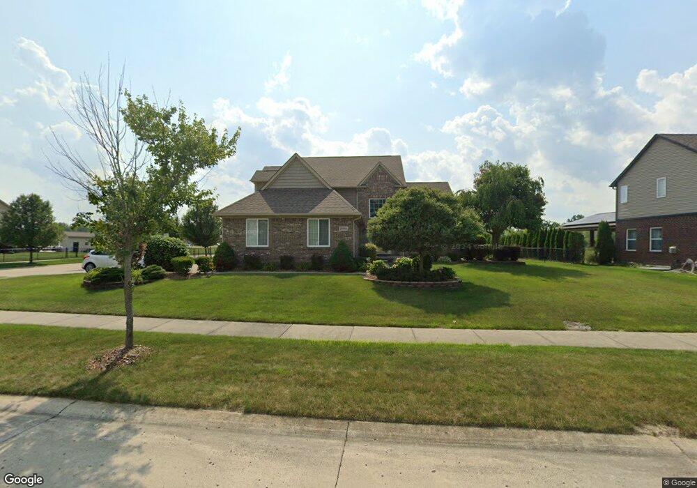
29568 Bradbury Dr Unit Bldg-Unit Flat Rock, MI 48134
Estimated Value: $485,000 - $531,000
Studio
3
Baths
2,611
Sq Ft
$194/Sq Ft
Est. Value
About This Home
This home is located at 29568 Bradbury Dr Unit Bldg-Unit, Flat Rock, MI 48134 and is currently estimated at $506,176, approximately $193 per square foot. 29568 Bradbury Dr Unit Bldg-Unit is a home located in Wayne County with nearby schools including Ethel C. Bobcean Elementary School, John M. Barnes Elementary School, and Thomas Simpson Middle School.
Ownership History
Date
Name
Owned For
Owner Type
Purchase Details
Closed on
Jun 7, 2018
Sold by
Russell Karen K
Bought by
Faiman Falman G and Pabis Faiman Denise L
Current Estimated Value
Home Financials for this Owner
Home Financials are based on the most recent Mortgage that was taken out on this home.
Original Mortgage
$135,000
Outstanding Balance
$117,014
Interest Rate
4.6%
Mortgage Type
New Conventional
Estimated Equity
$389,162
Purchase Details
Closed on
Feb 9, 2011
Sold by
The Preserves At Bradbury Park Llc
Bought by
Russell Karen K
Home Financials for this Owner
Home Financials are based on the most recent Mortgage that was taken out on this home.
Original Mortgage
$173,600
Interest Rate
4.89%
Mortgage Type
New Conventional
Create a Home Valuation Report for This Property
The Home Valuation Report is an in-depth analysis detailing your home's value as well as a comparison with similar homes in the area
Home Values in the Area
Average Home Value in this Area
Purchase History
| Date | Buyer | Sale Price | Title Company |
|---|---|---|---|
| Faiman Falman G | $335,000 | None Available | |
| Russell Karen K | $217,000 | Greco |
Source: Public Records
Mortgage History
| Date | Status | Borrower | Loan Amount |
|---|---|---|---|
| Open | Faiman Falman G | $135,000 | |
| Previous Owner | Russell Karen K | $173,600 |
Source: Public Records
Tax History
| Year | Tax Paid | Tax Assessment Tax Assessment Total Assessment is a certain percentage of the fair market value that is determined by local assessors to be the total taxable value of land and additions on the property. | Land | Improvement |
|---|---|---|---|---|
| 2025 | $8,223 | $257,700 | $0 | $0 |
| 2024 | $7,984 | $248,900 | $0 | $0 |
| 2023 | $7,614 | $214,600 | $0 | $0 |
| 2022 | $9,217 | $192,200 | $0 | $0 |
| 2021 | $8,473 | $164,100 | $0 | $0 |
| 2020 | $8,361 | $162,700 | $0 | $0 |
| 2019 | $8,206 | $150,300 | $0 | $0 |
| 2018 | $3,912 | $142,300 | $0 | $0 |
| 2017 | $2,060 | $127,800 | $0 | $0 |
| 2016 | $4,735 | $120,600 | $0 | $0 |
| 2015 | $8,714 | $116,000 | $0 | $0 |
| 2013 | $8,294 | $97,200 | $0 | $0 |
| 2012 | $3,273 | $81,000 | $19,100 | $61,900 |
Source: Public Records
Map
Nearby Homes
- 29530 Cambridge St
- 23827 Romero
- 23841 Romero
- 23869 Romero
- 23883 Romero
- 23855 Romero
- 23911 Romero
- 23814 Meadows Ave
- 23897 Romero
- 23838 Meadows Ave
- 23376 Port St
- VL Gibraltar Rd
- 00 Gibraltar Rd
- 23965 Gibraltar Rd
- 0 Woodruff Unit 20251062264
- 24943 Mayfair St
- 29726 Red Cedar Dr
- 24664 E Huron River Dr
- 29715 Walnut St
- 23452 Astrid Ln
- 29568 Bradbury Dr Unit 61
- 29540 Bradbury Dr
- 29571 Bradbury Dr
- 29512 Bradbury Dr
- 29543 Bradbury Dr
- 29515 Bradbury Dr
- 29487 Bradbury Dr
- 29643 Bradbury Dr
- 29484 Bradbury Dr
- 29640 Bradbury Dr
- 29512 Cambridge St
- 29668 Bradbury Dr
- 29456 Bradbury Dr Unit 57
- 29450 Cambridge St
- 29714 Cambridge St
- 29438 Cambridge St
- 29699 Bradbury Dr
- 29428 Bradbury Dr
Your Personal Tour Guide
Ask me questions while you tour the home.