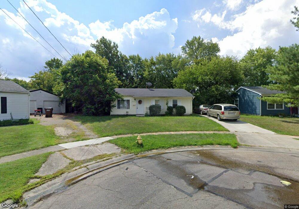
2957 Laverne Dr Cincinnati, OH 45251
Estimated Value: $143,000 - $152,000
3
Beds
1
Bath
864
Sq Ft
$172/Sq Ft
Est. Value
About This Home
This home is located at 2957 Laverne Dr, Cincinnati, OH 45251 and is currently estimated at $148,686, approximately $172 per square foot. 2957 Laverne Dr is a home located in Hamilton County with nearby schools including Taylor Elementary School, Pleasant Run Elementary School, and Pleasant Run Middle School.
Ownership History
Date
Name
Owned For
Owner Type
Purchase Details
Closed on
Jul 22, 1994
Sold by
Tran Suong
Bought by
Hassett Katharine A and Nevsimal James H
Current Estimated Value
Home Financials for this Owner
Home Financials are based on the most recent Mortgage that was taken out on this home.
Original Mortgage
$46,550
Interest Rate
8.53%
Create a Home Valuation Report for This Property
The Home Valuation Report is an in-depth analysis detailing your home's value as well as a comparison with similar homes in the area
Home Values in the Area
Average Home Value in this Area
Purchase History
| Date | Buyer | Sale Price | Title Company |
|---|---|---|---|
| Hassett Katharine A | -- | -- |
Source: Public Records
Mortgage History
| Date | Status | Borrower | Loan Amount |
|---|---|---|---|
| Closed | Hassett Katharine A | $46,550 |
Source: Public Records
Tax History Compared to Growth
Tax History
| Year | Tax Paid | Tax Assessment Tax Assessment Total Assessment is a certain percentage of the fair market value that is determined by local assessors to be the total taxable value of land and additions on the property. | Land | Improvement |
|---|---|---|---|---|
| 2024 | $1,782 | $31,686 | $10,150 | $21,536 |
| 2023 | $1,761 | $31,686 | $10,150 | $21,536 |
| 2022 | $1,542 | $22,681 | $8,985 | $13,696 |
| 2021 | $1,557 | $22,681 | $8,985 | $13,696 |
| 2020 | $1,538 | $22,681 | $8,985 | $13,696 |
| 2019 | $1,338 | $18,291 | $7,245 | $11,046 |
| 2018 | $1,204 | $18,291 | $7,245 | $11,046 |
| 2017 | $1,156 | $18,291 | $7,245 | $11,046 |
| 2016 | $1,201 | $18,557 | $7,315 | $11,242 |
| 2015 | $1,196 | $18,557 | $7,315 | $11,242 |
| 2014 | $1,199 | $18,557 | $7,315 | $11,242 |
| 2013 | $1,203 | $19,534 | $7,700 | $11,834 |
Source: Public Records
Map
Nearby Homes
- 9562 Trafalgar Ct
- 3013 Niagara St
- 2908 Libra Ln
- 9738 Gibralter Dr
- 2702 Niagara St
- 9712 Manhattan Dr
- 9302 Loralinda Dr
- 9717 Loralinda Dr
- 9484 Ridgemoor Ave
- 3151 Birchway Dr Unit 3151
- 2697 Wenning Rd
- 9737 Dunraven Dr
- 3258 Lillwood Ln
- 3205 Donnybrook Ln
- 2542 Ontario St
- 3246 Ainsworth Dr
- 9828 Loralinda Dr
- 9329 Comstock Dr
- 9224 Comstock Dr
- 2592 Wenning Rd
- 2965 Laverne Dr
- 2944 Hyannis Dr
- 2958 Hyannis Dr
- 2934 Hyannis Dr
- 2975 Laverne Dr
- 2968 Hyannis Dr
- 2958 Laverne Dr
- 2920 Hyannis Dr
- 9523 Anaheim Ct
- 9513 Anaheim Ct
- 2950 Laverne Dr
- 2966 Laverne Dr
- 2985 Laverne Dr
- 9526 Burgess Dr
- 9503 Anaheim Ct
- 2974 Laverne Dr
- 9533 Anaheim Ct
- 2988 Hyannis Dr
- 2947 Hyannis Dr
- 2937 Hyannis Dr