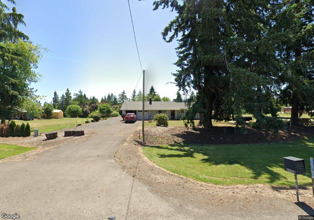
29570 Highway 34 Corvallis, OR 97333
Estimated Value: $434,000 - $573,911
3
Beds
2
Baths
1,482
Sq Ft
$354/Sq Ft
Est. Value
About This Home
This home is located at 29570 Highway 34, Corvallis, OR 97333 and is currently estimated at $524,637, approximately $354 per square foot. 29570 Highway 34 is a home located in Linn County with nearby schools including Garfield Elementary School, Linus Pauling Middle School, and Corvallis High School.
Ownership History
Date
Name
Owned For
Owner Type
Purchase Details
Closed on
Oct 29, 2009
Sold by
Heirs Of Wilda M Modrell
Bought by
Freel Milton E
Current Estimated Value
Home Financials for this Owner
Home Financials are based on the most recent Mortgage that was taken out on this home.
Original Mortgage
$216,956
Outstanding Balance
$140,512
Interest Rate
5%
Mortgage Type
VA
Estimated Equity
$384,125
Purchase Details
Closed on
Sep 28, 2004
Sold by
Modrell Marshall M and Modrell Wilda M
Bought by
Modrell Wilda M
Home Financials for this Owner
Home Financials are based on the most recent Mortgage that was taken out on this home.
Original Mortgage
$130,000
Interest Rate
5.76%
Mortgage Type
New Conventional
Create a Home Valuation Report for This Property
The Home Valuation Report is an in-depth analysis detailing your home's value as well as a comparison with similar homes in the area
Home Values in the Area
Average Home Value in this Area
Purchase History
| Date | Buyer | Sale Price | Title Company |
|---|---|---|---|
| Freel Milton E | $225,000 | First American Title | |
| Modrell Wilda M | -- | Ticor Title |
Source: Public Records
Mortgage History
| Date | Status | Borrower | Loan Amount |
|---|---|---|---|
| Open | Freel Milton E | $216,956 | |
| Previous Owner | Modrell Wilda M | $130,000 |
Source: Public Records
Tax History Compared to Growth
Tax History
| Year | Tax Paid | Tax Assessment Tax Assessment Total Assessment is a certain percentage of the fair market value that is determined by local assessors to be the total taxable value of land and additions on the property. | Land | Improvement |
|---|---|---|---|---|
| 2025 | $4,179 | $271,370 | -- | -- |
| 2024 | $4,055 | $263,470 | -- | -- |
| 2023 | $3,936 | $255,800 | $0 | $0 |
| 2022 | $3,821 | $248,350 | $0 | $0 |
| 2021 | $3,655 | $241,120 | $0 | $0 |
| 2020 | $3,546 | $234,100 | $0 | $0 |
| 2019 | $3,471 | $227,290 | $0 | $0 |
| 2018 | $3,391 | $220,670 | $0 | $0 |
| 2017 | $3,102 | $214,250 | $0 | $0 |
| 2016 | $2,812 | $192,580 | $0 | $0 |
| 2015 | $2,724 | $186,980 | $0 | $0 |
| 2014 | $2,758 | $181,540 | $0 | $0 |
Source: Public Records
Map
Nearby Homes
- 33844 SE White Oak Rd
- 29509 NE Pheasant Ave
- 29229 Highway 34 Unit 6
- 34123 Cushman Rd Unit 1200
- 34123 Cushman Rd Unit 3 Lots
- 34123 Cushman Rd Unit 1400
- 34123 Cushman Rd Unit 1300
- (Near 34123) Cushman (Lot 1200) Rd
- (Near 34123) Rd
- (Near 34123) Cushman (Lot 1400) Rd
- (Near 34123) Cushman (Lot 1300) Rd
- 33125 SE White Oak Rd Unit 21 Rd
- 33125 SE White Oak Rd Unit 17
- 33125 SE White Oak Rd Unit 5 Rd
- 33125 SE White Oak (#20) Rd Unit 20
- 33125 SE White Oak (#56) Rd Unit 56
- 33125 SE White Oak (#1) Rd Unit 1
- 34505 Riverside Dr SW
- 32642 Peoria Rd SW
- 2635 NE Seavy Place
- 33890 SE White Oak Rd
- 29540 Highway 34
- 29540 Highway 34 (#0226635 & 0226643)
- 29540 Highway 34 (#0226643)
- 29540 Highway 34
- 29530 Highway 34
- 29555 Highway 34
- 29545 Highway 34
- 29626 Highway 34 SW
- 29626 Highway 34 SW
- 24526 S Joy Place E
- 33780 SE White Oak Rd
- 33850 SE Joy Ln
- 33787 SE White Oak Rd
- 33977 NE Colorado Lake Dr
- 33765 SE White Oak Rd
- 29706 Highway 34 SW
- 33766 SE White Oak Rd
- 33976 NE Colorado Lake Dr
- 33756 SE White Oak Rd