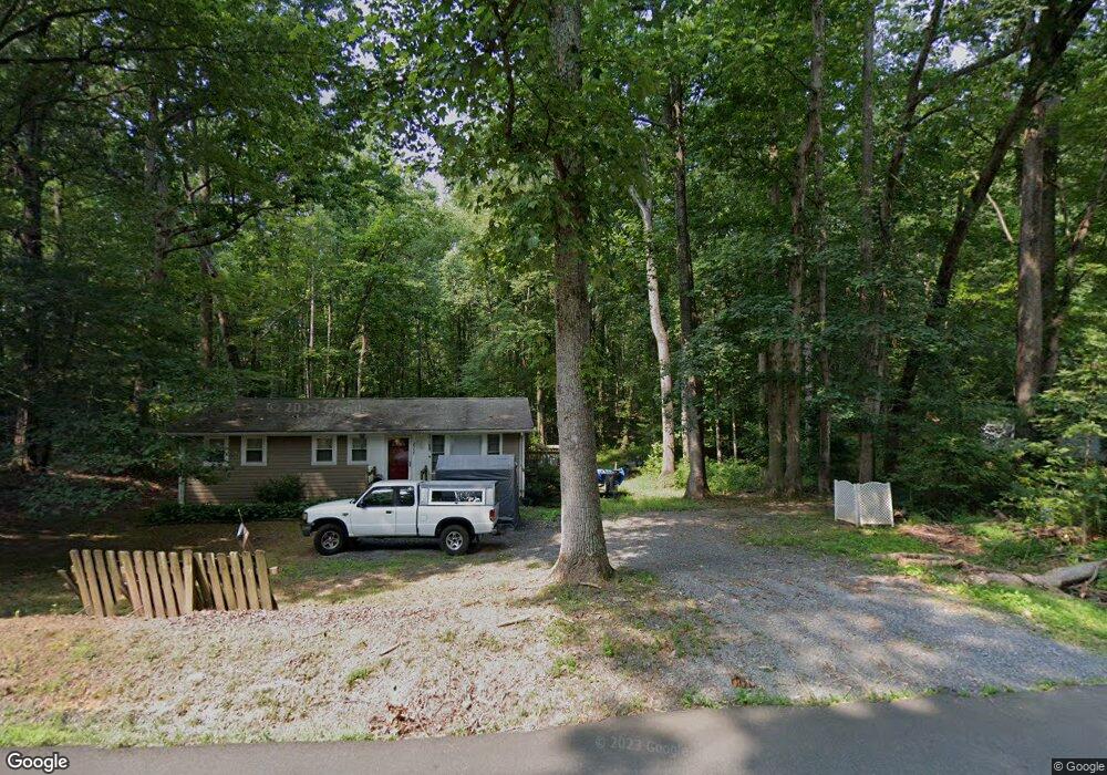
2958 Rolling Rd Scottsville, VA 24590
Estimated Value: $287,213 - $350,000
3
Beds
1
Bath
1,134
Sq Ft
$273/Sq Ft
Est. Value
About This Home
This home is located at 2958 Rolling Rd, Scottsville, VA 24590 and is currently estimated at $309,553, approximately $272 per square foot. 2958 Rolling Rd is a home located in Albemarle County with nearby schools including Stone Robinson Elementary School, Walton Middle School, and Monticello High School.
Ownership History
Date
Name
Owned For
Owner Type
Purchase Details
Closed on
Jul 25, 2006
Sold by
Moore Charles F and Hall Mitchell A
Bought by
Heritage Iii Properties Llc
Current Estimated Value
Home Financials for this Owner
Home Financials are based on the most recent Mortgage that was taken out on this home.
Original Mortgage
$35,220
Outstanding Balance
$21,174
Interest Rate
6.88%
Mortgage Type
Seller Take Back
Estimated Equity
$288,379
Create a Home Valuation Report for This Property
The Home Valuation Report is an in-depth analysis detailing your home's value as well as a comparison with similar homes in the area
Home Values in the Area
Average Home Value in this Area
Purchase History
| Date | Buyer | Sale Price | Title Company |
|---|---|---|---|
| Heritage Iii Properties Llc | -- | -- |
Source: Public Records
Mortgage History
| Date | Status | Borrower | Loan Amount |
|---|---|---|---|
| Open | Heritage Iii Properties Llc | $35,220 |
Source: Public Records
Tax History Compared to Growth
Tax History
| Year | Tax Paid | Tax Assessment Tax Assessment Total Assessment is a certain percentage of the fair market value that is determined by local assessors to be the total taxable value of land and additions on the property. | Land | Improvement |
|---|---|---|---|---|
| 2025 | $2,079 | $232,500 | $65,400 | $167,100 |
| 2024 | -- | $231,600 | $62,300 | $169,300 |
| 2023 | $1,961 | $229,600 | $54,300 | $175,300 |
| 2022 | $1,776 | $208,000 | $57,000 | $151,000 |
| 2021 | $1,559 | $182,600 | $57,000 | $125,600 |
| 2020 | $1,407 | $164,800 | $49,400 | $115,400 |
| 2019 | $1,325 | $155,200 | $45,600 | $109,600 |
| 2018 | $1,056 | $140,700 | $38,000 | $102,700 |
| 2017 | $931 | $111,000 | $37,100 | $73,900 |
| 2016 | $1,034 | $123,300 | $49,400 | $73,900 |
| 2015 | $988 | $120,600 | $49,400 | $71,200 |
| 2014 | -- | $120,300 | $49,400 | $70,900 |
Source: Public Records
Map
Nearby Homes
- TBD Rose Hill Church Ln
- 3209 Rolling Rd
- 2621 Coopers Ln
- 2405 Coopers Ln
- TBD Presidents Rd
- 2055 Thomas Jefferson Pkwy
- 2157 Thomas Jefferson Pkwy
- Lot 41B Ed Jones Rd
- 5A Marie Curie Ct
- 1840 Ed Jones Rd
- 36 Mary Jackson Ct
- 35 Mary Jackson Ct
- 1124 Arden Dr
- 1229 Milton Rd
- 35A Mary Jackson Ct
- 3422 Montague St
- The Aspen Plan at Galaxie Farm
- 2126 Avinity Loop
- 1694 Royal Oak Ct
- 3991 Carters Mountain Rd
- 2946 Rolling Rd
- 2968 Rolling Rd
- 2941 Rolling Rd
- 2932 Rolling Rd
- 2985 Rolling Rd
- 2997 Rolling Rd
- 3038 Rolling Rd
- 973 Scott Hill Ln
- 959 Scott Hill Ln
- 2895 Rolling Rd
- 3059 Rolling Rd
- 1071 Slate Hill Dr
- 937 Scott Hill Ln
- 3070 Rolling Rd
- 1101 Slate Hill Dr
- 3068 Rolling Rd
- 3075 Rolling Rd
- 1112 Slate Hill Dr
- 3091 Rolling Rd
- 3103 Rolling Rd