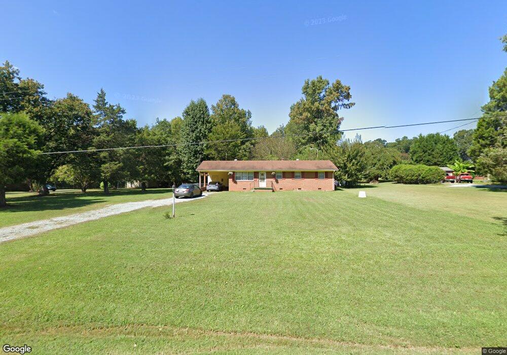
2959 Alfred Rd Graham, NC 27253
Estimated Value: $236,000 - $276,000
3
Beds
2
Baths
1,242
Sq Ft
$207/Sq Ft
Est. Value
About This Home
This home is located at 2959 Alfred Rd, Graham, NC 27253 and is currently estimated at $257,337, approximately $207 per square foot. 2959 Alfred Rd is a home located in Alamance County with nearby schools including Alexander Wilson Elementary School, Hawfields Middle School, and River Mill Academy.
Ownership History
Date
Name
Owned For
Owner Type
Purchase Details
Closed on
Jul 31, 2003
Sold by
Dryer Robert
Bought by
Racke James
Current Estimated Value
Home Financials for this Owner
Home Financials are based on the most recent Mortgage that was taken out on this home.
Original Mortgage
$12,000
Outstanding Balance
$5,111
Interest Rate
5.17%
Mortgage Type
New Conventional
Estimated Equity
$252,226
Create a Home Valuation Report for This Property
The Home Valuation Report is an in-depth analysis detailing your home's value as well as a comparison with similar homes in the area
Home Values in the Area
Average Home Value in this Area
Purchase History
| Date | Buyer | Sale Price | Title Company |
|---|---|---|---|
| Racke James | $12,000 | -- |
Source: Public Records
Mortgage History
| Date | Status | Borrower | Loan Amount |
|---|---|---|---|
| Open | Racke James | $12,000 |
Source: Public Records
Tax History Compared to Growth
Tax History
| Year | Tax Paid | Tax Assessment Tax Assessment Total Assessment is a certain percentage of the fair market value that is determined by local assessors to be the total taxable value of land and additions on the property. | Land | Improvement |
|---|---|---|---|---|
| 2025 | $1,192 | $215,200 | $49,810 | $165,390 |
| 2024 | $1,138 | $215,200 | $49,810 | $165,390 |
| 2023 | $1,053 | $215,200 | $49,810 | $165,390 |
| 2022 | $863 | $117,224 | $38,297 | $78,927 |
| 2021 | $875 | $117,224 | $38,297 | $78,927 |
| 2020 | $886 | $117,224 | $38,297 | $78,927 |
| 2019 | $891 | $117,224 | $38,297 | $78,927 |
| 2018 | $0 | $117,224 | $38,297 | $78,927 |
| 2017 | $781 | $117,224 | $38,297 | $78,927 |
| 2016 | $783 | $116,918 | $38,722 | $78,196 |
| 2015 | $781 | $117,101 | $38,722 | $78,379 |
| 2014 | -- | $117,101 | $38,722 | $78,379 |
Source: Public Records
Map
Nearby Homes
- 0 Bob Vaughn Rd
- 2529 Reynolds Dr
- 1237 Gemstone Ct
- 2986 Worth Ln
- 818 Houston Ct
- 828 Houston Ct
- 1054 George Bason Rd
- 401 Lawton Dr
- 1308 Green Vista Way
- 3514 Perrin Dr
- FREEPORT Plan at Quarry Hills
- Clifton Plan at Quarry Hills - Freedom
- Dover Plan at Quarry Hills - Freedom
- Bristol Plan at Quarry Hills - Freedom
- Cali Plan at Quarry Hills
- ABERDEEN Plan at Quarry Hills
- Aria Plan at Quarry Hills
- 1644 Abberly Place
- 1677 Abberly Place
- 434 Lawton Dr
- 2951 Alfred Rd
- 2973 Alfred Rd
- 2933 Alfred Rd
- 3003 Alfred Rd
- 3015 Alfred Rd
- 3033 Alfred Rd
- 3041 Alfred Rd
- 3049 Alfred Rd
- 3246 Swepsonville Saxapahaw Rd
- 3248 Swepsonville Saxapahaw Rd
- 3248 Swepsonville Saxapahaw Rd
- 3230 Swepsonville Saxapahaw Rd
- 3220 Swepsonville Saxapahaw Rd
- 3247 Swepsonville Saxapahaw Rd
- 3237 Swepsonville Saxapahaw Rd
- 3271 Swepsonville Saxapahaw Rd
- 3166 Swepsonville Saxapahaw Rd
- 3221 Swepsonville Saxapahaw Rd
- 3148 Swepsonville Saxapahaw Rd
- 3131 Tom Burke Ln