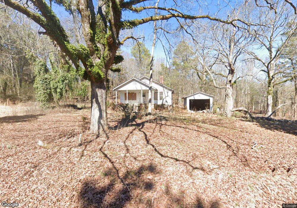
2959 Wayside Rd Kingston, GA 30145
Estimated Value: $137,000 - $219,000
--
Bed
1
Bath
1,332
Sq Ft
$138/Sq Ft
Est. Value
About This Home
This home is located at 2959 Wayside Rd, Kingston, GA 30145 and is currently estimated at $183,667, approximately $137 per square foot. 2959 Wayside Rd is a home located in Floyd County with nearby schools including Model Middle School and Model High School.
Ownership History
Date
Name
Owned For
Owner Type
Purchase Details
Closed on
Apr 22, 2025
Sold by
Carver Randall E
Bought by
Maxwell Morgan R
Current Estimated Value
Purchase Details
Closed on
Apr 19, 2017
Sold by
Ball Carol Ann
Bought by
Carver Randall E and Carver Sylvia D
Purchase Details
Closed on
Sep 27, 2014
Sold by
Headrick Kimberly Ball
Bought by
Ball Carol Ann Blackwell
Purchase Details
Closed on
Sep 22, 2014
Sold by
Ball Emma J
Bought by
Ball Carol Ann Blackwell
Purchase Details
Closed on
Apr 9, 2014
Sold by
Ball Sarah H
Bought by
Ball James Earl and Ball Benny Wayne
Purchase Details
Closed on
May 1, 1974
Bought by
P and R
Purchase Details
Closed on
Jan 4, 1955
Bought by
Kerce John
Purchase Details
Closed on
Jan 2, 1955
Sold by
Kerce John
Bought by
Ball Raymond Hill
Create a Home Valuation Report for This Property
The Home Valuation Report is an in-depth analysis detailing your home's value as well as a comparison with similar homes in the area
Home Values in the Area
Average Home Value in this Area
Purchase History
| Date | Buyer | Sale Price | Title Company |
|---|---|---|---|
| Maxwell Morgan R | -- | -- | |
| Carver Randall E | $12,000 | -- | |
| Ball Carol Ann Blackwell | -- | -- | |
| Ball Carol Ann Blackwell | -- | -- | |
| Ball Carol Ann Blackwell | -- | -- | |
| Ball James Earl | -- | -- | |
| P | -- | -- | |
| Ball Sarah H | -- | -- | |
| Kerce John | -- | -- | |
| Ball Raymond Hill | -- | -- |
Source: Public Records
Tax History Compared to Growth
Tax History
| Year | Tax Paid | Tax Assessment Tax Assessment Total Assessment is a certain percentage of the fair market value that is determined by local assessors to be the total taxable value of land and additions on the property. | Land | Improvement |
|---|---|---|---|---|
| 2024 | $372 | $11,667 | $9,599 | $2,068 |
| 2023 | $334 | $9,847 | $8,726 | $1,121 |
| 2022 | $239 | $8,044 | $6,923 | $1,121 |
| 2021 | $224 | $7,418 | $6,297 | $1,121 |
| 2020 | $201 | $6,597 | $5,476 | $1,121 |
| 2019 | $198 | $6,597 | $5,476 | $1,121 |
| 2018 | $144 | $6,336 | $5,215 | $1,121 |
| 2017 | $179 | $5,950 | $4,829 | $1,121 |
| 2016 | $181 | $5,920 | $4,800 | $1,120 |
| 2015 | $89 | $11,892 | $4,800 | $7,092 |
| 2014 | $89 | $11,892 | $4,800 | $7,092 |
Source: Public Records
Map
Nearby Homes
- 0 Mcclain Rd Unit 10537234
- 145 Wiseman Rd
- 676 Flowery Branch Rd
- 169 Barnsley Church Rd
- 0 Galway Dr NE
- 96 Collins Rd NE
- 92 Davis Loop
- 0 Fire Tower Rd NE Unit 10418895
- 22 Starling Ct
- 851 Barnsley Garden Rd
- 350 Galway Dr
- 1644 Wayside Rd NE
- 818 Morrison Camp Ground Rd NE
- 291 Youngs Mill Rd
- 370 Youngs Mill Rd
- 489 Barron Rd NE
- 1849 Morrison Camp Ground Rd NE
- 8 Cinnamon Ln NE
- 221 Dry Creek Rd NW Unit LotWP001
- 221 Dry Creek Rd NW
- 2847 Wayside Rd
- 2980 Wayside Rd
- 50 Flowery Branch Rd
- 000 Flowery Branch Rd
- 10 Flowery Branch Rd
- 71 Flowery Branch Rd
- 695 Mcclain Rd
- 2993 Wayside Rd
- 3055 Wayside Rd
- 155 Boulder Rd
- 121 Boulder Rd
- 89 Boulder Rd
- 491 Mcclain Rd
- 247 Boulder Rd
- 3235 Wayside Rd
- 233 Boulder Rd
- 135 Boulder Rd
- 489 Mcclain Rd
- 3268 Wayside Rd
- 90 Boulder Rd