Estimated Value: $188,038 - $283,000
--
Bed
1
Bath
864
Sq Ft
$269/Sq Ft
Est. Value
About This Home
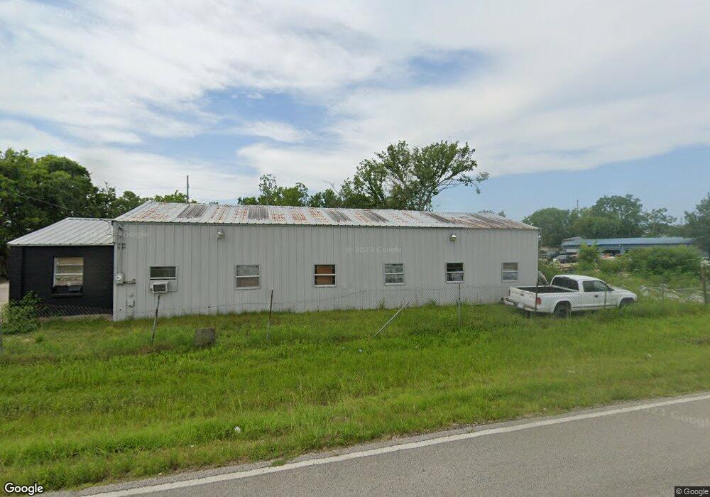
This home is located at 296 Cline Dr, Alvin, TX 77511 and is currently estimated at $232,010, approximately $268 per square foot. 296 Cline Dr is a home located in Brazoria County with nearby schools including Mark Twain Elementary School, G.W. Harby Junior High School, and Alvin High School.
Ownership History
Date
Name
Owned For
Owner Type
Purchase Details
Closed on
Dec 29, 2009
Sold by
Tipps Lola Jan and Tipps Alvin B
Bought by
Alviso Felipe Dejesus
Current Estimated Value
Home Financials for this Owner
Home Financials are based on the most recent Mortgage that was taken out on this home.
Original Mortgage
$39,900
Interest Rate
4.82%
Mortgage Type
Seller Take Back
Purchase Details
Closed on
Jul 24, 2001
Sold by
Wynn Billy and Wynn Anne
Bought by
Tipps Jan
Purchase Details
Closed on
Aug 14, 1998
Sold by
Mccraw Jeffery G and Mccraw Pamala A
Bought by
Wynn Billy and Wynn Ann
Create a Home Valuation Report for This Property
The Home Valuation Report is an in-depth analysis detailing your home's value as well as a comparison with similar homes in the area
Home Values in the Area
Average Home Value in this Area
Purchase History
| Date | Buyer | Sale Price | Title Company |
|---|---|---|---|
| Alviso Felipe Dejesus | -- | None Available | |
| Tipps Jan | $20,000 | -- | |
| Wynn Billy | -- | -- |
Source: Public Records
Mortgage History
| Date | Status | Borrower | Loan Amount |
|---|---|---|---|
| Closed | Alviso Felipe Dejesus | $39,900 |
Source: Public Records
Tax History Compared to Growth
Tax History
| Year | Tax Paid | Tax Assessment Tax Assessment Total Assessment is a certain percentage of the fair market value that is determined by local assessors to be the total taxable value of land and additions on the property. | Land | Improvement |
|---|---|---|---|---|
| 2025 | $543 | $100,465 | $79,200 | $89,160 |
| 2023 | $543 | $83,029 | $79,200 | $85,920 |
| 2022 | $1,608 | $75,481 | $69,300 | $40,290 |
| 2021 | $1,523 | $96,390 | $58,500 | $37,890 |
| 2020 | $1,403 | $94,390 | $54,000 | $40,390 |
| 2019 | $1,313 | $56,710 | $13,500 | $43,210 |
| 2018 | $1,373 | $59,160 | $16,200 | $42,960 |
| 2017 | $1,298 | $55,260 | $16,200 | $39,060 |
| 2016 | $1,269 | $55,260 | $16,200 | $39,060 |
| 2014 | $937 | $51,440 | $13,500 | $37,940 |
Source: Public Records
Map
Nearby Homes
- 432 Kendall Crest Dr
- 424 Kendall Crest Dr
- 415 Kendall Crest Dr
- 406 Kendall Crest Dr
- 396 Kendall Crest Dr
- 394 Kendall Crest Dr
- 431 Kendall Crest Dr
- 418 Kendall Crest Dr
- 414 Kendall Crest Dr
- 404 Kendall Crest Dr
- 390 Kendall Crest Dr
- 397 Kendall Crest Dr
- 380 Kendall Crest Dr
- 368 Selah Ct
- 356 Selah Ct
- 103 Cline Dr
- 350 Selah Ct
- 340 Kendall Crest Dr
- 5330 Latigo Ct
- 5307 Camerford Ct
- 543 County Road 296
- 325 Oliver
- 515 County Road 296
- 572 Cline Dr
- 572 County Road 296
- 328 County Road 296
- 503 County Road 296
- 503 County Rd
- 638 County Road 296
- 487 County Road 296 Unit 296
- 655 County Road 296
- 487 Cline Dr Unit 296
- 502 Cline Dr
- 502 County Road 296
- 656 County Road 296 Unit 296
- 388 Kendall Crest Dr
- 656 Cline Dr
- 403 Kendall Crest Dr
- 419 Kendall Crest Dr
- 457 County Road 296