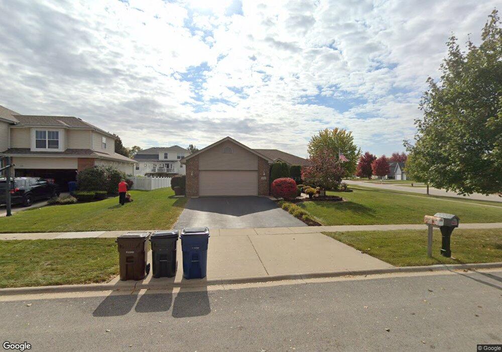
296 Colony Ln New Lenox, IL 60451
Estimated Value: $361,383 - $498,000
--
Bed
--
Bath
--
Sq Ft
0.27
Acres
About This Home
This home is located at 296 Colony Ln, New Lenox, IL 60451 and is currently estimated at $440,846. 296 Colony Ln is a home located in Will County with nearby schools including Bentley Elementary School, Arnold J Tyler School, and Alex M Martino Jr High School.
Ownership History
Date
Name
Owned For
Owner Type
Purchase Details
Closed on
Sep 29, 2006
Sold by
Griffith Jennifer and Estrada Ward Jennifer
Bought by
Lucille L Smuskiewicz Living Trust
Current Estimated Value
Purchase Details
Closed on
Aug 17, 2005
Sold by
Ward Robert J
Bought by
Estrada Ward Jennifer
Purchase Details
Closed on
Sep 17, 2002
Sold by
Nlsb
Bought by
Ward Robert J and Estrada Ward Jennifer
Home Financials for this Owner
Home Financials are based on the most recent Mortgage that was taken out on this home.
Original Mortgage
$160,000
Interest Rate
6.39%
Create a Home Valuation Report for This Property
The Home Valuation Report is an in-depth analysis detailing your home's value as well as a comparison with similar homes in the area
Home Values in the Area
Average Home Value in this Area
Purchase History
| Date | Buyer | Sale Price | Title Company |
|---|---|---|---|
| Lucille L Smuskiewicz Living Trust | $290,000 | Chicago Title Insurance Co | |
| Estrada Ward Jennifer | -- | First American Title | |
| Ward Robert J | $205,000 | First American Title |
Source: Public Records
Mortgage History
| Date | Status | Borrower | Loan Amount |
|---|---|---|---|
| Previous Owner | Ward Robert J | $160,000 |
Source: Public Records
Tax History Compared to Growth
Tax History
| Year | Tax Paid | Tax Assessment Tax Assessment Total Assessment is a certain percentage of the fair market value that is determined by local assessors to be the total taxable value of land and additions on the property. | Land | Improvement |
|---|---|---|---|---|
| 2024 | $7,480 | $108,178 | $33,360 | $74,818 |
| 2023 | $7,480 | $98,612 | $30,410 | $68,202 |
| 2022 | $6,909 | $90,845 | $28,015 | $62,830 |
| 2021 | $6,524 | $85,437 | $26,347 | $59,090 |
| 2020 | $6,317 | $82,389 | $25,407 | $56,982 |
| 2019 | $6,028 | $79,834 | $24,619 | $55,215 |
| 2018 | $5,868 | $77,081 | $23,770 | $53,311 |
| 2017 | $5,559 | $74,865 | $23,087 | $51,778 |
| 2016 | $5,380 | $72,861 | $22,469 | $50,392 |
| 2015 | $5,598 | $70,568 | $21,762 | $48,806 |
| 2014 | $5,598 | $69,696 | $21,493 | $48,203 |
| 2013 | $5,598 | $70,636 | $21,783 | $48,853 |
Source: Public Records
Map
Nearby Homes
- 329 Hancock Dr
- 1000 S Cedar Rd
- 718 S Prairie Rd
- 808 Stonegate Rd
- 1046 Schoolgate Rd Unit 3
- 105 Roy St
- 1007 Nelson Rd
- 709 Young Dr
- 14620 W Laraway Rd
- 00 NE Corner Cherry Hill Road and Moss Lane Rd
- 315 S Pine St
- 13255 W Laraway Rd
- 235 Roberts Rd
- 574 Prairie Crossing Dr
- 920 Barnside Rd
- 416 Manor Ct Unit B
- 1914 Heatherway Ln Unit 27
- 203 Tonell Ave
- 2231 Stone Creek Dr
- 2241 Stone Creek Dr
- 276 Colony Ln
- 295 Congress Dr
- 275 Congress Dr
- 1127 Ogden Rd
- 256 Colony Ln
- 1113 Ogden Rd Unit 3
- 295 Colony Ln
- 255 Congress Dr
- 275 Colony Ln
- 1141 Ogden Rd
- 255 Colony Ln
- 1075 Ogden Rd
- 236 Colony Ln
- 1153 Ogden Rd
- 1055 Ogden Rd
- 235 Congress Dr
- 282 Congress Dr
- 298 Charleston Dr
- 1114 Patriot Dr
- 296 Congress Dr