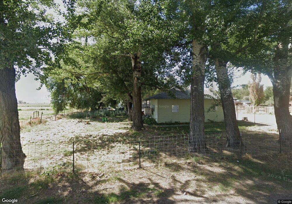
296 E 400 N Hinckley, UT 84635
Estimated Value: $178,000 - $264,000
--
Bed
--
Bath
--
Sq Ft
0.67
Acres
About This Home
This home is located at 296 E 400 N, Hinckley, UT 84635 and is currently estimated at $221,000. 296 E 400 N is a home.
Ownership History
Date
Name
Owned For
Owner Type
Purchase Details
Closed on
Sep 30, 2025
Sold by
Taylor Rebecca L
Bought by
Tkj Properties Llc
Current Estimated Value
Purchase Details
Closed on
Aug 26, 2025
Sold by
Taylor Rebecca L
Bought by
Tkj Properties Llc
Purchase Details
Closed on
Oct 13, 2021
Sold by
Wardle Samuel W
Bought by
Taylor Rebecca L
Purchase Details
Closed on
Sep 18, 2017
Sold by
Shurtz Kay L
Bought by
Wardle Samuel W and Norton Connor
Purchase Details
Closed on
Nov 30, 2006
Sold by
Summit George Don
Bought by
Shurtz Kay L
Home Financials for this Owner
Home Financials are based on the most recent Mortgage that was taken out on this home.
Original Mortgage
$38,000
Interest Rate
6.32%
Mortgage Type
Purchase Money Mortgage
Create a Home Valuation Report for This Property
The Home Valuation Report is an in-depth analysis detailing your home's value as well as a comparison with similar homes in the area
Home Values in the Area
Average Home Value in this Area
Purchase History
| Date | Buyer | Sale Price | Title Company |
|---|---|---|---|
| Tkj Properties Llc | -- | None Listed On Document | |
| Tkj Properties Llc | -- | None Listed On Document | |
| Tkj Properties Llc | -- | None Listed On Document | |
| Taylor Rebecca L | -- | First American Title | |
| Taylor Rebecca L | -- | First American Title | |
| Wardle Samuel W | -- | -- | |
| Shurtz Kay L | -- | -- |
Source: Public Records
Mortgage History
| Date | Status | Borrower | Loan Amount |
|---|---|---|---|
| Previous Owner | Shurtz Kay L | $38,000 |
Source: Public Records
Tax History Compared to Growth
Tax History
| Year | Tax Paid | Tax Assessment Tax Assessment Total Assessment is a certain percentage of the fair market value that is determined by local assessors to be the total taxable value of land and additions on the property. | Land | Improvement |
|---|---|---|---|---|
| 2025 | $595 | $70,836 | $16,519 | $54,317 |
| 2024 | $595 | $63,436 | $6,365 | $57,071 |
| 2023 | $707 | $63,436 | $6,365 | $57,071 |
| 2022 | $461 | $38,828 | $5,787 | $33,041 |
| 2021 | $376 | $30,153 | $4,822 | $25,331 |
| 2020 | $326 | $26,148 | $4,593 | $21,555 |
| 2019 | $323 | $26,148 | $4,593 | $21,555 |
| 2018 | $315 | $26,148 | $4,593 | $21,555 |
| 2017 | $320 | $25,520 | $4,593 | $20,927 |
| 2016 | $307 | $25,520 | $4,593 | $20,927 |
| 2015 | $313 | $26,009 | $4,593 | $21,416 |
| 2014 | -- | $26,009 | $4,593 | $21,416 |
| 2013 | -- | $25,386 | $4,593 | $20,793 |
Source: Public Records
Map
Nearby Homes
- 168 N 100 Rd W
- 6500 W 2000 S
- 289 W Center St S
- 1040 W Center St
- 700 Acres
- 1500 S 10000 W
- 6000 N 10000 W
- 700 Acres Hwy 6 & Main St (Hwy 50)
- 2000 E 10500 N
- 6200 S 3000 W
- 3480 S 4000 W
- 3770 S 4000 Rd W
- 0 Tbd 3000 Rd S Unit LotWP001
- 6177 S 3000 Rd W
- 17000 W 2500 Rd S
- 16700 W 2500 South Rd
- 16800 W 2500 South Rd
- 3885 W 4500 S
- 470 S 2750 W Unit 6
- 460 S 2750 W Unit 7