Estimated Value: $1,013,000 - $1,276,000
6
Beds
5
Baths
2,666
Sq Ft
$432/Sq Ft
Est. Value
About This Home
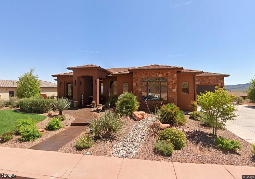
This home is located at 296 E 400 N, Ivins, UT 84738 and is currently estimated at $1,151,013, approximately $431 per square foot. 296 E 400 N is a home with nearby schools including Red Mountain School, Snow Canyon Middle School, and Lava Ridge Intermediate School.
Ownership History
Date
Name
Owned For
Owner Type
Purchase Details
Closed on
Aug 25, 2014
Sold by
Asay Clark and Asay Christine
Bought by
Asay Christine
Current Estimated Value
Purchase Details
Closed on
Jul 18, 2012
Sold by
Hutchison Robyn L
Bought by
Asay Clark and Asay Christine
Purchase Details
Closed on
Jul 6, 2012
Sold by
Desert Sky Homes Llc
Bought by
Hutchison Robyn L
Purchase Details
Closed on
Jun 22, 2012
Sold by
Rbc Real Estate Finance Inc
Bought by
Desert Sky Homes Llc
Purchase Details
Closed on
Jul 21, 2010
Sold by
Red Mountain Estates Llc
Bought by
Rbc Real Estate Finance Inc
Create a Home Valuation Report for This Property
The Home Valuation Report is an in-depth analysis detailing your home's value as well as a comparison with similar homes in the area
Purchase History
| Date | Buyer | Sale Price | Title Company |
|---|---|---|---|
| Asay Christine | -- | Stg | |
| Asay Clark | -- | Skyview Title Insurance Agen | |
| Hutchison Robyn L | -- | Accommodation | |
| Desert Sky Homes Llc | -- | Founders Title Company | |
| Rbc Real Estate Finance Inc | -- | None Available |
Source: Public Records
Tax History
| Year | Tax Paid | Tax Assessment Tax Assessment Total Assessment is a certain percentage of the fair market value that is determined by local assessors to be the total taxable value of land and additions on the property. | Land | Improvement |
|---|---|---|---|---|
| 2025 | $4,573 | $674,575 | $181,500 | $493,075 |
| 2023 | $4,356 | $638,385 | $165,000 | $473,385 |
| 2022 | $4,574 | $631,015 | $155,100 | $475,915 |
| 2021 | $3,902 | $799,700 | $174,000 | $625,700 |
| 2020 | $3,651 | $708,200 | $138,000 | $570,200 |
| 2019 | $3,587 | $680,300 | $114,000 | $566,300 |
| 2018 | $3,489 | $340,560 | $0 | $0 |
| 2017 | $3,294 | $312,785 | $0 | $0 |
| 2016 | $3,403 | $298,485 | $0 | $0 |
| 2015 | $3,498 | $295,350 | $0 | $0 |
| 2014 | $6,311 | $535,400 | $0 | $0 |
Source: Public Records
Map
Nearby Homes
- 543 W Fox Tail Way
- 1312 Willow Way 1 Unit 1
- 165 E 350 N
- 125 E 300 N
- 155 E 200 N
- 463 E Red Desert Trail
- 633 E Flint Rock Cir
- 310 N Main St
- 676 E Palisades Dr
- 673 Coral Autumn Ln
- 691 Crimson Flare Ln
- 285 W 450 N
- 163 S 480 E
- 328 N Harrier Ln
- 143 N Apex Ln
- 88 N Apex Ln
- 185 W Center St
- TBD N Agave Way
- 308 W Mallow Way
- 278 N Falcon Ct
Your Personal Tour Guide
Ask me questions while you tour the home.