296 Junie Dr Blue Ridge, GA 30513
Estimated Value: $623,000 - $1,574,000
--
Bed
1
Bath
1,240
Sq Ft
$886/Sq Ft
Est. Value
About This Home
This home is located at 296 Junie Dr, Blue Ridge, GA 30513 and is currently estimated at $1,098,500, approximately $885 per square foot. 296 Junie Dr is a home with nearby schools including Fannin County High School.
Ownership History
Date
Name
Owned For
Owner Type
Purchase Details
Closed on
Aug 10, 2009
Sold by
Owenby Michael T
Bought by
The 85 At Noontootla Llc
Current Estimated Value
Purchase Details
Closed on
Mar 27, 2002
Sold by
The Owenby Land Company
Bought by
Owenby Michael T
Purchase Details
Closed on
Dec 22, 1992
Bought by
Owenby Michael T
Purchase Details
Closed on
Mar 3, 1992
Bought by
Owenby Sara J
Purchase Details
Closed on
Nov 10, 1989
Bought by
Owenby Paul B
Create a Home Valuation Report for This Property
The Home Valuation Report is an in-depth analysis detailing your home's value as well as a comparison with similar homes in the area
Home Values in the Area
Average Home Value in this Area
Purchase History
| Date | Buyer | Sale Price | Title Company |
|---|---|---|---|
| The 85 At Noontootla Llc | -- | -- | |
| The 85 At Noontootla Llc | -- | -- | |
| Owenby Michael T | $1,000 | -- | |
| Owenby Michael T | -- | -- | |
| Owenby Sara J | -- | -- | |
| Owenby Paul B | -- | -- |
Source: Public Records
Tax History Compared to Growth
Tax History
| Year | Tax Paid | Tax Assessment Tax Assessment Total Assessment is a certain percentage of the fair market value that is determined by local assessors to be the total taxable value of land and additions on the property. | Land | Improvement |
|---|---|---|---|---|
| 2024 | $2,328 | $413,740 | $192,189 | $221,551 |
| 2023 | $2,186 | $374,892 | $192,189 | $182,702 |
| 2022 | $2,097 | $366,919 | $192,189 | $174,730 |
| 2021 | $2,131 | $296,137 | $174,798 | $121,339 |
| 2020 | $2,154 | $296,137 | $174,798 | $121,339 |
| 2019 | $2,183 | $296,137 | $174,798 | $121,339 |
| 2018 | $1,915 | $253,990 | $157,778 | $96,212 |
| 2017 | $4,544 | $256,830 | $157,778 | $99,052 |
| 2016 | $1,907 | $243,597 | $157,778 | $85,819 |
| 2015 | $2,021 | $245,225 | $157,778 | $87,447 |
| 2014 | $2,141 | $257,813 | $161,192 | $96,621 |
| 2013 | -- | $232,539 | $161,192 | $71,347 |
Source: Public Records
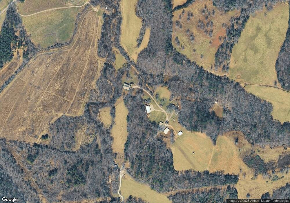
Map
Nearby Homes
- 60 Bailey Creek Dr
- 0 Hillbilly Holler Unit 7429512
- 0 Hillbilly Holler Unit 10349381
- 0 Hillbilly Unit 7636164
- 213 Valley Branch Rd
- 213 Valley Branch
- 156 Peter Knob Rd
- 0 Doublehead Gap Rd Unit 7602279
- 306 Native Trail
- 51+ acre Mountain Cove Way
- 51+ acre Mountain Cove Way Unit 1-8
- Lot 21 Mountain Trace
- Lot 20 Black Oaks Rd
- Lot 1A Colbert Mountain Rd
- 3006 Doublehead Gap Rd
- 100 Black Oaks Rd
- 1630 Black Ankle Creek Rd
- 356 Mountain Trace
- LOT 10 Papa Bear Path
- 328 Black Ankle Creek Rd
- 135 Junie Dr
- NA Doublehead Gap Rd
- 10 AC Doublehead Gap Rd Unit TRACT 1
- 15.5A Doublehead Gap Rd
- LOT 5 Doublehead Gap Rd
- LOT 4 Doublehead Gap Rd
- L3 Doublehead Gap Rd
- TR 4 Doublehead Gap Rd
- TR 3 Doublehead Gap Rd
- 10 AC Doublehead Gap Rd
- 15 AC Doublehead Gap Rd
- LT 16 Doublehead Gap Rd
- 9663 Doublehead Gap Rd
- 1 Doublehead Gap Rd
- 6 Doublehead Gap Rd
- 7 Doublehead Gap Rd
- 4 Doublehead Gap Rd
- Lot 6 Doublehead Gap Rd
- Lot 6 Doublehead Gap Rd Unit Lot 6
- Lot 2 Doublehead Gap Rd