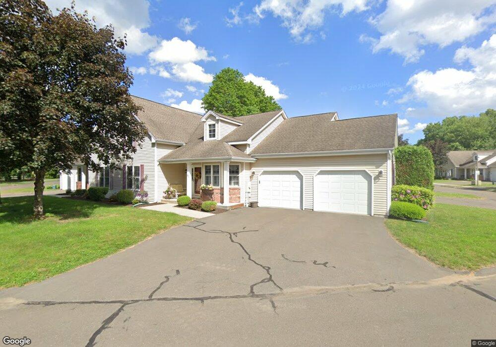
296 Kings Landing Windsor, CT 06095
West Windsor NeighborhoodEstimated Value: $374,000 - $436,000
5
Beds
3
Baths
2,061
Sq Ft
$193/Sq Ft
Est. Value
About This Home
This home is located at 296 Kings Landing, Windsor, CT 06095 and is currently estimated at $398,615, approximately $193 per square foot. 296 Kings Landing is a home located in Hartford County with nearby schools including Poquonock Elementary School, Clover Street School, and Sage Park Middle School.
Ownership History
Date
Name
Owned For
Owner Type
Purchase Details
Closed on
Aug 9, 2019
Sold by
Landry Ervin H and Landry Alice A
Bought by
Alice A Landry Lt and Landry
Current Estimated Value
Purchase Details
Closed on
Oct 12, 2001
Sold by
Kings Landing Llc
Bought by
Landry Ervin and Landry Alice
Home Financials for this Owner
Home Financials are based on the most recent Mortgage that was taken out on this home.
Original Mortgage
$120,000
Interest Rate
6.93%
Mortgage Type
Purchase Money Mortgage
Create a Home Valuation Report for This Property
The Home Valuation Report is an in-depth analysis detailing your home's value as well as a comparison with similar homes in the area
Home Values in the Area
Average Home Value in this Area
Purchase History
| Date | Buyer | Sale Price | Title Company |
|---|---|---|---|
| Alice A Landry Lt | -- | -- | |
| Landry Ervin | $223,182 | -- |
Source: Public Records
Mortgage History
| Date | Status | Borrower | Loan Amount |
|---|---|---|---|
| Previous Owner | Landry Ervin | $86,000 | |
| Previous Owner | Landry Ervin | $110,000 | |
| Previous Owner | Landry Ervin | $120,000 |
Source: Public Records
Tax History Compared to Growth
Tax History
| Year | Tax Paid | Tax Assessment Tax Assessment Total Assessment is a certain percentage of the fair market value that is determined by local assessors to be the total taxable value of land and additions on the property. | Land | Improvement |
|---|---|---|---|---|
| 2025 | $6,371 | $223,930 | $0 | $223,930 |
| 2024 | $6,790 | $223,930 | $0 | $223,930 |
| 2023 | $4,765 | $141,820 | $0 | $141,820 |
| 2022 | $4,718 | $141,820 | $0 | $141,820 |
| 2021 | $4,718 | $141,820 | $0 | $141,820 |
| 2020 | $4,696 | $141,820 | $0 | $141,820 |
| 2019 | $4,592 | $141,820 | $0 | $141,820 |
| 2018 | $5,574 | $169,120 | $0 | $169,120 |
| 2017 | $5,488 | $169,120 | $0 | $169,120 |
| 2016 | $5,331 | $169,120 | $0 | $169,120 |
| 2015 | $5,229 | $169,120 | $0 | $169,120 |
| 2014 | $5,153 | $169,120 | $0 | $169,120 |
Source: Public Records
Map
Nearby Homes
- 12 London Rd
- 139 Windbrook Dr
- 580 W Wolcott Ave
- 5 Eagleton Dr
- 17 Mills Rd
- 2 Sandra Dr
- 89 E Wolcott Ave
- 107 Sunnyfield Dr
- 26 Kelsey Place
- 15 Kelsey Place
- 39 Wade Ave
- 18 Englewood Ave
- 32 Sunnyfield Dr
- 28 Sunnyfield Dr
- 280 Deerfield Rd
- 31 Farmstead Cir
- 29 Quail Hollow Dr
- 13 Patton Rd
- 52 Greenwood Ave
- 3 Saville St
- 310 Kings Landing
- 310 Kings Landing Unit 310
- 298 Kings Landing
- 268 Kings Landing
- 268 Kings Landing Unit 268
- 283 Kings Landing
- 281 Kings Landing
- 312 Kings Landing
- 312 Kings Landing Unit 312
- 295 Kings Landing
- 297 Kings Landing
- 297 Kings Landing Unit 297
- 279 Kings Landing
- 279 Kings Landing Unit 279
- 316 Kings Landing
- 316 Kings Landing Unit 316
- 258 Kings Landing
- 277 Kings Landing
- 277 Kings Landing Unit 277
- 263 Kings Landing