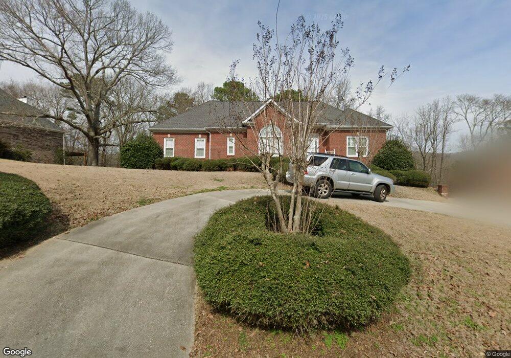
296 MacDonald Lake Rd Springville, AL 35146
Estimated Value: $398,000 - $462,000
--
Bed
2
Baths
2,355
Sq Ft
$185/Sq Ft
Est. Value
About This Home
This home is located at 296 MacDonald Lake Rd, Springville, AL 35146 and is currently estimated at $436,451, approximately $185 per square foot. 296 MacDonald Lake Rd is a home located in St. Clair County with nearby schools including Springville Elementary School, Springville Middle School, and Springville High School.
Ownership History
Date
Name
Owned For
Owner Type
Purchase Details
Closed on
Aug 26, 2021
Sold by
West Gloria J
Bought by
Cather William C and Cather Elizabeth W
Current Estimated Value
Home Financials for this Owner
Home Financials are based on the most recent Mortgage that was taken out on this home.
Original Mortgage
$272,000
Outstanding Balance
$247,500
Interest Rate
2.8%
Mortgage Type
New Conventional
Estimated Equity
$188,951
Create a Home Valuation Report for This Property
The Home Valuation Report is an in-depth analysis detailing your home's value as well as a comparison with similar homes in the area
Home Values in the Area
Average Home Value in this Area
Purchase History
| Date | Buyer | Sale Price | Title Company |
|---|---|---|---|
| Cather William C | $340,000 | None Available |
Source: Public Records
Mortgage History
| Date | Status | Borrower | Loan Amount |
|---|---|---|---|
| Open | Cather William C | $272,000 |
Source: Public Records
Tax History Compared to Growth
Tax History
| Year | Tax Paid | Tax Assessment Tax Assessment Total Assessment is a certain percentage of the fair market value that is determined by local assessors to be the total taxable value of land and additions on the property. | Land | Improvement |
|---|---|---|---|---|
| 2024 | $2,143 | $85,932 | $18,760 | $67,172 |
| 2023 | $2,143 | $69,840 | $8,000 | $61,840 |
| 2022 | $1,209 | $34,920 | $4,000 | $30,920 |
| 2021 | $743 | $34,920 | $4,000 | $30,920 |
| 2020 | $748 | $25,927 | $4,000 | $21,927 |
| 2019 | $643 | $25,927 | $4,000 | $21,927 |
| 2018 | $630 | $22,100 | $0 | $0 |
| 2017 | $651 | $22,100 | $0 | $0 |
| 2016 | $630 | $22,100 | $0 | $0 |
| 2015 | $651 | $22,100 | $0 | $0 |
| 2014 | $651 | $22,820 | $0 | $0 |
Source: Public Records
Map
Nearby Homes
- 428 MacDonald Lake Rd
- 120 MacDonald Lake Rd
- 973 MacDonald Lake Rd
- 6178 Route 11
- 434 Mountain Dr
- 325 Mcginnis St Unit LOT
- 18 Wilson St
- 351 Mcginnis St
- 1247 Cross St
- 6559 Us Highway 11
- 5288 Highway 27
- 282 Robinson St
- 6371 Us Highway 11
- 251 Robinson St
- 0 Robinson St Unit 1
- 112 Robinson St Unit 1
- 200 Daphne Rd Unit 1
- 200 Daphne Rd
- 289 Rena Dr
- 0 Highway 174 Unit 17746312
- 296 MacDonald Farm Rd
- 320 MacDonald Lake Rd
- 274 MacDonald Lake Rd
- 305 MacDonald Lake Rd
- 370 MacDonald Lake Rd
- 279 MacDonald Lake Rd
- 323 MacDonald Lake Rd
- 211 MacDonald Lake Rd
- 372 MacDonald Lake Rd
- 240 MacDonald Lake Rd
- 341 MacDonald Lake Rd
- 341 MacDonald Lake Rd Unit 40
- 181 MacDonald Lake Rd
- 361 MacDonald Lake Rd
- 170 Macdonald Ct
- 186 Macdonald Ct
- 390 MacDonald Lake Rd
- 158 Macdonald Ct
- 200 Macdonald Ct
- 220 MacDonald Lake Rd