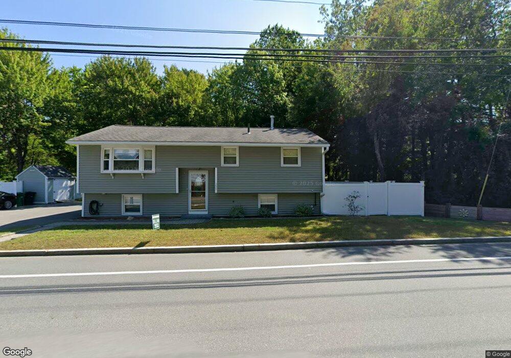
296 Main Dunstable Rd Nashua, NH 03062
Southwest Nashua NeighborhoodEstimated Value: $448,000 - $484,000
3
Beds
2
Baths
914
Sq Ft
$509/Sq Ft
Est. Value
About This Home
This home is located at 296 Main Dunstable Rd, Nashua, NH 03062 and is currently estimated at $465,656, approximately $509 per square foot. 296 Main Dunstable Rd is a home located in Hillsborough County with nearby schools including Fairgrounds Elementary School, Elm Street Middle School, and Nashua High School South.
Ownership History
Date
Name
Owned For
Owner Type
Purchase Details
Closed on
Dec 1, 2021
Sold by
Croteau Michael R and Croteau Katie L
Bought by
M R & K L Croteau Ret and Croteau
Current Estimated Value
Purchase Details
Closed on
Sep 27, 2018
Sold by
Coteau Michael R and Croteau Katie L
Bought by
Coteau Michael R and Croteau Katie L
Purchase Details
Closed on
Apr 19, 2004
Sold by
Munro Elton H and Munro Marie F
Bought by
Croteau Michael R
Home Financials for this Owner
Home Financials are based on the most recent Mortgage that was taken out on this home.
Original Mortgage
$184,000
Interest Rate
5.58%
Mortgage Type
Purchase Money Mortgage
Create a Home Valuation Report for This Property
The Home Valuation Report is an in-depth analysis detailing your home's value as well as a comparison with similar homes in the area
Home Values in the Area
Average Home Value in this Area
Purchase History
| Date | Buyer | Sale Price | Title Company |
|---|---|---|---|
| M R & K L Croteau Ret | -- | None Available | |
| Coteau Michael R | -- | -- | |
| Croteau Michael R | $230,000 | -- |
Source: Public Records
Mortgage History
| Date | Status | Borrower | Loan Amount |
|---|---|---|---|
| Previous Owner | Croteau Michael R | $60,465 | |
| Previous Owner | Croteau Michael R | $184,000 |
Source: Public Records
Tax History
| Year | Tax Paid | Tax Assessment Tax Assessment Total Assessment is a certain percentage of the fair market value that is determined by local assessors to be the total taxable value of land and additions on the property. | Land | Improvement |
|---|---|---|---|---|
| 2025 | $7,018 | $417,000 | $151,200 | $265,800 |
| 2024 | $6,630 | $417,000 | $151,200 | $265,800 |
| 2023 | $6,229 | $341,700 | $121,000 | $220,700 |
| 2022 | $6,175 | $341,700 | $121,000 | $220,700 |
| 2021 | $5,468 | $235,500 | $80,700 | $154,800 |
| 2020 | $5,325 | $235,500 | $80,700 | $154,800 |
| 2019 | $5,124 | $235,500 | $80,700 | $154,800 |
| 2018 | $4,694 | $235,500 | $80,700 | $154,800 |
| 2017 | $4,629 | $179,500 | $69,900 | $109,600 |
| 2016 | $4,500 | $179,500 | $69,900 | $109,600 |
| 2015 | $4,403 | $179,500 | $69,900 | $109,600 |
| 2014 | $4,317 | $179,500 | $69,900 | $109,600 |
Source: Public Records
Map
Nearby Homes
- 9 Leslie Ln
- 8 Althea Ln Unit U26
- 247 Main Dunstable Rd
- 40 Hollow Ridge Dr
- 2 Henry David Dr Unit 207
- 2 Henry David Dr Unit 209
- 47 Dogwood Dr Unit U202
- 4 Kittery Dr
- 4 Henry David Dr Unit 203
- 103 Saranac Dr
- 23 Spring Cove Rd Unit U152
- 16 Champagne Dr Unit U31
- 9 Michelle Dr
- 30 Spring Cove Rd Unit U112
- 5 Stafford Rd
- 668 W Hollis St
- 2 Freshwater Ct
- 9 Dale St
- 22 Kern Dr
- 25 Kern Dr Unit 25
- 297 Main Dunstable Rd
- 299 Main Dunstable Rd
- 295 Main Dunstable Rd
- 294 Main Dunstable Rd
- 301 Main Dunstable Rd
- 293 Main Dunstable Rd
- 5 White Plains Dr
- 292 Main Dunstable Rd
- 3 White Plains Dr
- 7 White Plains Dr
- 1 White Plains Dr
- 291 Main Dunstable Rd
- 305 Main Dunstable Rd
- 290 Main Dunstable Rd
- 9 White Plains Dr
- 8 White Plains Dr
- 10 White Plains Dr
- 6 White Plains Dr
- 306 Main Dunstable Rd
- 4 Fordham Dr
Your Personal Tour Guide
Ask me questions while you tour the home.