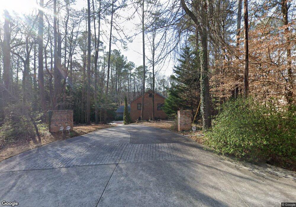
296 Nickajack Rd SE Mableton, GA 30126
Estimated Value: $693,000 - $903,000
4
Beds
5
Baths
4,372
Sq Ft
$181/Sq Ft
Est. Value
About This Home
This home is located at 296 Nickajack Rd SE, Mableton, GA 30126 and is currently estimated at $789,957, approximately $180 per square foot. 296 Nickajack Rd SE is a home located in Cobb County with nearby schools including Mableton Elementary School, Floyd Middle School, and Covered Bridge Academy.
Ownership History
Date
Name
Owned For
Owner Type
Purchase Details
Closed on
Oct 25, 2002
Sold by
Carlson Daniel E
Bought by
Carlson Daniel E and Carlson Kathy P
Current Estimated Value
Home Financials for this Owner
Home Financials are based on the most recent Mortgage that was taken out on this home.
Original Mortgage
$252,500
Interest Rate
5.93%
Mortgage Type
New Conventional
Create a Home Valuation Report for This Property
The Home Valuation Report is an in-depth analysis detailing your home's value as well as a comparison with similar homes in the area
Home Values in the Area
Average Home Value in this Area
Purchase History
| Date | Buyer | Sale Price | Title Company |
|---|---|---|---|
| Carlson Daniel E | -- | -- |
Source: Public Records
Mortgage History
| Date | Status | Borrower | Loan Amount |
|---|---|---|---|
| Closed | Carlson Daniel E | $252,500 |
Source: Public Records
Tax History Compared to Growth
Tax History
| Year | Tax Paid | Tax Assessment Tax Assessment Total Assessment is a certain percentage of the fair market value that is determined by local assessors to be the total taxable value of land and additions on the property. | Land | Improvement |
|---|---|---|---|---|
| 2024 | $1,739 | $299,620 | $39,900 | $259,720 |
| 2023 | $1,322 | $229,156 | $44,100 | $185,056 |
| 2022 | $1,424 | $194,336 | $37,800 | $156,536 |
| 2021 | $1,400 | $186,404 | $35,700 | $150,704 |
| 2020 | $1,375 | $178,004 | $27,300 | $150,704 |
| 2019 | $1,375 | $178,004 | $27,300 | $150,704 |
| 2018 | $1,284 | $147,616 | $14,700 | $132,916 |
| 2017 | $1,130 | $147,616 | $14,700 | $132,916 |
| 2016 | $1,108 | $139,244 | $12,600 | $126,644 |
| 2015 | $1,182 | $137,568 | $12,600 | $124,968 |
| 2014 | $3,620 | $137,568 | $0 | $0 |
Source: Public Records
Map
Nearby Homes
- 387 Nickajack Rd SE
- 0 Nickajack Rd SE Unit 7594642
- 4724 Warrior Way SE Unit II
- 4875 Millen Dr SE
- 0 East-West Connector Unit 11589710
- 51 Queen Anne Dr SE
- 164 Wana Cir SE
- 162 Wana Cir SE
- 4909 Millen Dr SE
- 4717 Crest Knoll Dr SE
- 476 Cooper Lake Rd SE
- 4070 W Cooper Lake Dr SE
- 4461 Derby Ln SE
- 3910 W Cooper Lake Dr SE
- 4782 Donnegal Ct SE
- 71 Anita Place SE
- 26 Flint Ridge Dr SE
- 4094 Norton Place SE
- 290 Nickajack Rd SE
- 300 Nickajack Rd SE
- 4748 Broken Arrow Ct SE Unit II
- 4749 Broken Arrow Ct SE Unit 2
- 181 Port Patrick Ln SE
- 248 Nickajack Rd SE
- 4752 Broken Arrow Ct SE
- 179 Port Patrick Ln SE
- 170 Port Patrick Ln SE
- 383 Nickajack Rd SE
- 177 Settendown Trail SE
- 236 Nickajack Rd SE
- 179 Nickajack Rd SE
- 168 Port Patrick Ln SE
- 181 Settendown Trail SE
- 177 Port Patrick Ln SE
- 173 Settendown Trail SE
- 166 Port Patrick Ln SE
- 169 Settendown Trail SE
- 185 Settendown Trail SE