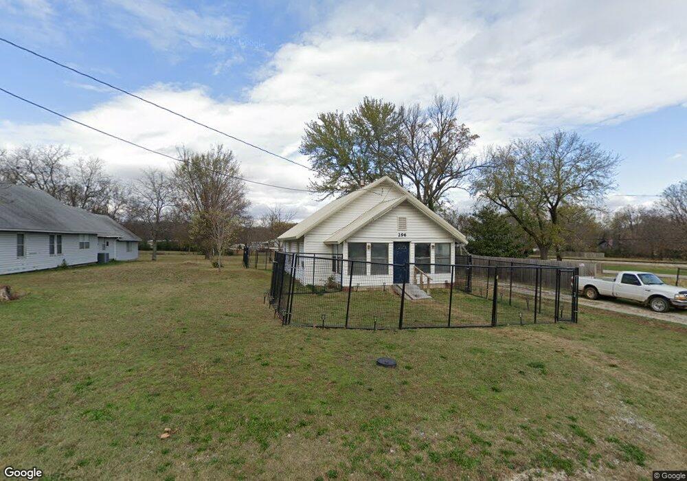
296 Phillips St West Fork, AR 72774
Estimated Value: $130,132 - $220,000
Studio
1
Bath
1,008
Sq Ft
$175/Sq Ft
Est. Value
About This Home
This home is located at 296 Phillips St, West Fork, AR 72774 and is currently estimated at $176,533, approximately $175 per square foot. 296 Phillips St is a home located in Washington County with nearby schools including West Fork Elementary School, West Fork Middle School, and West Fork High School.
Ownership History
Date
Name
Owned For
Owner Type
Purchase Details
Closed on
Feb 28, 2020
Sold by
Davis Kendall Lee and Davis Clyde Thomas
Bought by
Davis Kendall Lee and Cole Lara L
Current Estimated Value
Purchase Details
Closed on
Jul 16, 2007
Sold by
Davis Kendall Lee and Davis Clyde Thomas
Bought by
Davis Tommy B and Davis Frances E
Purchase Details
Closed on
Jan 1, 1985
Bought by
Davis Tommy B
Create a Home Valuation Report for This Property
The Home Valuation Report is an in-depth analysis detailing your home's value as well as a comparison with similar homes in the area
Home Values in the Area
Average Home Value in this Area
Purchase History
| Date | Buyer | Sale Price | Title Company |
|---|---|---|---|
| Davis Kendall Lee | -- | None Available | |
| Davis Tommy B | -- | None Available | |
| Davis Tommy B | -- | -- |
Source: Public Records
Tax History
| Year | Tax Paid | Tax Assessment Tax Assessment Total Assessment is a certain percentage of the fair market value that is determined by local assessors to be the total taxable value of land and additions on the property. | Land | Improvement |
|---|---|---|---|---|
| 2025 | $76 | $22,700 | $7,000 | $15,700 |
| 2024 | $145 | $22,700 | $7,000 | $15,700 |
| 2023 | $195 | $22,700 | $7,000 | $15,700 |
| 2022 | $215 | $15,750 | $3,500 | $12,250 |
| 2021 | $191 | $15,750 | $3,500 | $12,250 |
| 2020 | $166 | $15,750 | $3,500 | $12,250 |
| 2019 | $117 | $12,550 | $3,600 | $8,950 |
| 2018 | $142 | $12,550 | $3,600 | $8,950 |
| 2017 | $128 | $12,550 | $3,600 | $8,950 |
| 2016 | $128 | $12,550 | $3,600 | $8,950 |
| 2015 | $128 | $12,550 | $3,600 | $8,950 |
| 2014 | $128 | $9,261 | $2,131 | $7,130 |
Source: Public Records
Map
Nearby Homes
- 224 Maple Ave
- 0000 Highway 170
- 185 Wheeler St
- 327 W Smith St
- 385 W Smith St
- 0 W Smith St Unit 1334508
- 365 W Smith St
- 353 W Smith St
- 222 Rivendale Dr
- 503 Clark Ave
- 338 Hidden Creek Place
- 260 Culp Trail
- 846 James Place
- 815 James Place
- 13582 S Highway 170
- 67 S Red Oak Ave
- 696 E Thornstone Ave
- 13653 W Mountain Rd
- 312 Phillips St
- 0 White River Land
- 000 Mcknight Ave Unit 10662 Union Star Chu
- 290 Phillips St
- 0 McKnight 6 865a Unit 681563
- 0 Hwy 170 Devels State Park Hwy Unit 694418
- 0 Mcknight St
- 14658 Arkansas 170
- J0 Arkansas 170
- --- Arkansas 170
- Off Arkansas 170
- - Arkansas 170
- . Arkansas 170
- 14514 Arkansas 170
- 19209 Arkansas 170
- 19145 Arkansas 170
- 14581 Arkansas 170
- 15972 Arkansas 170
- 189 S Campbell Ave
- 235 Mcknight Ave
Your Personal Tour Guide
Ask me questions while you tour the home.