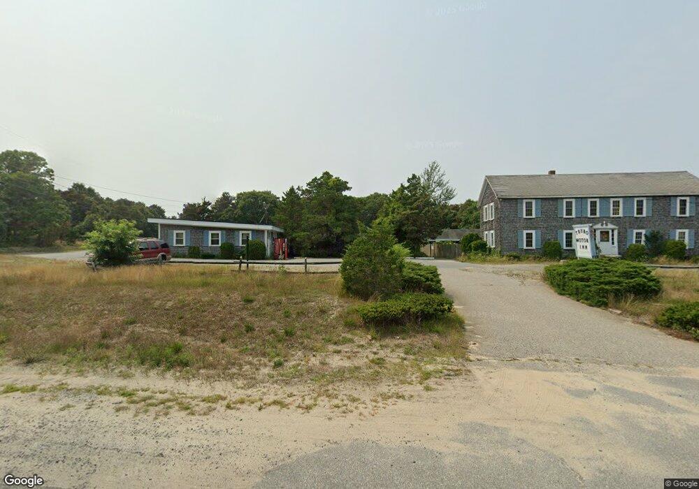
296 Route 6 and 209 Milford, PA 18337
Estimated Value: $1,187,022
--
Bed
--
Bath
1,580
Sq Ft
$751/Sq Ft
Est. Value
About This Home
This home is located at 296 Route 6 and 209, Milford, PA 18337 and is currently priced at $1,187,022, approximately $751 per square foot. 296 Route 6 and 209 is a home located in Pike County with nearby schools including Delaware Valley High School and New Life Christian Day School.
Ownership History
Date
Name
Owned For
Owner Type
Purchase Details
Closed on
Jan 28, 2022
Sold by
Johns Allen P
Bought by
Reed Commercial Holdings Llc
Current Estimated Value
Purchase Details
Closed on
Dec 14, 2011
Sold by
Wtro Properties Inc
Bought by
Johns Allen P and Johns Dawn E
Home Financials for this Owner
Home Financials are based on the most recent Mortgage that was taken out on this home.
Original Mortgage
$375,000
Interest Rate
4.01%
Mortgage Type
Commercial
Create a Home Valuation Report for This Property
The Home Valuation Report is an in-depth analysis detailing your home's value as well as a comparison with similar homes in the area
Home Values in the Area
Average Home Value in this Area
Purchase History
| Date | Buyer | Sale Price | Title Company |
|---|---|---|---|
| Reed Commercial Holdings Llc | $1,000,000 | -- | |
| Johns Allen P | $500,000 | None Available |
Source: Public Records
Mortgage History
| Date | Status | Borrower | Loan Amount |
|---|---|---|---|
| Previous Owner | Johns Allen P | $375,000 |
Source: Public Records
Tax History Compared to Growth
Tax History
| Year | Tax Paid | Tax Assessment Tax Assessment Total Assessment is a certain percentage of the fair market value that is determined by local assessors to be the total taxable value of land and additions on the property. | Land | Improvement |
|---|---|---|---|---|
| 2025 | $8,415 | $51,760 | $37,760 | $14,000 |
| 2024 | $8,415 | $51,760 | $37,760 | $14,000 |
| 2023 | $8,324 | $51,760 | $37,760 | $14,000 |
| 2022 | $8,170 | $51,760 | $37,760 | $14,000 |
| 2021 | $8,092 | $51,760 | $37,760 | $14,000 |
| 2020 | $8,092 | $51,760 | $37,760 | $14,000 |
| 2019 | $7,904 | $51,760 | $37,760 | $14,000 |
| 2018 | $7,930 | $51,760 | $37,760 | $14,000 |
| 2017 | $8,019 | $51,760 | $37,760 | $14,000 |
| 2016 | $0 | $51,760 | $37,760 | $14,000 |
| 2014 | -- | $51,760 | $37,760 | $14,000 |
Source: Public Records
Map
Nearby Homes
- 116 Cummins Hill Rd
- 37 Gary Ln
- 4 Gary Ln
- 133 River Rd
- 9 Gary Ln
- 47 New Mashipacong Rd
- 37 New Mashipacong Rd
- 102 Old Farm Rd
- 29 New Mashipacong Rd
- 74 River Rd
- 108 Braeburn Path
- Lot 55 Summit Ct
- 4 Highland Ave
- 900 Macintosh Way
- 2 New Mashipacong Rd
- 110 Wheatfield Ct
- 258 Clove Rd
- 123 Highland Ave
- 202 Braeburn Path
- 111 Bear Creek Ct
- 296 Route 6 and 209
- 110 Riverview Terrace
- 112 Riverview Terrace
- 108 Riverview Terrace
- 114 Riverview Terrace
- 106 Riverview Terrace
- 116 Riverview Terrace
- 104 Riverview Terrace
- 102 Riverview Terrace
- 118 Riverview Terrace
- 100 Riverview Terrace
- 306 Route 6 and 209
- 308 Route 6 and 209
- 290 Route 6&209
- 312 U S 6
- 312 Route 6
- 312 Route 6 Unit 209
- 312 Route 6 & 209
- 312 Route 6 and 209
- 150P River Rd