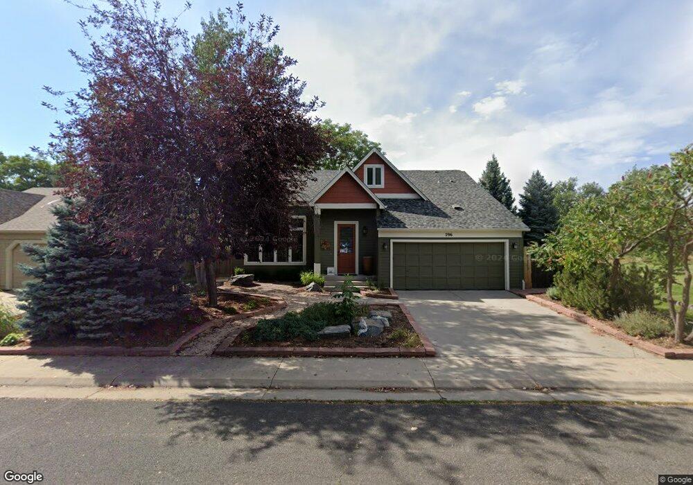
296 S Buchanan Cir Louisville, CO 80027
Estimated Value: $863,869 - $975,000
4
Beds
3
Baths
1,976
Sq Ft
$456/Sq Ft
Est. Value
About This Home
This home is located at 296 S Buchanan Cir, Louisville, CO 80027 and is currently estimated at $901,467, approximately $456 per square foot. 296 S Buchanan Cir is a home located in Boulder County with nearby schools including Fireside Elementary School, Monarch K-8 School, and Monarch High School.
Ownership History
Date
Name
Owned For
Owner Type
Purchase Details
Closed on
Feb 24, 2014
Sold by
Larson Joanne D and Crowder Paul R
Bought by
Crowder Paul R
Current Estimated Value
Home Financials for this Owner
Home Financials are based on the most recent Mortgage that was taken out on this home.
Original Mortgage
$268,000
Outstanding Balance
$203,903
Interest Rate
4.44%
Mortgage Type
New Conventional
Estimated Equity
$697,564
Purchase Details
Closed on
Apr 7, 1993
Bought by
Crowder Paul R
Purchase Details
Closed on
May 1, 1990
Bought by
Crowder Paul R
Purchase Details
Closed on
Sep 21, 1983
Bought by
Crowder Paul R
Purchase Details
Closed on
May 10, 1983
Bought by
Crowder Paul R
Create a Home Valuation Report for This Property
The Home Valuation Report is an in-depth analysis detailing your home's value as well as a comparison with similar homes in the area
Home Values in the Area
Average Home Value in this Area
Purchase History
| Date | Buyer | Sale Price | Title Company |
|---|---|---|---|
| Crowder Paul R | -- | Fidelity National Title Ins | |
| Crowder Paul R | -- | -- | |
| Crowder Paul R | $84,000 | -- | |
| Crowder Paul R | $74,200 | -- | |
| Crowder Paul R | -- | -- |
Source: Public Records
Mortgage History
| Date | Status | Borrower | Loan Amount |
|---|---|---|---|
| Open | Crowder Paul R | $268,000 |
Source: Public Records
Tax History Compared to Growth
Tax History
| Year | Tax Paid | Tax Assessment Tax Assessment Total Assessment is a certain percentage of the fair market value that is determined by local assessors to be the total taxable value of land and additions on the property. | Land | Improvement |
|---|---|---|---|---|
| 2025 | $5,425 | $61,081 | $18,200 | $42,881 |
| 2024 | $5,425 | $61,081 | $18,200 | $42,881 |
| 2023 | $5,333 | $60,354 | $19,162 | $44,877 |
| 2022 | $4,337 | $45,064 | $13,942 | $31,122 |
| 2021 | $4,666 | $50,386 | $15,587 | $34,799 |
| 2020 | $4,308 | $46,032 | $12,441 | $33,591 |
| 2019 | $4,247 | $46,032 | $12,441 | $33,591 |
| 2018 | $3,431 | $38,405 | $8,424 | $29,981 |
| 2017 | $3,363 | $42,458 | $9,313 | $33,145 |
| 2016 | $3,340 | $37,961 | $9,711 | $28,250 |
| 2015 | $3,165 | $32,389 | $17,830 | $14,559 |
| 2014 | $2,769 | $32,389 | $17,830 | $14,559 |
Source: Public Records
Map
Nearby Homes
- 641 W Dahlia St
- 284 S Taft Ct Unit 76
- 362 S Taft Ct Unit 108
- 279 S Taft Ct Unit 53
- 323 S Taft Ct Unit 26
- 159 S Polk Ave
- 305 S Taft Ct Unit 33
- 539 Coal Creek Ln
- 567 Manorwood Ln
- 749 Apple Ct
- 203 Springs Dr
- 118 S Tanager Ct
- 322 Diamond Cir
- 408 Fillmore Ct
- 812 W Mulberry St
- 546 Ridgeview Dr
- 291 W Sycamore Ln
- 494 Owl Dr Unit 4
- 572 Ridgeview Dr
- 592 Spruce Cir
- 294 S Buchanan Cir
- 292 S Buchanan Cir
- 281 S Buchanan Cir
- 279 S Buchanan Cir
- 290 S Buchanan Cir
- 283 S Buchanan Cir
- 275 S Buchanan Cir
- 271 S Buchanan Cir
- 619 W Juniper Ct
- 278 S Buchanan Cir
- 286 S Madison Ave
- 270 S Buchanan Cir
- 288 S Madison Ave
- 610 W Juniper Ct
- 280 S Madison Ave
- 262 S Buchanan Cir
- 265 S Buchanan Cir
- 622 W Aspen Ct
- 627 W Juniper Ct
- 603 W Aspen Ct