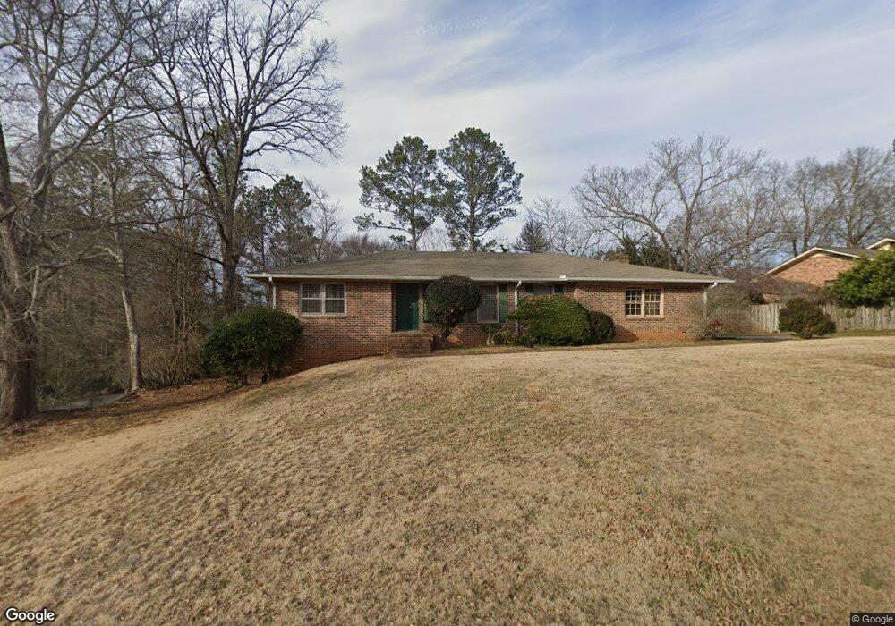
296 Tara Way Athens, GA 30606
Forest Heights NeighborhoodEstimated Value: $356,776 - $385,000
3
Beds
2
Baths
1,796
Sq Ft
$207/Sq Ft
Est. Value
About This Home
This home is located at 296 Tara Way, Athens, GA 30606 and is currently estimated at $371,194, approximately $206 per square foot. 296 Tara Way is a home located in Clarke County with nearby schools including Oglethorpe Avenue Elementary School, Burney-Harris-Lyons Middle School, and Clarke Central High School.
Ownership History
Date
Name
Owned For
Owner Type
Purchase Details
Closed on
Mar 7, 2019
Sold by
Mckinney Traci F
Bought by
Mckinney John P
Current Estimated Value
Home Financials for this Owner
Home Financials are based on the most recent Mortgage that was taken out on this home.
Original Mortgage
$132,800
Outstanding Balance
$116,279
Interest Rate
4.4%
Mortgage Type
New Conventional
Estimated Equity
$254,915
Purchase Details
Closed on
Oct 31, 2001
Sold by
Gunder Rose C Estate Of
Bought by
Mckinney John P and Mckinney Traci F
Create a Home Valuation Report for This Property
The Home Valuation Report is an in-depth analysis detailing your home's value as well as a comparison with similar homes in the area
Home Values in the Area
Average Home Value in this Area
Purchase History
| Date | Buyer | Sale Price | Title Company |
|---|---|---|---|
| Mckinney John P | -- | -- | |
| Mckinney John P | $117,000 | -- |
Source: Public Records
Mortgage History
| Date | Status | Borrower | Loan Amount |
|---|---|---|---|
| Open | Mckinney John P | $132,800 |
Source: Public Records
Tax History Compared to Growth
Tax History
| Year | Tax Paid | Tax Assessment Tax Assessment Total Assessment is a certain percentage of the fair market value that is determined by local assessors to be the total taxable value of land and additions on the property. | Land | Improvement |
|---|---|---|---|---|
| 2025 | $3,737 | $139,130 | $18,000 | $121,130 |
| 2024 | $3,737 | $131,920 | $18,000 | $113,920 |
| 2023 | $3,623 | $123,673 | $14,000 | $109,673 |
| 2022 | $2,964 | $102,925 | $14,000 | $88,925 |
| 2021 | $2,377 | $80,534 | $14,000 | $66,534 |
| 2020 | $2,308 | $78,483 | $14,000 | $64,483 |
| 2019 | $2,098 | $71,793 | $12,000 | $59,793 |
| 2018 | $1,951 | $67,476 | $11,200 | $56,276 |
| 2017 | $1,802 | $63,090 | $11,200 | $51,890 |
| 2016 | $1,684 | $59,614 | $9,600 | $50,014 |
| 2015 | $1,592 | $56,800 | $9,600 | $47,200 |
| 2014 | $1,615 | $57,414 | $9,600 | $47,814 |
Source: Public Records
Map
Nearby Homes
- 140 Breckenridge Ln
- 135 Tara Way
- 185 Landor Dr
- 105 Westchester Dr Unit A8
- 105 Westchester Dr Unit A8
- 105 Westchester Dr Unit E5
- 809 Forest Heights Dr
- 107 Berkeshire Ct
- 330 Stoneland Dr
- 607 Creekside Ct
- 369 Westchester Dr
- 115 Davis Place
- 119 E Surry Ct
- 104 Westchester Cir Unit 4
- 275 Westchester Cir
- 125 Hampton Park Dr