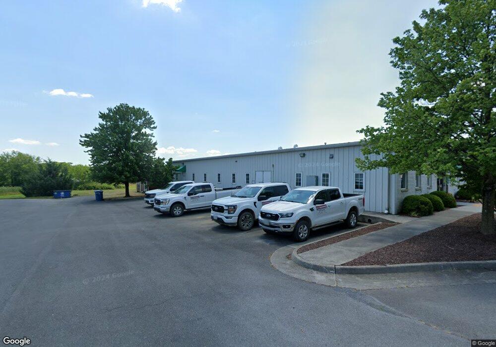
296 Victory Rd Winchester, VA 22602
Estimated Value: $1,321,541
--
Bed
--
Bath
5,000
Sq Ft
$264/Sq Ft
Est. Value
About This Home
This home is located at 296 Victory Rd, Winchester, VA 22602 and is currently estimated at $1,321,541, approximately $264 per square foot. 296 Victory Rd is a home located in Frederick County with nearby schools including Armel Elementary School, Admiral Richard E. Byrd Middle School, and Millbrook High School.
Ownership History
Date
Name
Owned For
Owner Type
Purchase Details
Closed on
Apr 30, 2008
Sold by
Davelow L L C
Bought by
Watkins Front Royal
Current Estimated Value
Home Financials for this Owner
Home Financials are based on the most recent Mortgage that was taken out on this home.
Original Mortgage
$500,000
Outstanding Balance
$318,465
Interest Rate
5.99%
Mortgage Type
Construction
Estimated Equity
$1,003,076
Purchase Details
Closed on
May 23, 2001
Sold by
B R C Llc
Bought by
D A V C Low Llc
Home Financials for this Owner
Home Financials are based on the most recent Mortgage that was taken out on this home.
Original Mortgage
$336,000
Interest Rate
7.05%
Mortgage Type
Commercial
Create a Home Valuation Report for This Property
The Home Valuation Report is an in-depth analysis detailing your home's value as well as a comparison with similar homes in the area
Home Values in the Area
Average Home Value in this Area
Purchase History
| Date | Buyer | Sale Price | Title Company |
|---|---|---|---|
| Watkins Front Royal | $675,000 | -- | |
| D A V C Low Llc | $395,000 | -- |
Source: Public Records
Mortgage History
| Date | Status | Borrower | Loan Amount |
|---|---|---|---|
| Open | Watkins Front Royal | $500,000 | |
| Previous Owner | D A V C Low Llc | $336,000 |
Source: Public Records
Tax History Compared to Growth
Tax History
| Year | Tax Paid | Tax Assessment Tax Assessment Total Assessment is a certain percentage of the fair market value that is determined by local assessors to be the total taxable value of land and additions on the property. | Land | Improvement |
|---|---|---|---|---|
| 2025 | $3,921 | $816,900 | $174,200 | $642,700 |
| 2024 | $1,834 | $719,100 | $158,100 | $561,000 |
| 2023 | $3,667 | $719,100 | $158,100 | $561,000 |
| 2022 | $3,568 | $584,900 | $130,700 | $454,200 |
| 2021 | $3,568 | $584,900 | $130,700 | $454,200 |
| 2020 | $3,456 | $566,500 | $134,600 | $431,900 |
| 2019 | $3,456 | $566,500 | $134,600 | $431,900 |
| 2018 | $3,637 | $596,300 | $134,600 | $461,700 |
| 2017 | $3,578 | $596,300 | $134,600 | $461,700 |
| 2016 | $3,371 | $561,800 | $134,600 | $427,200 |
| 2015 | $3,146 | $561,800 | $134,600 | $427,200 |
| 2014 | $1,455 | $497,600 | $134,600 | $363,000 |
Source: Public Records
Map
Nearby Homes
- 368 Victory Rd
- 128 Raven Oaks Dr
- 121 Raven Oaks Dr
- 128 Nevermore Dr
- 108 Kinross Dr
- 206 Custer Ave
- 109 Shelby Ct
- 127 Kinross Dr
- 280 Costello
- 219 Taggart Dr
- 0 Front Royal Pike
- 132 Cahille Dr
- 123 Etnam St
- 226 Taggart Dr
- 229 Taggart Dr
- 122 Meadowbrooke Place
- 220 Flanagan Dr
- 101 Maloy Dr
- 260 Costello
- 125 Dewberry Dr
- 310 Victory Rd
- 280 Victory Rd
- 320 Victory Rd
- 344 Victory Rd
- 320 Independence Dr
- 320 Independence Rd
- 326 Independence Rd
- 322 Independence Rd
- 250 Independence Dr
- 331 Victory Rd
- 212 Independence Rd
- 351 Victory Rd
- 120 Security Dr
- 380 Arbor Ct
- 285 Independence Rd
- 285 Independence Rd
- 338 Arbor Ct
- 325 Arbor Ct
- 289 Independence Rd
- 289 Independence Rd Unit 2