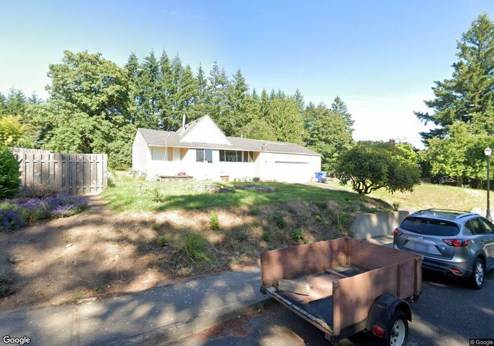
2960 NW Mcdaniel Rd Portland, OR 97229
Forest Park NeighborhoodEstimated Value: $487,388 - $773,000
2
Beds
1
Bath
1,246
Sq Ft
$464/Sq Ft
Est. Value
About This Home
This home is located at 2960 NW Mcdaniel Rd, Portland, OR 97229 and is currently estimated at $577,847, approximately $463 per square foot. 2960 NW Mcdaniel Rd is a home located in Multnomah County with nearby schools including Bonny Slope Elementary School, Sunset High School, and Montessori School Of Beaverton.
Ownership History
Date
Name
Owned For
Owner Type
Purchase Details
Closed on
Jun 29, 2011
Sold by
Rohani Hooshang
Bought by
Mirarabshahi Omid
Current Estimated Value
Purchase Details
Closed on
Jul 30, 2010
Sold by
Mirarabshahi Omid
Bought by
Talebi Hooshang and Rohani Tahareh
Purchase Details
Closed on
Jul 31, 2007
Sold by
Harper Ben Wade
Bought by
Mirarabshahi Omid
Purchase Details
Closed on
Oct 19, 1979
Sold by
Hill Robert E and Hill Patricia I
Bought by
Harper Ben Wade and Harper Peggy Ann
Create a Home Valuation Report for This Property
The Home Valuation Report is an in-depth analysis detailing your home's value as well as a comparison with similar homes in the area
Home Values in the Area
Average Home Value in this Area
Purchase History
| Date | Buyer | Sale Price | Title Company |
|---|---|---|---|
| Mirarabshahi Omid | -- | None Available | |
| Talebi Hooshang | $75,000 | None Available | |
| Mirarabshahi Omid | $410,000 | Lawyers Title Ins | |
| Harper Ben Wade | $48,000 | -- |
Source: Public Records
Tax History Compared to Growth
Tax History
| Year | Tax Paid | Tax Assessment Tax Assessment Total Assessment is a certain percentage of the fair market value that is determined by local assessors to be the total taxable value of land and additions on the property. | Land | Improvement |
|---|---|---|---|---|
| 2025 | $3,719 | $203,510 | -- | -- |
| 2024 | $3,557 | $197,590 | -- | -- |
| 2023 | $3,441 | $191,840 | $0 | $0 |
| 2022 | $3,361 | $186,260 | $0 | $0 |
| 2021 | $3,235 | $180,840 | $0 | $0 |
| 2020 | $3,042 | $175,580 | $0 | $0 |
| 2019 | $2,937 | $170,470 | $0 | $0 |
| 2018 | $2,840 | $165,510 | $0 | $0 |
| 2017 | $2,734 | $160,690 | $0 | $0 |
| 2016 | $2,756 | $162,420 | $0 | $0 |
| 2015 | $2,681 | $157,690 | $0 | $0 |
| 2014 | $2,615 | $153,100 | $0 | $0 |
Source: Public Records
Map
Nearby Homes
- 3096 NW Parkhurst Terrace
- 2377 NW Burkhart Dr
- 10703 NW Glenmore Way
- 3042 NW Parkhurst Terrace
- 10409 NW Burkhardt Ct
- 10071 NW Jack Ln Unit 83
- 2635 NW Kennedy Ct Unit 133
- 2964 NW Parkhurst Terrace
- 10626 NW Glenmore Way
- 9926 NW Justus Ln Unit 27
- 10175 NW Wilshire Ln Unit 40
- 10223 NW Wilshire Ln Unit 37
- 2910 NW Parkhurst Terrace
- 2865 NW Kennedy Ct Unit 57
- 10010 NW Thompson Rd
- 10275 NW Wilshire Ln Unit 19
- 10005 NW Thompson Rd
- 10272 NW Edgewood Dr
- 2541 NW Marsden Place
- 10264 NW Edgewood Dr
- 2824 NW Mill Pond Rd
- 2940 NW Mill Pond Rd
- 2930 NW Mcdaniel Rd
- 2816 NW Mill Pond Rd
- 123407 NW Mcdaniel Rd Unit 7
- 3000 NW Mcdaniel Rd
- 2910 NW Mcdaniel Rd
- 2809 NW Mill Pond Rd
- 2804 NW Mill Pond Rd
- 10350 NW Thompson Rd
- 2931 NW Mcdaniel Rd
- 11660 NW Thompson Rd
- 2734 NW Mill Pond Rd
- 2911 NW Mcdaniel Rd
- 2727 NW Mill Pond Rd
- 2716 NW Mill Pond Rd
- 10444 NW Thompson Rd
- 2713 NW Mill Pond Rd
- 10512 NW Malia Ln
- 10530 NW Malia Ln