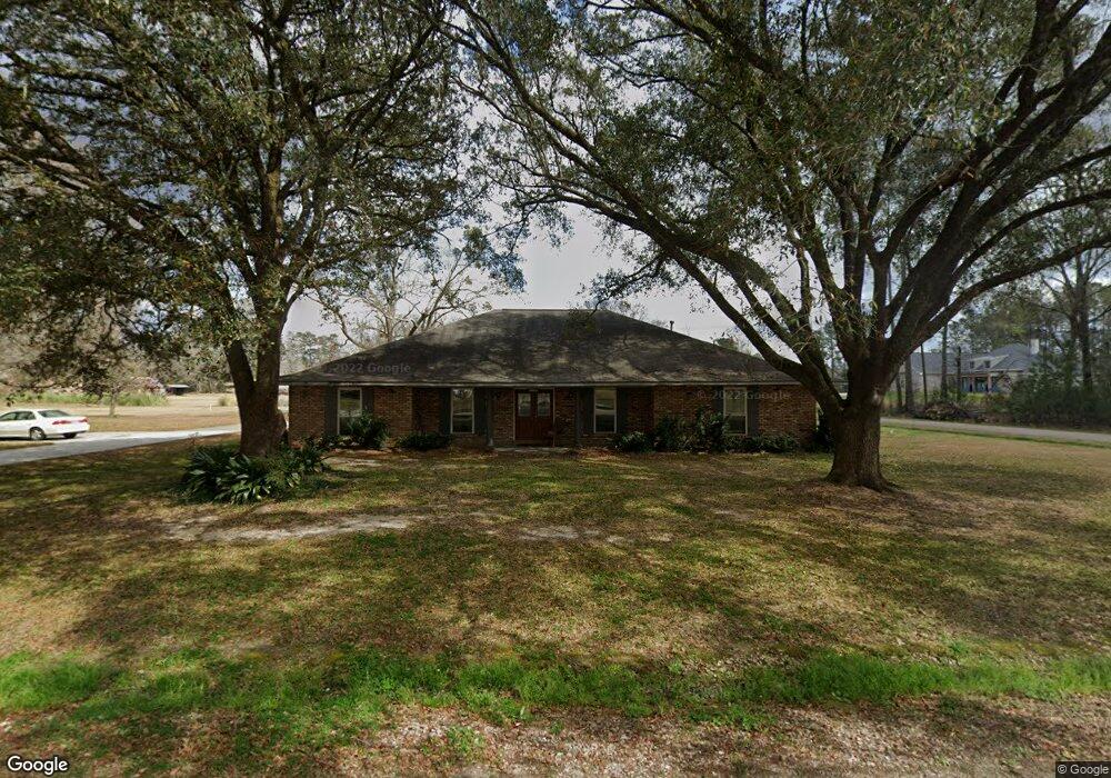
29600 Christopher Blvd Walker, LA 70785
Estimated Value: $191,551 - $350,000
4
Beds
2
Baths
2,618
Sq Ft
$110/Sq Ft
Est. Value
About This Home
This home is located at 29600 Christopher Blvd, Walker, LA 70785 and is currently estimated at $288,638, approximately $110 per square foot. 29600 Christopher Blvd is a home located in Livingston Parish with nearby schools including Walker Elementary School, Westside Junior High School, and Walker High School.
Ownership History
Date
Name
Owned For
Owner Type
Purchase Details
Closed on
Nov 9, 2009
Sold by
Denicola Jasper and Denicola Sara A
Bought by
Anderson Cassidy Charles A and Anderson Cassidy Mary
Current Estimated Value
Home Financials for this Owner
Home Financials are based on the most recent Mortgage that was taken out on this home.
Original Mortgage
$198,320
Outstanding Balance
$128,365
Interest Rate
4.83%
Mortgage Type
New Conventional
Estimated Equity
$160,273
Create a Home Valuation Report for This Property
The Home Valuation Report is an in-depth analysis detailing your home's value as well as a comparison with similar homes in the area
Home Values in the Area
Average Home Value in this Area
Purchase History
| Date | Buyer | Sale Price | Title Company |
|---|---|---|---|
| Anderson Cassidy Charles A | $247,900 | Varsity Title |
Source: Public Records
Mortgage History
| Date | Status | Borrower | Loan Amount |
|---|---|---|---|
| Open | Anderson Cassidy Charles A | $198,320 |
Source: Public Records
Tax History
| Year | Tax Paid | Tax Assessment Tax Assessment Total Assessment is a certain percentage of the fair market value that is determined by local assessors to be the total taxable value of land and additions on the property. | Land | Improvement |
|---|---|---|---|---|
| 2024 | $951 | $8,890 | $1,980 | $6,910 |
| 2023 | $1,095 | $8,890 | $1,980 | $6,910 |
| 2022 | $1,103 | $8,890 | $1,980 | $6,910 |
| 2021 | $973 | $8,890 | $1,980 | $6,910 |
| 2020 | $968 | $8,890 | $1,980 | $6,910 |
| 2019 | $910 | $8,120 | $1,980 | $6,140 |
| 2018 | $918 | $8,120 | $1,980 | $6,140 |
| 2017 | $904 | $7,810 | $1,980 | $5,830 |
| 2015 | $279 | $9,660 | $1,980 | $7,680 |
| 2014 | $283 | $9,660 | $1,980 | $7,680 |
Source: Public Records
Map
Nearby Homes
- 11334 Sandra Dr
- 8894 Florida Blvd
- 11637 Pine St
- 0 S Anne Dr
- 29378 S Anne Dr
- rural Rural St
- Lot 15 Magnolia Dr
- 29398 Magnolia Dr
- 11922 Pendarvis Ln
- 30460 Trace Ln
- 28766 Magnolia Dr
- 30453 Trace Ln
- 12079 Pendarvis Ln
- 29306 Red Oak Dr
- 29490 Red Oak Dr
- 29386 Red Oak Dr
- 8662 Florida Blvd
- 11598 Hideaway St
- 11589 Hideaway St
- 8611 Florida Blvd
- 1 W Anne Dr
- 0 W Anne Dr
- 29631 Christopher Blvd
- 29653 Christopher Blvd
- 29605 Christopher Blvd
- 11400 W Anne Dr
- 29680 Christopher Blvd
- 11417 W Anne Dr
- 29675 Christopher Blvd
- 11266 W Anne Dr
- 11430 W Anne Dr
- 11443 W Anne Dr
- 11267 W Anne Dr
- 11229 W Anne Dr
- 28269 Luke Ln
- 11310 W Anne Dr
- 11357 Sandra Dr
- 8954 Florida Blvd
- 11211 W Anne Dr
- 28270 Luke Ln
Your Personal Tour Guide
Ask me questions while you tour the home.