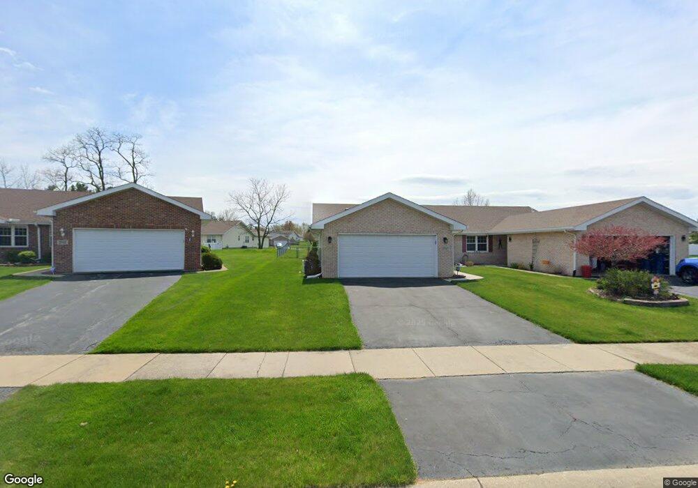
2961 Freedom Cir Crown Point, IN 46307
Estimated Value: $251,516 - $272,000
2
Beds
2
Baths
1,360
Sq Ft
$194/Sq Ft
Est. Value
About This Home
This home is located at 2961 Freedom Cir, Crown Point, IN 46307 and is currently estimated at $263,629, approximately $193 per square foot. 2961 Freedom Cir is a home located in Lake County with nearby schools including Peifer Elementary School, Hal E Clark Middle School, and Lake Central High School.
Ownership History
Date
Name
Owned For
Owner Type
Purchase Details
Closed on
Jul 12, 2010
Sold by
Mau Louis J
Bought by
Mauder William G
Current Estimated Value
Home Financials for this Owner
Home Financials are based on the most recent Mortgage that was taken out on this home.
Original Mortgage
$100,000
Interest Rate
4.7%
Mortgage Type
New Conventional
Create a Home Valuation Report for This Property
The Home Valuation Report is an in-depth analysis detailing your home's value as well as a comparison with similar homes in the area
Home Values in the Area
Average Home Value in this Area
Purchase History
| Date | Buyer | Sale Price | Title Company |
|---|---|---|---|
| Mauder William G | -- | Community Title Company |
Source: Public Records
Mortgage History
| Date | Status | Borrower | Loan Amount |
|---|---|---|---|
| Open | Mauder William G | $101,400 | |
| Closed | Mauder William G | $100,000 |
Source: Public Records
Tax History Compared to Growth
Tax History
| Year | Tax Paid | Tax Assessment Tax Assessment Total Assessment is a certain percentage of the fair market value that is determined by local assessors to be the total taxable value of land and additions on the property. | Land | Improvement |
|---|---|---|---|---|
| 2024 | $4,148 | $229,300 | $39,800 | $189,500 |
| 2023 | $1,549 | $203,700 | $39,800 | $163,900 |
| 2022 | $1,549 | $178,800 | $39,800 | $139,000 |
| 2021 | $1,451 | $172,300 | $39,800 | $132,500 |
| 2020 | $1,393 | $164,400 | $31,300 | $133,100 |
| 2019 | $1,518 | $161,800 | $29,200 | $132,600 |
| 2018 | $1,474 | $157,100 | $29,200 | $127,900 |
| 2017 | $1,314 | $150,600 | $29,200 | $121,400 |
| 2016 | $1,222 | $143,200 | $29,200 | $114,000 |
| 2014 | $1,128 | $142,200 | $29,200 | $113,000 |
| 2013 | $1,137 | $140,300 | $29,200 | $111,100 |
Source: Public Records
Map
Nearby Homes
- 2921 Morningside Dr
- 2914 Morningside Dr
- 1813 Redwood Ct
- 6076 Wexford Way
- 5547 Maggie Mae Ct
- 1881 Orchard Ct
- 5544 Maggie Mae Ct
- 1896 Azalea Ct
- 2720 Painted Leaf Ct
- 1785 Wedgewood Ct
- 1765 Wedgewood Ct
- 2756 Autumn Dr
- 5480 Victoria Place
- 6440 W 89th Ave
- 2609 Autumn Dr
- 8109 Victoria Place
- 2543 Harvest Dr
- 8849 Calhoun Place
- 8521 Morse Place
- 6501 W 89th Ave
- 2963 Freedom Cir
- 2957 Freedom Cir
- 1644 Flag Ct
- 1642 Flag Ct
- 1646 Flag Ct
- 2951 Freedom Cir
- 1640 Flag Ct
- 2962 Liberty Dr
- 2949 Freedom Cir
- 2954 Freedom Cir
- 3010 Liberty Dr
- 2956 Liberty Dr
- 2945 Freedom Cir
- 2952 Freedom Cir
- 1648 Flag Ct
- 2943 Freedom Cir
- 2950 Liberty Dr
- 3016 Liberty Dr
- 2939 Freedom Cir
- 1650 Flag Ct