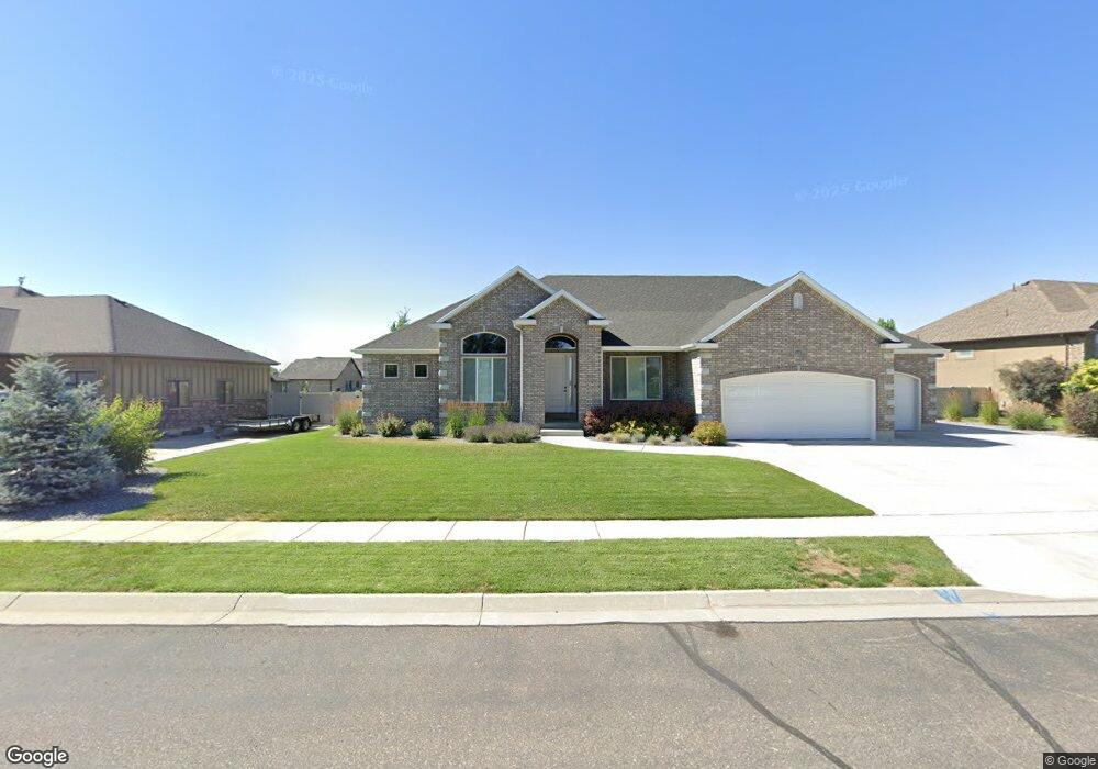
2961 W Red Sand Rd West Haven, UT 84401
Estimated Value: $783,000 - $978,179
--
Bed
5
Baths
2,515
Sq Ft
$340/Sq Ft
Est. Value
About This Home
This home is located at 2961 W Red Sand Rd, West Haven, UT 84401 and is currently estimated at $855,545, approximately $340 per square foot. 2961 W Red Sand Rd is a home with nearby schools including Deamude Adventist Christian School.
Ownership History
Date
Name
Owned For
Owner Type
Purchase Details
Closed on
Jun 10, 2016
Sold by
Clonts L Michael and Clonts Sherry
Bought by
Clonts Michael and Clonts Sherry
Current Estimated Value
Purchase Details
Closed on
May 25, 2016
Sold by
Clonts L Michael and Clonts Sherry
Bought by
Clonts Michael and Clonts Sherry
Purchase Details
Closed on
Nov 27, 2007
Sold by
Secrist Acres Development Inc
Bought by
Corporation Of The Presiding Bishop Of T
Create a Home Valuation Report for This Property
The Home Valuation Report is an in-depth analysis detailing your home's value as well as a comparison with similar homes in the area
Home Values in the Area
Average Home Value in this Area
Purchase History
| Date | Buyer | Sale Price | Title Company |
|---|---|---|---|
| Clonts Michael | -- | None Available | |
| Clonts Michael | -- | None Available | |
| Corporation Of The Presiding Bishop Of T | -- | None Available |
Source: Public Records
Tax History Compared to Growth
Tax History
| Year | Tax Paid | Tax Assessment Tax Assessment Total Assessment is a certain percentage of the fair market value that is determined by local assessors to be the total taxable value of land and additions on the property. | Land | Improvement |
|---|---|---|---|---|
| 2025 | $5,553 | $947,645 | $224,188 | $723,457 |
| 2024 | $5,313 | $511,499 | $123,303 | $388,196 |
| 2023 | $5,423 | $522,500 | $122,629 | $399,871 |
| 2022 | $5,588 | $553,300 | $111,637 | $441,663 |
| 2021 | $4,253 | $705,000 | $132,695 | $572,305 |
| 2020 | $3,989 | $605,000 | $97,470 | $507,530 |
| 2019 | $3,774 | $540,000 | $97,329 | $442,671 |
| 2018 | $3,922 | $539,000 | $87,216 | $451,784 |
| 2017 | $3,981 | $534,000 | $86,581 | $447,419 |
| 2016 | $1,228 | $78,909 | $78,909 | $0 |
| 2015 | $1,032 | $78,909 | $78,909 | $0 |
| 2014 | $861 | $64,255 | $64,255 | $0 |
Source: Public Records
Map
Nearby Homes
- 3672 3125 W Unit 12
- 2954 W 2325 S
- 3328 W 2100 S
- 2611 W 1850 S
- 1882 S 2475 W
- 2300 Farmhouse Select Plan at Fairhaven
- 1856 S 2425 W
- 1918 S 2475 W
- 1903 S 2425 W
- 1977 S 2425 W
- 2067 S 2425 W
- 2050 Farmhouse Select Plan at Fairhaven
- 1953 S 2425 W
- 1869 S 2425 W
- 1944 S 2425 W
- 3000 Farmhouse Select Plan at Fairhaven
- 2599 S 3075 W
- 2504 W 1725 S
- 2454 W 1775 S
- 3728 W Chalgrove Rd
- 2963 W Red Sand Rd
- 2964 W Red Sand Rd
- 2959 W 2025 S
- 2063 Cameron Dr
- 2063 S 2950 W
- 2969 W Red Sand Rd
- 2084 S 2975 W
- 2079 S Cameron Dr
- 2079 Cameron Dr
- 2079 S 2950 W
- 2973 W Red Sand Rd
- 2098 S 2975 W
- 2038 S Cameron Dr
- 2038 S 2950 W
- 2968 W Red Sand Rd
- 2093 S 2950 W Unit 5
- 2093 Cameron Dr
- 2011 S Cameron Dr
- 4010 W 2025 S
- 2088 S 2950 W