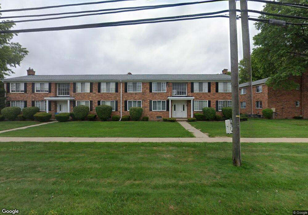
29620 Hoover Rd Warren, MI 48093
Northeast Warren NeighborhoodEstimated Value: $104,000 - $106,388
--
Bed
2
Baths
973
Sq Ft
$109/Sq Ft
Est. Value
About This Home
This home is located at 29620 Hoover Rd, Warren, MI 48093 and is currently estimated at $105,597, approximately $108 per square foot. 29620 Hoover Rd is a home located in Macomb County with nearby schools including Warren Woods Tower High School, Frontier International Academy Elementary, and Warren SDA Junior Academy.
Ownership History
Date
Name
Owned For
Owner Type
Purchase Details
Closed on
Mar 11, 2011
Sold by
Grobelski Georgann
Bought by
Cavanough Gloria
Current Estimated Value
Purchase Details
Closed on
Dec 22, 2005
Sold by
Cavanaugh Gloria and Grobelski Georgann
Bought by
Cavanaugh Gloria and Grobelski Georgann
Home Financials for this Owner
Home Financials are based on the most recent Mortgage that was taken out on this home.
Original Mortgage
$60,000
Interest Rate
6.4%
Mortgage Type
New Conventional
Purchase Details
Closed on
Nov 22, 2000
Sold by
Norwood Lora
Bought by
Cavanaugh Gloria
Purchase Details
Closed on
Dec 15, 1998
Sold by
Daniot Phyllis
Bought by
Norwood Lora
Create a Home Valuation Report for This Property
The Home Valuation Report is an in-depth analysis detailing your home's value as well as a comparison with similar homes in the area
Home Values in the Area
Average Home Value in this Area
Purchase History
| Date | Buyer | Sale Price | Title Company |
|---|---|---|---|
| Cavanough Gloria | -- | None Available | |
| Cavanaugh Gloria | -- | None Available | |
| Cavanaugh Gloria | $71,900 | -- | |
| Norwood Lora | $65,000 | -- |
Source: Public Records
Mortgage History
| Date | Status | Borrower | Loan Amount |
|---|---|---|---|
| Previous Owner | Cavanaugh Gloria | $60,000 |
Source: Public Records
Tax History Compared to Growth
Tax History
| Year | Tax Paid | Tax Assessment Tax Assessment Total Assessment is a certain percentage of the fair market value that is determined by local assessors to be the total taxable value of land and additions on the property. | Land | Improvement |
|---|---|---|---|---|
| 2025 | $2,909 | $42,830 | $0 | $0 |
| 2024 | $2,848 | $40,460 | $0 | $0 |
| 2023 | $792 | $40,050 | $0 | $0 |
| 2022 | $777 | $31,070 | $0 | $0 |
| 2021 | $762 | $29,150 | $0 | $0 |
| 2020 | $731 | $26,230 | $0 | $0 |
| 2019 | $698 | $22,180 | $0 | $0 |
| 2018 | $21 | $15,850 | $0 | $0 |
| 2017 | $667 | $15,770 | $2,450 | $13,320 |
| 2016 | $662 | $15,770 | $0 | $0 |
| 2015 | -- | $14,990 | $0 | $0 |
| 2013 | $644 | $12,600 | $0 | $0 |
Source: Public Records
Map
Nearby Homes
- 29368 Hoover Rd Unit A3
- 29227 Norma Dr
- 11916 Geoffry Dr
- 11447 Edwin Dr
- 29366 Wagner Dr
- 11357 Geoffry Dr
- 11345 Geoffry Dr
- 29091 Wagner Dr
- 54765 Palomino Ave
- 29171 Birchcrest Dr
- 29105 Palomino Dr
- 11116 Racine Rd
- 30329 Blancke Dr
- 29820 Palomino Dr
- 11582 Gerald Dr
- 28741 Roan Dr
- 30316 Barbary Ct
- 12531 Common Rd
- 12103 Diegel Rd
- 29379 Newport Dr
- 29614 Hoover Rd Unit Bldg-Unit
- 29642 Hoover Rd Unit 152
- 29640 Hoover Rd Unit 151
- 29634 Hoover Rd Unit M150
- 29632 Hoover Rd Unit 149
- 29626 Hoover Rd Unit 148
- 29624 Hoover Rd Unit 147
- 29618 Hoover Rd Unit 146
- 29616 Hoover Rd
- 29612 Hoover Rd
- 29614 Hoover Rd Unit M143
- 29622 Hoover Rd Unit 141
- 29630 Hoover Rd Unit 139
- 29636 Hoover Rd
- 29638 Hoover Rd Unit 137
- 29626 Hoover Rd Unit 626
- 29618 Hoover Rd Unit 618
- 29658 Hoover Rd Unit L136
- 29656 Hoover Rd Unit L135
- 29650 Hoover Rd Unit 134