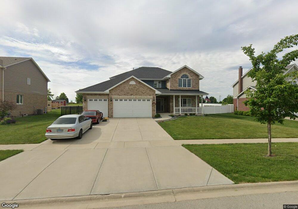
2963 Brett Dr New Lenox, IL 60451
Estimated Value: $593,000 - $630,000
4
Beds
3
Baths
3,116
Sq Ft
$194/Sq Ft
Est. Value
About This Home
This home is located at 2963 Brett Dr, New Lenox, IL 60451 and is currently estimated at $604,818, approximately $194 per square foot. 2963 Brett Dr is a home located in Will County with nearby schools including Nelson Prairie School, Lincoln Way West, and St. Jude School.
Ownership History
Date
Name
Owned For
Owner Type
Purchase Details
Closed on
May 12, 2020
Sold by
First Midwest Bank
Bought by
Scott William J and Scott Tina M
Current Estimated Value
Home Financials for this Owner
Home Financials are based on the most recent Mortgage that was taken out on this home.
Original Mortgage
$327,944
Outstanding Balance
$288,448
Interest Rate
3.37%
Mortgage Type
New Conventional
Estimated Equity
$316,370
Purchase Details
Closed on
Feb 7, 2020
Sold by
First Midwest Bank
Bought by
Litke Edward A and Litke Kimberly A
Home Financials for this Owner
Home Financials are based on the most recent Mortgage that was taken out on this home.
Original Mortgage
$399,597
Interest Rate
3.87%
Mortgage Type
New Conventional
Create a Home Valuation Report for This Property
The Home Valuation Report is an in-depth analysis detailing your home's value as well as a comparison with similar homes in the area
Home Values in the Area
Average Home Value in this Area
Purchase History
| Date | Buyer | Sale Price | Title Company |
|---|---|---|---|
| Scott William J | $345,204 | Fidelity National Title | |
| Litke Edward A | $437,034 | Fidelity National Title |
Source: Public Records
Mortgage History
| Date | Status | Borrower | Loan Amount |
|---|---|---|---|
| Open | Scott William J | $327,944 | |
| Previous Owner | Litke Edward A | $399,597 |
Source: Public Records
Tax History
| Year | Tax Paid | Tax Assessment Tax Assessment Total Assessment is a certain percentage of the fair market value that is determined by local assessors to be the total taxable value of land and additions on the property. | Land | Improvement |
|---|---|---|---|---|
| 2024 | $14,361 | $184,964 | $33,360 | $151,604 |
| 2023 | $14,361 | $168,609 | $30,410 | $138,199 |
| 2022 | $13,816 | $155,329 | $28,015 | $127,314 |
| 2021 | $12,277 | $146,082 | $26,347 | $119,735 |
| 2020 | $7,311 | $70 | $70 | $0 |
| 2019 | $0 | $70 | $70 | $0 |
| 2018 | $0 | $70 | $70 | $0 |
| 2017 | $0 | $70 | $70 | $0 |
| 2016 | $0 | $70 | $70 | $0 |
| 2015 | -- | $70 | $70 | $0 |
| 2014 | -- | $70 | $70 | $0 |
| 2013 | -- | $70 | $70 | $0 |
Source: Public Records
Map
Nearby Homes
- 2882 Mckenna Dr
- 2665 Daniel Lewis Dr
- 2414 Daniel Lewis Dr
- 14620 W Laraway Rd
- 819 Shagbark Rd
- 2101 Jackson Branch Dr
- 2341 Stone Creek Dr
- 0 W Baker Rd Unit 23833428
- 2301 Stone Creek Dr
- 2231 Stone Creek Dr
- 1327 Grandview Dr
- 1621 Andrea Dr
- 1111 W Baker Rd
- 1007 Nelson Rd
- 22250 Gougar Rd
- LOT 8 W Laraway Rd
- 23929 S William Dr
- 1973 Edgeview Dr
- 1647 Cobb St
- 1000 S Cedar Rd
Your Personal Tour Guide
Ask me questions while you tour the home.