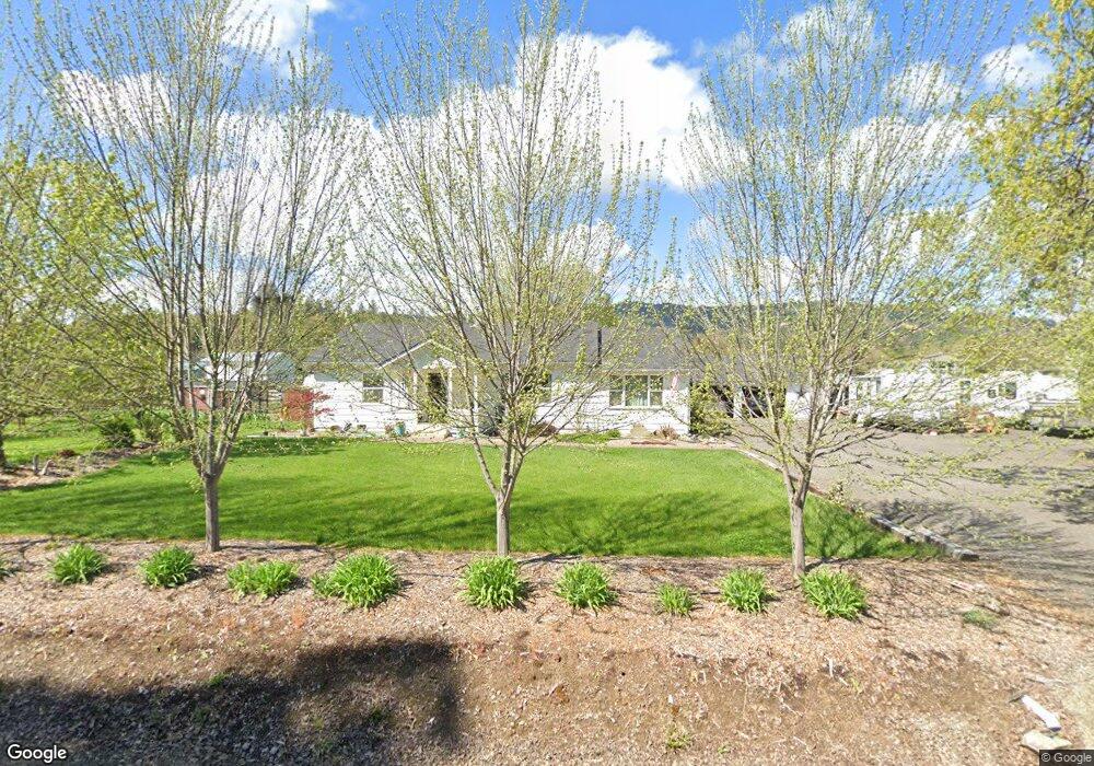
2963 Freeland Rd Central Point, OR 97502
Estimated Value: $450,000 - $486,098
3
Beds
2
Baths
1,620
Sq Ft
$288/Sq Ft
Est. Value
About This Home
This home is located at 2963 Freeland Rd, Central Point, OR 97502 and is currently estimated at $466,366, approximately $287 per square foot. 2963 Freeland Rd is a home located in Jackson County with nearby schools including Richardson Elementary School, Scenic Middle School, and Crater High School.
Ownership History
Date
Name
Owned For
Owner Type
Purchase Details
Closed on
Mar 31, 2015
Sold by
Whitehead Michael Dewayne and Huffman Pamela Jane
Bought by
Lowe Brian D and Lowe Lori L
Current Estimated Value
Purchase Details
Closed on
Dec 17, 2014
Sold by
Whitehead Michael Dewayne
Bought by
Huffman Pamela Jane and Whitehead Michael Dewayne
Create a Home Valuation Report for This Property
The Home Valuation Report is an in-depth analysis detailing your home's value as well as a comparison with similar homes in the area
Home Values in the Area
Average Home Value in this Area
Purchase History
| Date | Buyer | Sale Price | Title Company |
|---|---|---|---|
| Lowe Brian D | $195,000 | Ticor Title Company | |
| Huffman Pamela Jane | -- | None Available |
Source: Public Records
Tax History Compared to Growth
Tax History
| Year | Tax Paid | Tax Assessment Tax Assessment Total Assessment is a certain percentage of the fair market value that is determined by local assessors to be the total taxable value of land and additions on the property. | Land | Improvement |
|---|---|---|---|---|
| 2025 | $2,760 | $224,630 | $120,050 | $104,580 |
| 2024 | $2,760 | $218,090 | $107,870 | $110,220 |
| 2023 | $2,668 | $211,740 | $104,730 | $107,010 |
| 2022 | $2,611 | $211,740 | $104,730 | $107,010 |
| 2021 | $2,537 | $205,580 | $101,690 | $103,890 |
| 2020 | $2,463 | $199,600 | $98,740 | $100,860 |
| 2019 | $2,406 | $188,150 | $93,080 | $95,070 |
| 2018 | $2,332 | $182,670 | $90,370 | $92,300 |
| 2017 | $2,276 | $182,670 | $90,370 | $92,300 |
| 2016 | $2,210 | $172,190 | $85,180 | $87,010 |
| 2015 | $2,107 | $172,190 | $85,180 | $87,010 |
| 2014 | $2,057 | $162,320 | $80,280 | $82,040 |
Source: Public Records
Map
Nearby Homes
- 3220 Freeland Rd
- 3307 Freeland Rd
- 3506 New Ray Rd
- 3642 Oak Pine Way
- 570 Bachand Cir
- 429 Mayberry Ln
- 659 Jackson Creek Dr
- 420 Mayberry Ln
- 465 Creekside Cir
- 487 Creekside Cir
- 25 Donna Way
- 21 Hickory Ln
- 2805 Old Military Rd
- 2555 Old Military Rd
- 895 Holley Way
- 871 Holley Way
- 3364 Snowy Butte Ln
- 407 Silver Creek Dr
- 349 W Pine St
- 619 Palo Verde Way
- 2941 Freeland Rd
- 2940 Freeland Rd
- 2920 Freeland Rd
- 3039 Freeland Rd
- 2884 Sylvia Rd
- 2994 Freeland Rd
- 2904 Sylvia Rd
- 2845 Sylvia Rd
- 2877 Sylvia Rd
- 2907 Sylvia Rd
- 3078 Freeland Rd
- 2941 Sylvia Rd
- 2910 Sunnyvale Dr
- 3002 Sunnyvale Dr
- 3036 Sunnyvale Dr
- 2971 Sylvia Rd
- 3117 Freeland Rd
- 3064 Sunnyvale Dr
- 2985 Sunnyvale Dr
- 2790 Old Stage Rd