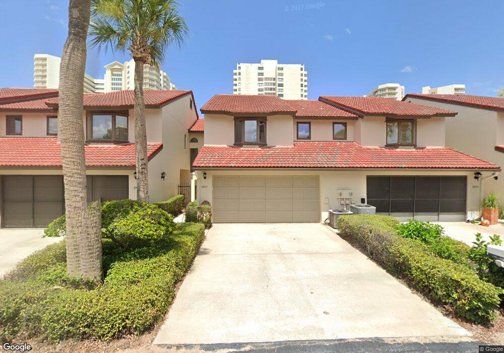
2963 Oceans Trace Daytona Beach, FL 32118
Estimated Value: $354,430 - $445,000
3
Beds
3
Baths
1,772
Sq Ft
$223/Sq Ft
Est. Value
About This Home
This home is located at 2963 Oceans Trace, Daytona Beach, FL 32118 and is currently estimated at $395,358, approximately $223 per square foot. 2963 Oceans Trace is a home with nearby schools including R.J. Longstreet Elementary School, Atlantic High School, and Silver Sands Middle School.
Ownership History
Date
Name
Owned For
Owner Type
Purchase Details
Closed on
Feb 15, 2001
Sold by
Piersa Bernice
Bought by
Chou Victoria C and Ilicic Miloje
Current Estimated Value
Home Financials for this Owner
Home Financials are based on the most recent Mortgage that was taken out on this home.
Original Mortgage
$75,000
Outstanding Balance
$25,719
Interest Rate
6.91%
Mortgage Type
Purchase Money Mortgage
Estimated Equity
$369,639
Purchase Details
Closed on
Oct 28, 1999
Sold by
Piersa Walter and Piersa Bernice
Bought by
Piersa Berncie
Purchase Details
Closed on
Apr 15, 1990
Bought by
Chou Victoria C
Create a Home Valuation Report for This Property
The Home Valuation Report is an in-depth analysis detailing your home's value as well as a comparison with similar homes in the area
Home Values in the Area
Average Home Value in this Area
Purchase History
| Date | Buyer | Sale Price | Title Company |
|---|---|---|---|
| Chou Victoria C | $151,000 | -- | |
| Piersa Berncie | -- | -- | |
| Chou Victoria C | $137,000 | -- |
Source: Public Records
Mortgage History
| Date | Status | Borrower | Loan Amount |
|---|---|---|---|
| Open | Chou Victoria C | $75,000 |
Source: Public Records
Tax History
| Year | Tax Paid | Tax Assessment Tax Assessment Total Assessment is a certain percentage of the fair market value that is determined by local assessors to be the total taxable value of land and additions on the property. | Land | Improvement |
|---|---|---|---|---|
| 2026 | $2,644 | $226,542 | -- | -- |
| 2025 | $2,644 | $226,542 | -- | -- |
| 2024 | $2,494 | $220,158 | -- | -- |
| 2023 | $2,494 | $213,746 | $0 | $0 |
| 2022 | $2,429 | $207,520 | $0 | $0 |
| 2021 | $2,496 | $201,476 | $0 | $0 |
| 2020 | $2,684 | $198,694 | $0 | $0 |
| 2019 | $2,600 | $194,227 | $35,500 | $158,727 |
| 2018 | $2,704 | $196,743 | $0 | $0 |
| 2017 | $2,714 | $192,696 | $0 | $0 |
| 2016 | $2,739 | $188,733 | $0 | $0 |
| 2015 | $2,867 | $187,421 | $0 | $0 |
| 2014 | $2,920 | $185,934 | $0 | $0 |
Source: Public Records
Map
Nearby Homes
- 2964 Oceans Trace
- 2966 Oceans Trace
- 2954 Oceans Trace
- 2942 Sea Oats Cir
- 2973 Sea Oats Cir
- 3 Oceans West Blvd Unit 7C1
- 3 Oceans West Blvd Unit 2C3
- 2937 S Atlantic Ave Unit 1002
- 2937 S Atlantic Ave Unit 703
- 2937 S Atlantic Ave Unit 708
- 2937 S Atlantic Ave Unit 2001
- 2937 S Atlantic Ave Unit 1907
- 2937 S Atlantic Ave Unit 2103
- 2937 S Atlantic Ave Unit 1603 & 1604
- 2937 S Atlantic Ave Unit 2001
- 2937 S Atlantic Ave Unit 703
- 2967 S Atlantic Ave Unit 707
- 2967 S Atlantic Ave Unit 508
- 2967 S Atlantic Ave Unit 1102
- 2967 S Atlantic Ave Unit 507
- 2965 Oceans Trace
- 2967 Oceans Trace
- 2959 Oceans Trace
- 2969 Oceans Trace
- 2957 Oceans Trace
- 2968 Oceans Trace
- 2962 Oceans Trace
- 2956 Sea Oats Cir
- 2958 Sea Oats Cir
- 2954 Sea Oats Cir
- 2955 Oceans Trace
- 2960 Sea Oats Cir
- 2952 Sea Oats Cir
- 2960 Oceans Trace
- 2962 Sea Oats Cir
- 2970 Oceans Trace
- 2983 Sea Oats Cir
- 2985 Sea Oats Cir
- 2950 Sea Oats Cir
- 2958 Oceans Trace