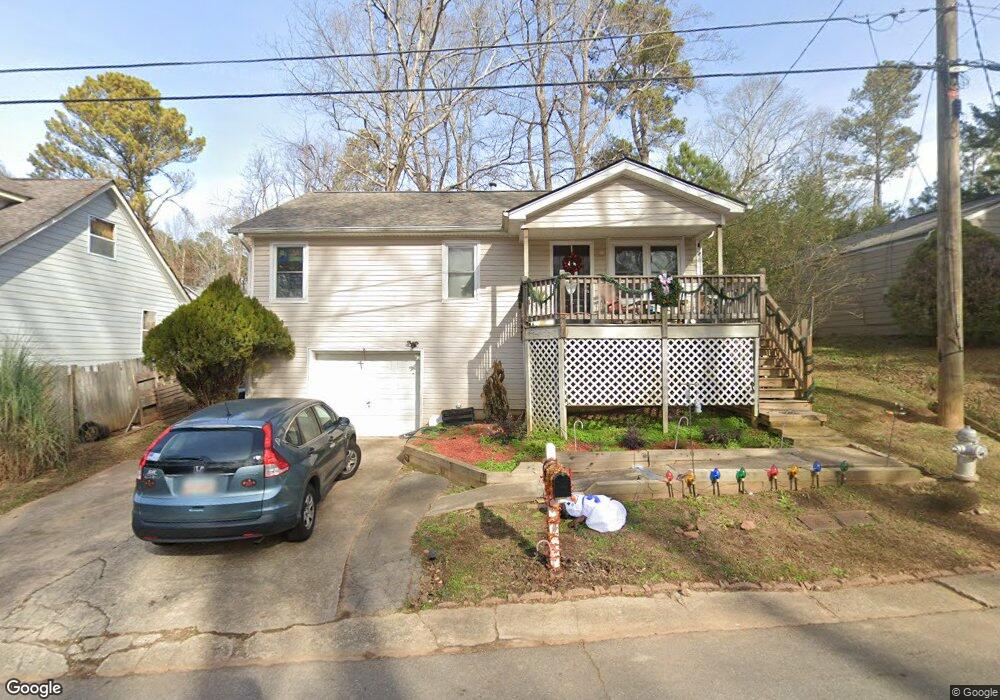
2963 Pebblebrook Dr Buford, GA 30518
Estimated Value: $301,000 - $326,432
3
Beds
2
Baths
1,020
Sq Ft
$311/Sq Ft
Est. Value
About This Home
This home is located at 2963 Pebblebrook Dr, Buford, GA 30518 and is currently estimated at $316,858, approximately $310 per square foot. 2963 Pebblebrook Dr is a home located in Gwinnett County with nearby schools including Buford Elementary School, Buford Senior Academy, and Buford Academy.
Ownership History
Date
Name
Owned For
Owner Type
Purchase Details
Closed on
Dec 13, 2002
Sold by
Citifiancial Svc Inc
Bought by
Swenson Nathan
Current Estimated Value
Home Financials for this Owner
Home Financials are based on the most recent Mortgage that was taken out on this home.
Original Mortgage
$54,000
Outstanding Balance
$23,323
Interest Rate
5.5%
Mortgage Type
New Conventional
Estimated Equity
$293,535
Purchase Details
Closed on
Sep 3, 2002
Sold by
Marsingill Laura P
Bought by
Commercial Credit Plan Inc
Purchase Details
Closed on
Apr 3, 1995
Sold by
Tanner Ricky D
Bought by
Marsingill
Create a Home Valuation Report for This Property
The Home Valuation Report is an in-depth analysis detailing your home's value as well as a comparison with similar homes in the area
Home Values in the Area
Average Home Value in this Area
Purchase History
| Date | Buyer | Sale Price | Title Company |
|---|---|---|---|
| Swenson Nathan | $60,000 | -- | |
| Commercial Credit Plan Inc | $60,089 | -- | |
| Marsingill | $49,000 | -- |
Source: Public Records
Mortgage History
| Date | Status | Borrower | Loan Amount |
|---|---|---|---|
| Open | Swenson Nathan | $54,000 | |
| Closed | Marsingill | $0 |
Source: Public Records
Map
Nearby Homes
- 2938 Pebblebrook Dr
- 3016 Pebblebrook Dr
- 3020 Pebblebrook Dr
- 2710 Blake Towers Ln
- 2416 Loughridge Dr
- Lot 2 Thunder Rd
- Lot 3 Thunder Rd
- 406 Thunder Rd
- 2838 N Bogan Rd
- 3267 N Bogan Rd NE
- 4375 Easter Lily Ave
- 4679 Silver Meadow Dr
- 3016 Sea Aster Way
- 3271 Meadow Lily Ct
- 405 Thunder Rd
- 4176 Cami Way
- 2802 Lakeview Ct
- 4184 Thompson Mill Rd
- 1049 Caruso Dr
- 1098 Caruso Dr
- 2959 Pebblebrook Dr
- 2967 Pebblebrook Dr
- 2895 Amber Ct
- 2955 Pebblebrook Dr
- 2891 Amber Ct
- 2964 Pebblebrook Dr
- 2960 Pebblebrook Dr
- 4600 Bryant Rd
- 4620 Bryant Rd
- 2951 Pebblebrook Dr
- 4630 Bryant Rd
- 4590 Bryant Rd
- 4640 Bryant Rd
- 4580 Bryant Rd
- 2976 Pebblebrook Dr
- 2947 Pebblebrook Dr Unit 9
- 2947 Pebblebrook Dr
- 2894 Amber Ct
- 4650 Bryant Rd
- 4570 Bryant Rd
Your Personal Tour Guide
Ask me questions while you tour the home.