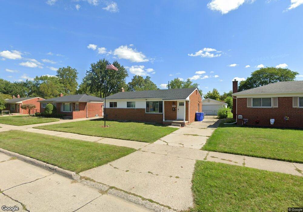
29640 Eiffel Ave Warren, MI 48088
Northeast Warren NeighborhoodEstimated Value: $224,128 - $246,000
3
Beds
2
Baths
1,030
Sq Ft
$226/Sq Ft
Est. Value
About This Home
This home is located at 29640 Eiffel Ave, Warren, MI 48088 and is currently estimated at $232,282, approximately $225 per square foot. 29640 Eiffel Ave is a home located in Macomb County with nearby schools including Warren Woods Tower High School, Frontier International Academy Elementary, and Warren Woods Christian School.
Ownership History
Date
Name
Owned For
Owner Type
Purchase Details
Closed on
Feb 14, 2022
Sold by
Velma L Blankenship Irrevocable Trust
Bought by
Blankenship Kyle David
Current Estimated Value
Purchase Details
Closed on
Jun 20, 2018
Sold by
Blankenship Velma L and Blankenship Kyle David
Bought by
Blankenshi Blankenship Kyle David and Velma L Blankenship Blankenship Irrevoca
Purchase Details
Closed on
Apr 12, 2018
Sold by
Blankenship Velma and Blankenship Jerry L
Bought by
Blankenship Velma and Blankenship Kyle David
Create a Home Valuation Report for This Property
The Home Valuation Report is an in-depth analysis detailing your home's value as well as a comparison with similar homes in the area
Home Values in the Area
Average Home Value in this Area
Purchase History
| Date | Buyer | Sale Price | Title Company |
|---|---|---|---|
| Blankenship Kyle David | -- | None Listed On Document | |
| Blankenship Kyle David | -- | None Listed On Document | |
| Blankenshi Blankenship Kyle David | -- | None Available | |
| Blankenship Velma | -- | None Available |
Source: Public Records
Tax History
| Year | Tax Paid | Tax Assessment Tax Assessment Total Assessment is a certain percentage of the fair market value that is determined by local assessors to be the total taxable value of land and additions on the property. | Land | Improvement |
|---|---|---|---|---|
| 2025 | $2,788 | $100,700 | $0 | $0 |
| 2024 | $27 | $91,480 | $0 | $0 |
| 2023 | $2,570 | $88,330 | $0 | $0 |
| 2022 | $2,520 | $76,930 | $0 | $0 |
| 2021 | $3,257 | $70,410 | $0 | $0 |
| 2020 | $3,154 | $65,760 | $0 | $0 |
| 2019 | $3,047 | $62,910 | $0 | $0 |
| 2018 | $2,287 | $54,150 | $0 | $0 |
| 2017 | $2,163 | $48,680 | $9,860 | $38,820 |
| 2016 | $2,147 | $48,680 | $0 | $0 |
| 2015 | -- | $43,290 | $0 | $0 |
| 2013 | $2,074 | $40,590 | $0 | $0 |
Source: Public Records
Map
Nearby Homes
- 29531 Eiffel Ave
- 13015 Walter Ave
- 29579 Fairfield Dr
- 13325 Iowa Dr
- 29143 Dover Ave
- 30507 Moulin Ave
- 29417 Scarborough Dr Unit 28
- 29454 Scarborough Dr Unit 7
- 29088 Yorkshire Ln Unit 28
- 30139 Flanders Ave
- 12531 Common Rd
- 54765 Palomino Ave
- 30806 Ridgefield Ave
- 29134 Palomino Dr
- 30745 Iroquois Dr
- 29105 Palomino Dr
- 14066 Castle Ave
- 30747 Sutherland Ave
- 29337 Roan Dr
- 28625 Bradner Dr
- 29654 Eiffel Ave
- 29628 Eiffel Ave
- 29614 Eiffel Ave
- 29668 Eiffel Ave
- 29637 Moulin Ave
- 29625 Moulin Ave
- 29657 Moulin Ave
- 29675 Moulin Ave
- 29615 Moulin Ave
- 29600 Eiffel Ave
- 13316 Walter Ave
- 29641 Eiffel Ave
- 29653 Eiffel Ave
- 29682 Eiffel Ave
- 29629 Eiffel Ave
- 29665 Eiffel Ave
- 29586 Eiffel Ave
- 29617 Eiffel Ave
- 13254 Walter Ave
- 29589 Moulin Ave
Your Personal Tour Guide
Ask me questions while you tour the home.