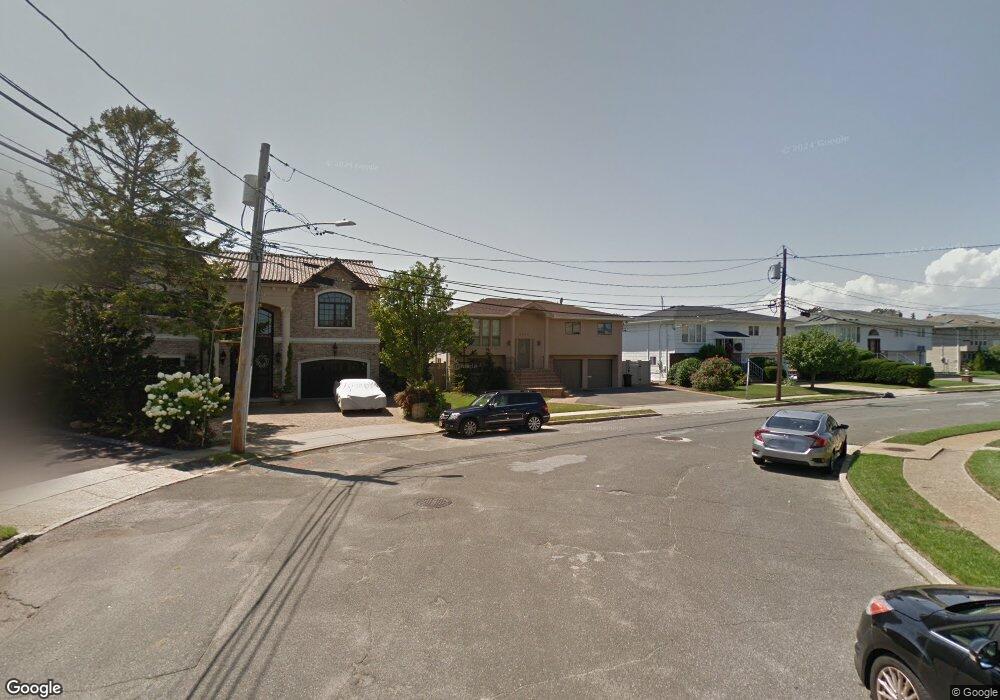
2965 Charlotte Dr Merrick, NY 11566
Estimated Value: $1,053,000 - $1,123,857
4
Beds
2
Baths
1,644
Sq Ft
$662/Sq Ft
Est. Value
About This Home
This home is located at 2965 Charlotte Dr, Merrick, NY 11566 and is currently estimated at $1,088,429, approximately $662 per square foot. 2965 Charlotte Dr is a home located in Nassau County with nearby schools including Merrick Avenue Middle School, John F. Kennedy High School, and St. Elizabeth Ann Seton Regional School.
Ownership History
Date
Name
Owned For
Owner Type
Purchase Details
Closed on
Aug 22, 2017
Sold by
Connors Michael and Connors Gayle
Bought by
Timpone Michael A
Current Estimated Value
Home Financials for this Owner
Home Financials are based on the most recent Mortgage that was taken out on this home.
Original Mortgage
$647,282
Outstanding Balance
$546,392
Interest Rate
4.4%
Mortgage Type
FHA
Estimated Equity
$542,037
Create a Home Valuation Report for This Property
The Home Valuation Report is an in-depth analysis detailing your home's value as well as a comparison with similar homes in the area
Home Values in the Area
Average Home Value in this Area
Purchase History
| Date | Buyer | Sale Price | Title Company |
|---|---|---|---|
| Timpone Michael A | $690,000 | Allegiance Abstract |
Source: Public Records
Mortgage History
| Date | Status | Borrower | Loan Amount |
|---|---|---|---|
| Open | Timpone Michael A | $647,282 |
Source: Public Records
Tax History Compared to Growth
Tax History
| Year | Tax Paid | Tax Assessment Tax Assessment Total Assessment is a certain percentage of the fair market value that is determined by local assessors to be the total taxable value of land and additions on the property. | Land | Improvement |
|---|---|---|---|---|
| 2025 | $20,884 | $729 | $290 | $439 |
| 2024 | $4,580 | $697 | $277 | $420 |
| 2023 | $19,741 | $738 | $293 | $445 |
| 2022 | $19,741 | $730 | $290 | $440 |
| 2021 | $26,717 | $723 | $287 | $436 |
| 2020 | $22,983 | $1,022 | $804 | $218 |
| 2019 | $7,156 | $1,356 | $1,067 | $289 |
| 2018 | $18,445 | $1,356 | $0 | $0 |
| 2017 | $11,965 | $1,356 | $1,067 | $289 |
| 2016 | $17,191 | $1,356 | $1,067 | $289 |
| 2015 | $4,568 | $1,356 | $1,067 | $289 |
| 2014 | $4,568 | $1,356 | $1,067 | $289 |
| 2013 | $4,556 | $1,356 | $1,067 | $289 |
Source: Public Records
Map
Nearby Homes
- 2035 Sans Ave
- 2863 Harbor Rd
- 2048 Holland Way
- 2819 Harbor Rd
- 2925 Hewlett Ave
- 2956 Judith Dr
- 2074 Ellen Dr
- 1944 Lowell Ln
- 1952 Julian Ln
- 2903 Preston Ln
- 2072 Brighton Way
- 2100 Beverly Way
- 1956 Leonard Ln
- 2998 Joyce Ln
- 2810 Wynsum Ave
- 2729 Shore Dr
- 110 Hampton Way
- 2000 Lake End Rd
- 2092 Vine Dr
- 3101 Lonni Ln
- 2959 Charlotte Dr
- 2969 Charlotte Dr
- 2953 Charlotte Dr
- 2973 Charlotte Dr
- 2978 Charlotte Dr
- 2960 Charlotte Dr
- 2947 Charlotte Dr
- 2977 Charlotte Dr
- 2954 Charlotte Dr
- 2929 Bay Dr
- 2983 Charlotte Dr
- 2923 Bay Dr
- 2941 Charlotte Dr
- 2917 Bay Dr
- 2946 Charlotte Dr
- 2935 Bay Dr
- 2990 Charlotte Dr
- 2950 Whaleneck Dr
- 2942 Whaleneck Dr
- 2911 Bay Dr