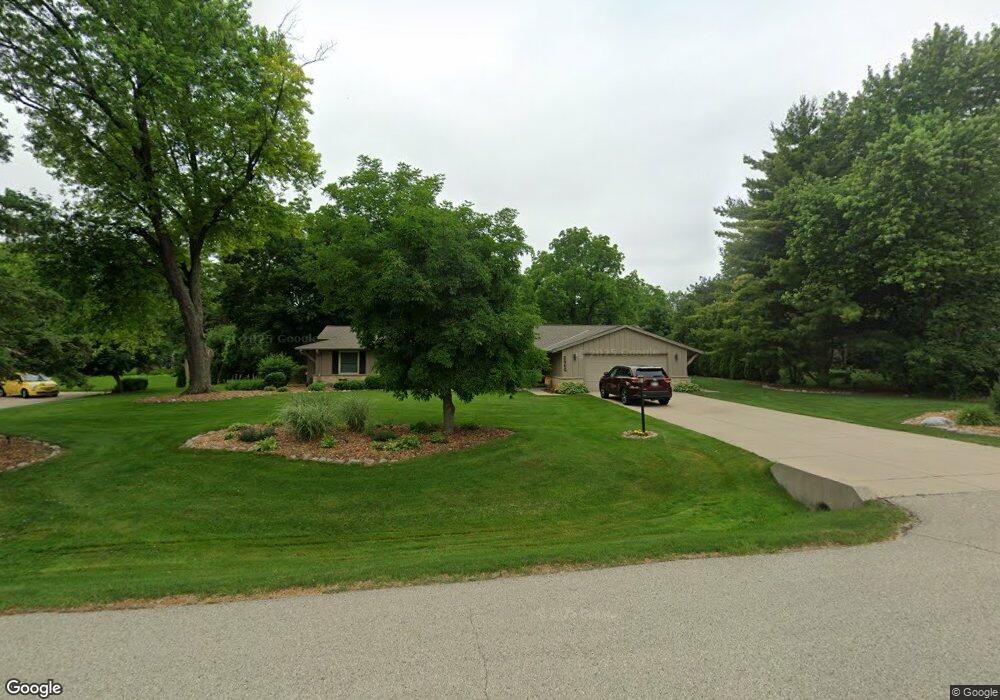
2965 Monterey Blvd Brookfield, WI 53005
Estimated Value: $470,246 - $482,000
3
Beds
3
Baths
1,590
Sq Ft
$299/Sq Ft
Est. Value
About This Home
This home is located at 2965 Monterey Blvd, Brookfield, WI 53005 and is currently estimated at $476,062, approximately $299 per square foot. 2965 Monterey Blvd is a home located in Waukesha County with nearby schools including Dixon Elementary School, Pilgrim Park Middle School, and Brookfield East High School.
Ownership History
Date
Name
Owned For
Owner Type
Purchase Details
Closed on
Mar 29, 2023
Sold by
Stevlingson Kevin M
Bought by
Kevin M Stevlingson Revocable Trust and Stevlingson
Current Estimated Value
Purchase Details
Closed on
May 29, 2008
Sold by
Davies Thomas J and Davies Sara K
Bought by
Stevlingson Kevin M
Home Financials for this Owner
Home Financials are based on the most recent Mortgage that was taken out on this home.
Original Mortgage
$204,000
Interest Rate
6.01%
Mortgage Type
Purchase Money Mortgage
Purchase Details
Closed on
Jan 15, 1999
Sold by
Smith Ruth G
Bought by
Davies Thomas J and Davies Sara K
Home Financials for this Owner
Home Financials are based on the most recent Mortgage that was taken out on this home.
Original Mortgage
$129,227
Interest Rate
6.25%
Mortgage Type
Purchase Money Mortgage
Create a Home Valuation Report for This Property
The Home Valuation Report is an in-depth analysis detailing your home's value as well as a comparison with similar homes in the area
Home Values in the Area
Average Home Value in this Area
Purchase History
| Date | Buyer | Sale Price | Title Company |
|---|---|---|---|
| Kevin M Stevlingson Revocable Trust | -- | None Listed On Document | |
| Stevlingson Kevin M | $255,000 | None Available | |
| Davies Thomas J | $159,000 | -- |
Source: Public Records
Mortgage History
| Date | Status | Borrower | Loan Amount |
|---|---|---|---|
| Previous Owner | Stevlingson Kevin M | $204,000 | |
| Previous Owner | Davies Thomas J | $129,227 |
Source: Public Records
Tax History Compared to Growth
Tax History
| Year | Tax Paid | Tax Assessment Tax Assessment Total Assessment is a certain percentage of the fair market value that is determined by local assessors to be the total taxable value of land and additions on the property. | Land | Improvement |
|---|---|---|---|---|
| 2024 | $4,019 | $365,700 | $135,000 | $230,700 |
| 2023 | $4,014 | $365,700 | $135,000 | $230,700 |
| 2022 | $4,028 | $287,100 | $130,000 | $157,100 |
| 2021 | $4,261 | $287,100 | $130,000 | $157,100 |
| 2020 | $4,465 | $287,100 | $130,000 | $157,100 |
| 2019 | $4,282 | $287,100 | $130,000 | $157,100 |
| 2018 | $4,022 | $262,400 | $120,000 | $142,400 |
| 2017 | $4,035 | $262,400 | $120,000 | $142,400 |
| 2016 | $4,094 | $262,400 | $120,000 | $142,400 |
| 2015 | $4,075 | $262,400 | $120,000 | $142,400 |
| 2014 | $4,227 | $262,400 | $120,000 | $142,400 |
| 2013 | $4,227 | $262,400 | $120,000 | $142,400 |
Source: Public Records
Map
Nearby Homes
- 14910 Pomona Rd
- 3085 Santa Barbara Dr
- 2925 San Gabriel Dr
- 14225 Forest View Ln
- 2600 Brookside Ln
- 2455 Mound Zion Woods Ct
- 15300 Fieldstone Dr
- 15555 Esser Ct
- 3025 Smith Dr
- 2415 Walnut Grove Ct Unit B
- 15800 Sky Cliff Dr
- Lt0 Pilgrim Rd
- 15260 Marilyn Dr
- 15620 Vernon Dr
- 2040 San Fernando Dr
- 12820 Winthrop Ct
- 15640 Brookhill Dr Unit 176984
- 14625 Club Dr
- 15935 Hill Ct
- Lt2 Capitol Dr
- 2975 Monterey Blvd
- 2945 Monterey Blvd
- 2930 Santa Barbara Dr
- 2950 Santa Barbara Dr
- 2910 Santa Barbara Dr
- 2935 Monterey Blvd
- 2980 Monterey Blvd
- 3005 Monterey Blvd
- 2970 Santa Barbara Dr
- 2890 Santa Barbara Dr
- 2940 Monterey Blvd
- 3010 Monterey Blvd
- 2925 Monterey Blvd
- 2925 Santa Barbara Dr
- 2945 Santa Barbara Dr
- 2905 Santa Barbara Dr
- 2965 San Juan Trail
- 3010 Santa Barbara Dr
- 2870 Santa Barbara Dr
- 14635 Mesa Ct