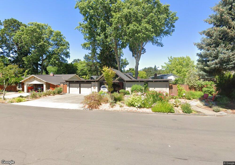
2965 NW Forest Ave Beaverton, OR 97006
Estimated Value: $818,000 - $919,000
3
Beds
2
Baths
2,660
Sq Ft
$327/Sq Ft
Est. Value
About This Home
This home is located at 2965 NW Forest Ave, Beaverton, OR 97006 and is currently estimated at $869,026, approximately $326 per square foot. 2965 NW Forest Ave is a home located in Washington County with nearby schools including Oak Hills Elementary School, Sunset High School, and Goodtime Chinese School.
Ownership History
Date
Name
Owned For
Owner Type
Purchase Details
Closed on
Feb 19, 2014
Sold by
Swenson Kenneth C and Swenson Barbara J
Bought by
The Swenson Family Trust and Swenson Barbara J
Current Estimated Value
Purchase Details
Closed on
Sep 15, 2006
Sold by
Devore Paula K
Bought by
Swenson Kenneth C and Swenson Barbara J
Purchase Details
Closed on
Oct 18, 2001
Sold by
Papish Jay Victor and Naumoff Cheryl L
Bought by
Devore Paula K
Home Financials for this Owner
Home Financials are based on the most recent Mortgage that was taken out on this home.
Original Mortgage
$168,000
Interest Rate
6.88%
Create a Home Valuation Report for This Property
The Home Valuation Report is an in-depth analysis detailing your home's value as well as a comparison with similar homes in the area
Home Values in the Area
Average Home Value in this Area
Purchase History
| Date | Buyer | Sale Price | Title Company |
|---|---|---|---|
| The Swenson Family Trust | -- | None Available | |
| Swenson Kenneth C | $385,000 | Pacific Nw Title | |
| Devore Paula K | $239,000 | Oregon Title Insurance Co |
Source: Public Records
Mortgage History
| Date | Status | Borrower | Loan Amount |
|---|---|---|---|
| Previous Owner | Devore Paula K | $168,000 |
Source: Public Records
Tax History Compared to Growth
Tax History
| Year | Tax Paid | Tax Assessment Tax Assessment Total Assessment is a certain percentage of the fair market value that is determined by local assessors to be the total taxable value of land and additions on the property. | Land | Improvement |
|---|---|---|---|---|
| 2025 | $5,714 | $352,140 | -- | -- |
| 2024 | $5,509 | $341,890 | -- | -- |
| 2023 | $5,509 | $331,940 | $0 | $0 |
| 2022 | $5,325 | $331,940 | $0 | $0 |
| 2021 | $5,122 | $312,900 | $0 | $0 |
| 2020 | $4,966 | $303,790 | $0 | $0 |
| 2019 | $4,799 | $294,950 | $0 | $0 |
| 2018 | $4,642 | $286,360 | $0 | $0 |
| 2017 | $4,474 | $278,020 | $0 | $0 |
| 2016 | $4,311 | $269,930 | $0 | $0 |
| 2015 | $4,145 | $262,070 | $0 | $0 |
| 2014 | $4,039 | $254,440 | $0 | $0 |
Source: Public Records
Map
Nearby Homes
- 15125 NW Oakmont Loop
- 3379 NW Banff Dr
- 14642 NW Fricke Ln
- 3105 NW 144th Ave
- 2920 NW 144th Ave
- 15335 NW Aberdeen Dr
- 15490 NW Tee Ct
- 15450 NW Aberdeen Dr
- 14573 NW Evergreen St
- 15867 NW Lyndel Ln
- 15705 NW Barkton St
- 14280 NW Burton St
- 16056 NW Telshire Dr
- 3830 NW 142nd Terrace
- 15179 NW Casey Dr
- 16254 NW Joscelyn St
- 16231 NW Ramona Dr
- 3525 NW Lehman Place
- 1924 NW 143rd Ave Unit 58
- 15178 NW Channa Dr
- 2935 NW Forest Ave
- 15020 NW Perimeter Dr
- 15050 NW Perimeter Dr
- 2990 NW 151st Place
- 3010 NW 151st Place
- 2915 NW Forest Ave
- 2930 NW Forest Ave
- 15015 NW Northumbria Ln
- 2970 NW 151st Place
- 14970 NW Perimeter Dr
- 2900 NW Forest Ave
- 15015 NW Perimeter Dr
- 14980 NW Northumbria Ln
- 2885 NW Forest Ave
- 15075 NW Perimeter Dr
- 15005 NW Northumbria Ln
- 2950 NW 151st Place
- 14985 NW Perimeter Dr
- 14940 NW Perimeter Dr
- 15140 NW Perimeter Dr