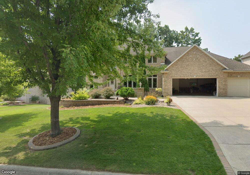
2965 Shelter Creek Ln Green Bay, WI 54313
Westside NeighborhoodEstimated Value: $632,000 - $906,000
--
Bed
--
Bath
--
Sq Ft
0.43
Acres
About This Home
This home is located at 2965 Shelter Creek Ln, Green Bay, WI 54313 and is currently estimated at $758,227. 2965 Shelter Creek Ln is a home located in Brown County with nearby schools including King Elementary School, Lombardi Middle School, and Southwest High School.
Ownership History
Date
Name
Owned For
Owner Type
Purchase Details
Closed on
Oct 9, 2003
Sold by
Francois Real Estate Ventures Llc
Bought by
Francois Craig A and Francois Jacqueline P
Current Estimated Value
Home Financials for this Owner
Home Financials are based on the most recent Mortgage that was taken out on this home.
Original Mortgage
$49,700
Outstanding Balance
$23,225
Interest Rate
6.23%
Mortgage Type
Purchase Money Mortgage
Estimated Equity
$735,002
Create a Home Valuation Report for This Property
The Home Valuation Report is an in-depth analysis detailing your home's value as well as a comparison with similar homes in the area
Home Values in the Area
Average Home Value in this Area
Purchase History
| Date | Buyer | Sale Price | Title Company |
|---|---|---|---|
| Francois Craig A | -- | Liberty Title |
Source: Public Records
Mortgage History
| Date | Status | Borrower | Loan Amount |
|---|---|---|---|
| Open | Francois Craig A | $49,700 |
Source: Public Records
Tax History Compared to Growth
Tax History
| Year | Tax Paid | Tax Assessment Tax Assessment Total Assessment is a certain percentage of the fair market value that is determined by local assessors to be the total taxable value of land and additions on the property. | Land | Improvement |
|---|---|---|---|---|
| 2024 | $12,070 | $620,600 | $62,600 | $558,000 |
| 2023 | $11,650 | $620,600 | $62,600 | $558,000 |
| 2022 | $11,303 | $620,600 | $62,600 | $558,000 |
| 2021 | $13,536 | $558,200 | $110,800 | $447,400 |
| 2020 | $13,505 | $558,200 | $110,800 | $447,400 |
| 2019 | $13,701 | $580,200 | $110,800 | $469,400 |
| 2018 | $13,328 | $580,200 | $110,800 | $469,400 |
| 2017 | $13,031 | $580,200 | $110,800 | $469,400 |
| 2016 | $12,853 | $580,200 | $110,800 | $469,400 |
| 2015 | $12,865 | $580,200 | $110,800 | $469,400 |
| 2014 | $13,498 | $580,200 | $110,800 | $469,400 |
| 2013 | $13,498 | $580,200 | $110,800 | $469,400 |
Source: Public Records
Map
Nearby Homes
- 2768 Independence Dr
- 1940 Renaissance Ct
- 3023 Crusade Ln
- 1602 W Crusade Ln
- 3097 S Sandstone Ct
- 1680 Cormier Rd
- 3096 S Sandstone Ct
- 2060 Wintergreen Ct
- 1433 Baumgart Rd Unit 1435
- 1310 Sandstone Place
- 2044 Ann Ln
- 2993 Fleetwood Dr
- 1570 Mesa Dr
- 2550 He Nis Ra Ln
- 2466 Parkwood Dr
- 3102 Sandstone Ct
- 2689 Clive St
- 3379 Belmar Rd
- 2549 Babcock Rd Unit 2551
- 2445 Basswood St
- 2975 Shelter Creek Ln
- 2975 Shelter Creek Ln
- 2961 Shelter Creek Ln
- 2116 Muirwood Ln
- 2985 Shelter Creek Ln
- 2105 W Muirwood Dr
- 2951 Shelter Creek Ct
- 2098 Muirwood Ln
- 2119 Muirwood Ln
- 2950 2950 Shelter Creek
- 2091 W Muirwood Dr
- 2943 Shelter Creek Ct
- 2114 W Muirwood Dr
- 2106 W Muirwood Dr
- 2940 Shelter Creek Ct Unit 1
- 2939 Parkwood Dr
- 2081 W Muirwood Dr
- 2094 Muirwood Ln
- 2935 Shelter Creek Ct
- 2090 W Muirwood Dr