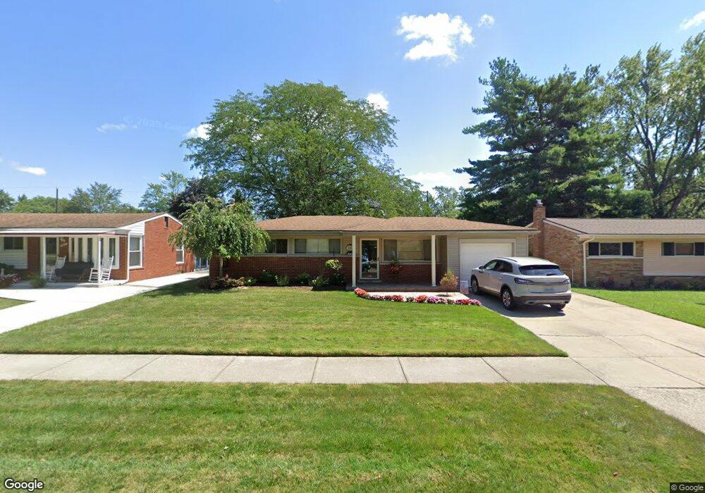
29667 Magnolia Dr Flat Rock, MI 48134
Estimated Value: $219,143 - $294,000
--
Bed
--
Bath
1,666
Sq Ft
$145/Sq Ft
Est. Value
About This Home
This home is located at 29667 Magnolia Dr, Flat Rock, MI 48134 and is currently estimated at $241,536, approximately $144 per square foot. 29667 Magnolia Dr is a home located in Wayne County with nearby schools including Ethel C. Bobcean Elementary School, John M. Barnes Elementary School, and Thomas Simpson Middle School.
Ownership History
Date
Name
Owned For
Owner Type
Purchase Details
Closed on
Sep 12, 2016
Sold by
Woods Daniel James
Bought by
Woods Daniel James and Carr Woods Cheryl
Current Estimated Value
Purchase Details
Closed on
Feb 10, 1995
Sold by
Woods Daniel R
Bought by
Woods Daniel J
Home Financials for this Owner
Home Financials are based on the most recent Mortgage that was taken out on this home.
Original Mortgage
$65,000
Interest Rate
9.21%
Mortgage Type
New Conventional
Create a Home Valuation Report for This Property
The Home Valuation Report is an in-depth analysis detailing your home's value as well as a comparison with similar homes in the area
Home Values in the Area
Average Home Value in this Area
Purchase History
| Date | Buyer | Sale Price | Title Company |
|---|---|---|---|
| Woods Daniel James | -- | Michigan Title Ins Agcy Inc | |
| Woods Daniel J | $81,250 | -- |
Source: Public Records
Mortgage History
| Date | Status | Borrower | Loan Amount |
|---|---|---|---|
| Closed | Woods Daniel J | $65,000 |
Source: Public Records
Tax History Compared to Growth
Tax History
| Year | Tax Paid | Tax Assessment Tax Assessment Total Assessment is a certain percentage of the fair market value that is determined by local assessors to be the total taxable value of land and additions on the property. | Land | Improvement |
|---|---|---|---|---|
| 2025 | $3,334 | $113,200 | $0 | $0 |
| 2024 | $3,334 | $108,700 | $0 | $0 |
| 2023 | $3,179 | $96,600 | $0 | $0 |
| 2022 | $3,848 | $85,700 | $0 | $0 |
| 2021 | $3,693 | $82,700 | $0 | $0 |
| 2020 | $3,645 | $85,300 | $0 | $0 |
| 2019 | $3,578 | $76,800 | $0 | $0 |
| 2018 | $2,780 | $69,500 | $0 | $0 |
| 2017 | $1,461 | $72,800 | $0 | $0 |
| 2016 | $3,361 | $68,700 | $0 | $0 |
| 2015 | $6,194 | $68,000 | $0 | $0 |
| 2013 | $6,000 | $60,000 | $0 | $0 |
| 2012 | $2,476 | $63,200 | $9,800 | $53,400 |
Source: Public Records
Map
Nearby Homes
- 29715 Walnut St
- 29593 Red Cedar Dr
- 29483 Aspen Dr
- 29456 Walnut St
- 29336 Evergreen St
- 29115 Magnolia Dr
- 29321 Tamarack Dr
- 29316 Sheeks Blvd S
- 24755 Gibraltar Rd
- 25763 Gibraltar Rd
- 26015 E Huron River Dr
- 24680 Huron River Dr
- 24664 E Huron River Dr
- 23965 Gibraltar Rd
- 28453 Church St
- 25345 Hunter Ln
- 26240 Gibraltar Rd
- VL Gibraltar Rd
- 26256 Ypsilanti St
- 26312 Ypsilanti St
- 29647 Magnolia Dr
- 29687 Magnolia Dr
- 29629 Magnolia Dr
- 29705 Magnolia Dr Unit Bldg-Unit
- 29705 Magnolia Dr
- 29706 Aspen Dr
- 29648 Aspen Dr
- 29668 Aspen Dr
- 29688 Aspen Dr
- 29611 Magnolia Dr
- 29725 Magnolia Dr
- 29630 Aspen Dr
- 29654 Magnolia Dr
- 29674 Magnolia Dr
- 29612 Aspen Dr
- 29634 Magnolia Dr
- 29694 Magnolia Dr
- 29726 Aspen Dr
- 29591 Magnolia Dr
- 29745 Magnolia Dr