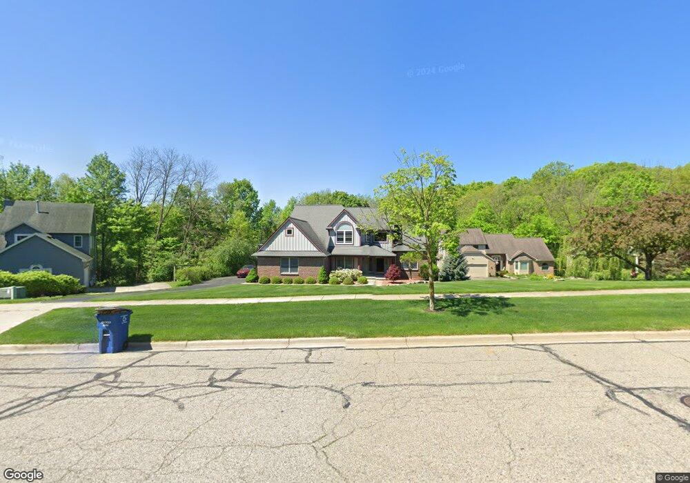
2967 Omlesaad Dr Ann Arbor, MI 48105
Northern Ann Arbor NeighborhoodEstimated Value: $671,000 - $756,213
4
Beds
2
Baths
2,675
Sq Ft
$261/Sq Ft
Est. Value
About This Home
This home is located at 2967 Omlesaad Dr, Ann Arbor, MI 48105 and is currently estimated at $699,053, approximately $261 per square foot. 2967 Omlesaad Dr is a home located in Washtenaw County with nearby schools including Logan Elementary School, Clague Middle School, and Skyline High School.
Ownership History
Date
Name
Owned For
Owner Type
Purchase Details
Closed on
Mar 29, 2021
Sold by
Digiovine Bruno and Digiovine Stephanie E
Bought by
Digiovine Bruno and Digiovine Stephanie E
Current Estimated Value
Purchase Details
Closed on
Aug 20, 1996
Sold by
Guenther Building Co
Bought by
Digiovine Bruno and Meyers Stephanie E
Home Financials for this Owner
Home Financials are based on the most recent Mortgage that was taken out on this home.
Original Mortgage
$281,700
Outstanding Balance
$22,784
Interest Rate
8.47%
Mortgage Type
New Conventional
Estimated Equity
$676,269
Create a Home Valuation Report for This Property
The Home Valuation Report is an in-depth analysis detailing your home's value as well as a comparison with similar homes in the area
Home Values in the Area
Average Home Value in this Area
Purchase History
| Date | Buyer | Sale Price | Title Company |
|---|---|---|---|
| Digiovine Bruno | -- | None Available | |
| Digiovine Bruno | $313,273 | -- |
Source: Public Records
Mortgage History
| Date | Status | Borrower | Loan Amount |
|---|---|---|---|
| Open | Digiovine Bruno | $281,700 |
Source: Public Records
Tax History Compared to Growth
Tax History
| Year | Tax Paid | Tax Assessment Tax Assessment Total Assessment is a certain percentage of the fair market value that is determined by local assessors to be the total taxable value of land and additions on the property. | Land | Improvement |
|---|---|---|---|---|
| 2025 | $12,657 | $396,400 | $0 | $0 |
| 2024 | $11,787 | $381,800 | $0 | $0 |
| 2023 | $10,868 | $368,600 | $0 | $0 |
| 2022 | $11,843 | $343,200 | $0 | $0 |
| 2021 | $11,499 | $314,600 | $0 | $0 |
| 2020 | $11,416 | $284,600 | $0 | $0 |
| 2019 | $10,723 | $269,400 | $269,400 | $0 |
| 2018 | $10,572 | $251,000 | $0 | $0 |
| 2017 | $10,284 | $240,900 | $0 | $0 |
| 2016 | $9,922 | $205,643 | $0 | $0 |
| 2015 | $9,416 | $204,331 | $0 | $0 |
| 2014 | $9,416 | $197,947 | $0 | $0 |
| 2013 | -- | $197,947 | $0 | $0 |
Source: Public Records
Map
Nearby Homes
- 3126 Fairhaven Ct
- 3156 Falcon Ct
- 2805 Rathmore Ln
- 3636 N Territorial Rd E
- 3657 Kinsley Blvd
- 3768 Kinsley Blvd
- 3743 Kinsley Blvd
- 3721 Kinsley Blvd
- 2824 Ridington Rd
- 3048 N Spurway Dr
- 3056 N Spurway Dr
- 2856 Ridington Rd
- 1 Westbury Ct
- 2626 Traver Blvd
- 0000 Nixon Rd
- 3328 Roseford Blvd
- 3107 Millbury Ln
- 3095 Millbury Ln
- 3100 Millbury Ln
- 2766 Maitland Dr
- 2971 Omlesaad Dr
- 2961 Omlesaad Dr
- 2400 Tamarack Ct
- 2981 Omlesaad Dr
- 2403 Tamarack Ct Unit 31
- 2991 Omlesaad Dr
- 2404 Tamarack Ct
- 2407 Tamarack Ct
- 2401 Meadowridge Ct Unit 15
- 2408 Tamarack Ct Unit 18
- 2405 Meadowridge Ct
- 2411 Tamarack Ct Unit 29
- 2412 Tamarack Ct
- 2415 Tamarack Ct
- 2402 Meadowridge Ct
- 2409 Meadowridge Ct
- 3000 Omlesaad Dr
- 2419 Tamarack Ct
- 0 Meadowridge Ct
- 2416 Tamarack Ct Unit 20