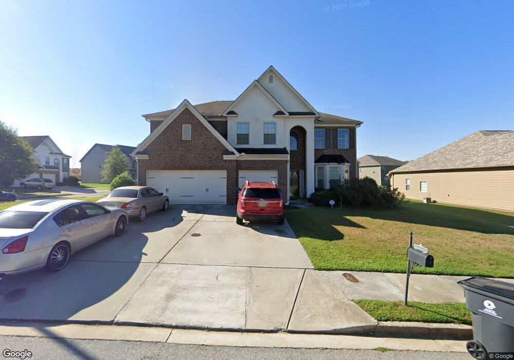
2969 Bluestone Dr SW Atlanta, GA 30331
Estimated Value: $489,000 - $599,000
5
Beds
4
Baths
4,808
Sq Ft
$114/Sq Ft
Est. Value
About This Home
This home is located at 2969 Bluestone Dr SW, Atlanta, GA 30331 and is currently estimated at $547,276, approximately $113 per square foot. 2969 Bluestone Dr SW is a home with nearby schools including Stonewall Tell Elementary School, Sandtown Middle School, and Westlake High School.
Ownership History
Date
Name
Owned For
Owner Type
Purchase Details
Closed on
Nov 27, 2013
Sold by
Dennis Edwina B
Bought by
Dennis Edwina B and Dennis Darryl L
Current Estimated Value
Purchase Details
Closed on
Apr 18, 2011
Sold by
Dr Horton Inc
Bought by
Dennis Edwina B
Home Financials for this Owner
Home Financials are based on the most recent Mortgage that was taken out on this home.
Original Mortgage
$229,042
Interest Rate
4.75%
Mortgage Type
FHA
Create a Home Valuation Report for This Property
The Home Valuation Report is an in-depth analysis detailing your home's value as well as a comparison with similar homes in the area
Home Values in the Area
Average Home Value in this Area
Purchase History
| Date | Buyer | Sale Price | Title Company |
|---|---|---|---|
| Dennis Edwina B | -- | -- | |
| Dennis Edwina B | $235,300 | -- |
Source: Public Records
Mortgage History
| Date | Status | Borrower | Loan Amount |
|---|---|---|---|
| Previous Owner | Dennis Edwina B | $229,042 |
Source: Public Records
Tax History Compared to Growth
Tax History
| Year | Tax Paid | Tax Assessment Tax Assessment Total Assessment is a certain percentage of the fair market value that is determined by local assessors to be the total taxable value of land and additions on the property. | Land | Improvement |
|---|---|---|---|---|
| 2025 | $3,296 | $188,400 | $34,480 | $153,920 |
| 2023 | $6,271 | $222,160 | $42,920 | $179,240 |
| 2022 | $3,115 | $187,040 | $39,040 | $148,000 |
| 2021 | $3,066 | $148,040 | $28,720 | $119,320 |
| 2020 | $3,074 | $143,760 | $20,160 | $123,600 |
| 2019 | $3,352 | $122,000 | $14,000 | $108,000 |
| 2018 | $4,167 | $129,000 | $13,680 | $115,320 |
| 2017 | $2,736 | $84,200 | $13,040 | $71,160 |
| 2016 | $2,734 | $84,200 | $13,040 | $71,160 |
| 2015 | $2,743 | $84,200 | $13,040 | $71,160 |
| 2014 | $2,866 | $84,200 | $13,040 | $71,160 |
Source: Public Records
Map
Nearby Homes
- 2844 Bluestone Dr SW
- 825 Stonehaven Rd SW
- 2539 Wrangler Dr SW
- 6498 Stonelake Place SW
- 5907 Bunting Ln Unit 2
- 5907 Bunting Ln
- 2552 Wolf Den Ln
- 6244 Selborn Dr SW
- 132 Wolf View Ct SW
- 3058 Parkland View
- 2746 Dayview Ln
- Edmund Plan at Sandtown Falls
- 6362 Sundowner Place Unit 108
- 6364 Sundowner Place Unit 109
- 6366 Sundowner Place Unit 110
- 3030 Parkland View
- 6368 Sundowner Place Unit 111
- 2901 Woodmill Way
- 0 Woodmill Way
- 2965 Bluestone Dr SW
- 349 Woodmill Way SW
- 324 Woodmill Way SW
- 334 Woodmill Way SW
- 2961 Bluestone Dr SW
- 2968 Bluestone Dr SW
- 2964 Bluestone Dr SW
- 314 Woodmill Way SW
- 6323 Jasper Way
- 359 Woodmill Way SW
- 354 Woodmill Way SW
- 2957 Bluestone Dr SW
- 304 Woodmill Way SW
- 369 Woodmill Way SW
- 242 Woodstone Ct
- 262 Woodstone Ct
- 364 Woodmill Way SW
- 520 Portico Ct SW