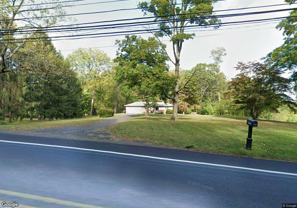
2969 Durham Rd Doylestown, PA 18902
Estimated Value: $510,000 - $586,000
3
Beds
1
Bath
1,218
Sq Ft
$450/Sq Ft
Est. Value
About This Home
This home is located at 2969 Durham Rd, Doylestown, PA 18902 and is currently estimated at $548,580, approximately $450 per square foot. 2969 Durham Rd is a home located in Bucks County with nearby schools including Buckingham Elementary School, Holicong Middle School, and Central Bucks High School - East.
Ownership History
Date
Name
Owned For
Owner Type
Purchase Details
Closed on
Jun 30, 2021
Sold by
Franklin Michael C and Franklin Sarah Ann
Bought by
Gaun Kenneth M
Current Estimated Value
Home Financials for this Owner
Home Financials are based on the most recent Mortgage that was taken out on this home.
Original Mortgage
$307,500
Interest Rate
2.9%
Mortgage Type
Future Advance Clause Open End Mortgage
Purchase Details
Closed on
Mar 22, 1995
Sold by
Atkinson James P
Bought by
Franklin Michael C and Franklin Sarah Ann
Purchase Details
Closed on
Aug 28, 1964
Bought by
Atkinson James P
Create a Home Valuation Report for This Property
The Home Valuation Report is an in-depth analysis detailing your home's value as well as a comparison with similar homes in the area
Home Values in the Area
Average Home Value in this Area
Purchase History
| Date | Buyer | Sale Price | Title Company |
|---|---|---|---|
| Gaun Kenneth M | $410,000 | Tohickon Settlement Svcs Inc | |
| Franklin Michael C | -- | -- | |
| Atkinson James P | -- | -- |
Source: Public Records
Mortgage History
| Date | Status | Borrower | Loan Amount |
|---|---|---|---|
| Previous Owner | Gaun Kenneth M | $307,500 |
Source: Public Records
Tax History
| Year | Tax Paid | Tax Assessment Tax Assessment Total Assessment is a certain percentage of the fair market value that is determined by local assessors to be the total taxable value of land and additions on the property. | Land | Improvement |
|---|---|---|---|---|
| 2025 | $4,949 | $30,400 | $12,680 | $17,720 |
| 2024 | $4,949 | $30,400 | $12,680 | $17,720 |
| 2023 | $4,782 | $30,400 | $12,680 | $17,720 |
| 2022 | $4,724 | $30,400 | $12,680 | $17,720 |
| 2021 | $4,668 | $30,400 | $12,680 | $17,720 |
| 2020 | $4,668 | $30,400 | $12,680 | $17,720 |
| 2019 | $4,638 | $30,400 | $12,680 | $17,720 |
| 2018 | $4,638 | $30,400 | $12,680 | $17,720 |
| 2017 | $4,600 | $30,400 | $12,680 | $17,720 |
| 2016 | $4,645 | $30,400 | $12,680 | $17,720 |
| 2015 | -- | $30,400 | $12,680 | $17,720 |
| 2014 | -- | $30,400 | $12,680 | $17,720 |
Source: Public Records
Map
Nearby Homes
- 3039 Durham Rd
- 2798 Forge Place
- 5025 Anderson Rd
- 4602 Sands Way
- 2918 Snake Hill Rd
- 3468 Holicong Rd
- 5358 York Rd
- 3689 Hancock Ln
- 3455 & 3479 Durham Rd
- 6185 Mechanicsville Rd
- 5765 Valley Stream Dr
- 5491 Long Ln
- 3960 S Mallard Ln
- 3889 Robin Rd
- 4203 Greenspire Ln
- 4533 Deep Creek Way
- 2980 Yorkshire Rd
- 3775 Buckingham Dr
- 3660 Buttonwood Dr
- 3795 Route 202
- 2987 Durham Rd
- 4887 Church Rd
- 2940 Stover Trail
- 2930 Stover Trail
- 4875 Church Rd
- 2950 Stover Trail
- 2966 White Tail Ct
- 4861 Church Rd
- 2903 Durham Rd
- 2925 Stover Trail
- 2960 Stover Trail
- 4913 Paist Rd
- 4819 Church Rd
- 2974 White Tail Ct
- 2928 Durham Rd
- 2905 Stover Trail
- 4971 Paist Rd
- 3056 Durham Rd
- 2916 White Tail Ct
- 4949 Paist Rd
Your Personal Tour Guide
Ask me questions while you tour the home.